Frostenden
| Frostenden | |
|---|---|
 Frostenden All Saints | |
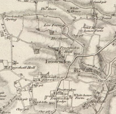 19th Century Map of Frostenden | |
 Frostenden Location within Suffolk | |
| Population | 167 (2011 Census) |
| Civil parish |
|
| District |
|
| Shire county |
|
| Region | |
| Country | England |
| Sovereign state | United Kingdom |
| Post town | BECCLES |
| Postcode district | NR34 |
| Dialling code | 01502 |
| Police | Suffolk |
| Fire | Suffolk |
| Ambulance | East of England |

Frostenden is a village and civil parish in the East Suffolk district of the English county of Suffolk. It is around 8 miles (13 km) south-west of Lowestoft and 3.5 miles (5.6 km) north-west of Southwold and lies on the A12 road. The parish church, All Saints, is one of 38 existing round-tower churches in Suffolk.
In 1870, Frostenden was described by John Marius Wilson in the "Imperial Gazetteer of England and Wales":
The property is divided among a few. The living is a rectory in the diocese of Norwich. Value, £348. Patron, Thomas Barne, Esq. The church is chiefly early English; has a round western tower; and contains an early English piscina and a later English font. Charities, £28.[1]
Frostenden was previously part of the Blything Hundred district, a form of county division used up until the end of the 19th century. Blything was the largest of the 21 Suffolk hundreds, and was composed of 48 parishes.[2]
Population[]
In 1881, the population was reported as 386[3] but in 2011 the Frostenden population had decreased to 167.[4] The highest population recorded was in the 1851 census with a total of 456 people.
All Saints Church[]

A key feature of Frostenden is the Round-tower church, which is now a Grade I listed building.[5] The tower is one of the oldest in Suffolk and dates back to either the Norman or Saxon era. The church however dates back to the 13th century.[6] Above the southern door to the church sits a distinctive and bright sundial, thought to be from the 18th century, reading "vigilate et orate" meaning "Watch and Pray" in Latin. The stained glass windows of the church are much newer, dating back to the early 20th century.
The village had previously been a medieval fort, and the former river bed sits just behind the church; at the time of the Domesday Book being compiled, the village had a considerable population and two churches.
The number "1606" is scratched into one of the church walls, which could be reference to when the Dutch navigator, Willem Janszoon, reached the shores of Australia for the first time.[7]
Memorials[]
There are several memorials on the site of the church, for both the First World War and the Second World War. Unusually for the area, the parish lost more men during the Second World War, which is uncommon for rural areas as it indicates the population was much higher during this time.[6]
Domesday entry[]
The parish of Frostenden appeared within the Domesday Book in 1086. The entry listed:
Wood for 40 pigs, formerly 1 salt house, 3½ acres meadow, 1 cob, 6 cattle, 13 pigs, 60 sheep, 24 goats, 2 beehives.[8]
In contrast to modern times, however, the area was described as a sea port, indicating that the now dried-up river bed behind the church was once navigable and of a considerable size compared with today.[8] The population of Frostenden in 1086 was listed as 35.
During this time, it has also been suggested that the area had a thriving fishing industry, due to the sea port. There is evidence to suggest that the fishermen would travel down the river to the sea to catch herring along the coast; herring fishing had been a key aspect to the Anglo-Saxon economy. This also explains the presence of a salt house, as listed in the Domesday Book as an asset of the parish, as large amounts of salt would be needed to preserve the herrings they caught.[9] It has also been suggested that there would have been a dock or quay on the river in Frostenden to allow easy access for the fishing trade.[10]
References[]
- ^ Wilson, John Marius (1870–1872). Imperial Gazetteer of England and Wales. Frostenden: A. Fullerton & Co. Retrieved 27 January 2015.
- ^ Warner, P.M. (1982). "BLYTHING HUNDRED: A Study in the Development of Settlement AD. 400-1400" (PDF).
- ^ "GB Historical GIS / University of Portsmouth, Frostenden AP/CP through time | Population Statistics | Total Population, A Vision of Britain through Time". www.visionofbritain.org.uk. Retrieved 8 February 2017.
- ^ "Office For National Statistics, Neighbourhood Statistics, Population Density 2011". neighbourhood.statistics.gov.uk. Retrieved 27 January 2015.
- ^ "Church of All Saints, Frostenden, Suffolk". www.britishlistedbuildings.co.uk. Retrieved 21 March 2017.
- ^ a b "Suffolk Churches, All Saints, Frostenden". www.suffolkchurches.co.uk. Retrieved 14 March 2017.
- ^ Noble, J. C. (4 May 2016). A Perfect Captain. Lulu.com. ISBN 9781326448509.
- ^ a b "Open Domesday Book". opendomesday.org. 1066. Retrieved 1 February 2022.
{{cite web}}:|first=missing|last=(help) - ^ North, William (21 March 2017). The Haskins Society Journal 21: 2009. Studies in Medieval History. Boydell & Brewer. ISBN 9781843835608.
- ^ Harper-Bill, Christopher; Rawcliffe, Carole; Wilson, Richard George (1 January 2002). East Anglia's History: Studies in Honour of Norman Scarfe. Boydell Press. ISBN 9780851158785.
External links[]
| Wikimedia Commons has media related to Frostenden. |
- East Suffolk (district)
- Villages in Suffolk
- Civil parishes in Suffolk