Furiani
show This article may be expanded with text translated from the corresponding article in French. (December 2008) Click [show] for important translation instructions. |
Furiani | |
|---|---|
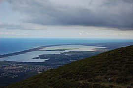 Étang de Baguglia | |
show Location of Furiani | |
 Furiani | |
| Coordinates: 42°39′32″N 9°24′54″E / 42.6589°N 9.415°ECoordinates: 42°39′32″N 9°24′54″E / 42.6589°N 9.415°E | |
| Country | France |
| Region | Corsica |
| Department | Haute-Corse |
| Arrondissement | Bastia |
| Canton | Bastia-4 |
| Intercommunality | Bastia |
| Government | |
| • Mayor (2020–2026) | Pierre-Michel Simonpietri[1] |
| Area 1 | 18.49 km2 (7.14 sq mi) |
| Population (Jan. 2018)[2] | 5,628 |
| • Density | 300/km2 (790/sq mi) |
| Time zone | UTC+01:00 (CET) |
| • Summer (DST) | UTC+02:00 (CEST) |
| INSEE/Postal code | 2B120 /20600 |
| Elevation | 0–720 m (0–2,362 ft) (avg. 150 m or 490 ft) |
| 1 French Land Register data, which excludes lakes, ponds, glaciers > 1 km2 (0.386 sq mi or 247 acres) and river estuaries. | |


Furiani (French pronunciation: [fuʁjani]) is a commune in the Haute-Corse department of France on the island of Corsica.
Population[]
| Year | Pop. | ±% |
|---|---|---|
| 1962 | 362 | — |
| 1968 | 414 | +14.4% |
| 1975 | 565 | +36.5% |
| 1982 | 1,323 | +134.2% |
| 1990 | 3,286 | +148.4% |
| 1999 | 3,902 | +18.7% |
| 2008 | 4,731 | +21.2% |
See also[]
- Communes of the Haute-Corse department
- Tour de Furiani
- Railway stations in Corsica
References[]
- ^ "Répertoire national des élus: les maires". data.gouv.fr, Plateforme ouverte des données publiques françaises (in French). 2 December 2020.
- ^ "Populations légales 2018". INSEE. 28 December 2020.
| Wikimedia Commons has media related to Furiani. |
| show Communes of the Haute-Corse department |
|---|
| show Authority control |
|---|
This Haute-Corse geographical article is a stub. You can help Wikipedia by . |
Categories:
- Communes of Haute-Corse
- Haute-Corse geography stubs