Gammelsdorf
Gammelsdorf | |
|---|---|
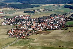 Aerial view | |
 Coat of arms | |
show Location of Gammelsdorf within Freising district | |
 Gammelsdorf | |
| Coordinates: 48°33′N 11°57′E / 48.550°N 11.950°ECoordinates: 48°33′N 11°57′E / 48.550°N 11.950°E | |
| Country | Germany |
| State | Bavaria |
| Admin. region | Oberbayern |
| District | Freising |
| Municipal assoc. | Mauern |
| Government | |
| • Mayor (2020–26) | Raimunda Menzel[1] |
| Area | |
| • Total | 21.63 km2 (8.35 sq mi) |
| Elevation | 495 m (1,624 ft) |
| Population (2020-12-31)[2] | |
| • Total | 1,488 |
| • Density | 69/km2 (180/sq mi) |
| Time zone | UTC+01:00 (CET) |
| • Summer (DST) | UTC+02:00 (CEST) |
| Postal codes | 85408 |
| Dialling codes | 08766 |
| Vehicle registration | FS |
| Website | https://www.vg-mauern.de/gammelsdorf/ |


Gammelsdorf is a municipality in the district of Freising in Bavaria in Germany.
It was the site of the 1313 Battle of Gammelsdorf.
Until the mid-1990s Gammelsdorf was home of the "Circus", formerly known as the world's first village cinema, and later a nightclub where many famous artists and rock bands held concerts, most notably Nirvana.
References[]
- ^ Liste der ersten Bürgermeister/Oberbürgermeister in kreisangehörigen Gemeinden, Bayerisches Landesamt für Statistik, 15 July 2021.
- ^ "Tabellenblatt "Daten 2", Statistischer Bericht A1200C 202041 Einwohnerzahlen der Gemeinden, Kreise und Regierungsbezirke". Bayerisches Landesamt für Statistik (in German). June 2021.
External links[]
| show Towns and municipalities in Freising (district) |
|---|
| Authority control |
|---|
This Freising district location article is a stub. You can help Wikipedia by . |
Categories:
- Municipalities in Bavaria
- Freising (district)
- Upper Bavaria geography stubs