Garoua
Garoua | |
|---|---|
City | |
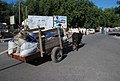
 The Market at Garoua | |
 Garoua Location in Cameroon | |
| Coordinates: 9°18′N 13°24′E / 9.300°N 13.400°E | |
| Country | |
| Region | North |
| Department | Bénoué |
| Elevation | 249 m (817 ft) |
| Population (2009) | |
| • Total | 600,000 |
| Climate | Aw |

Garoua or Garua (German: Garua) is a port city and the capital of the North Region of Cameroon, lying on the Benue River. A thriving centre of the textiles and cotton industries, the city has approximately 836,899 inhabitants in 2018.[1]
History[]
Garoua was established by the Fulani emir Modibbo Adama in the first half of the 19th century. During the steamship era, it developed into a major river port.[2]
The population of the city was 30,000 in 1967.[3]
Geography[]
Garoua is situated in northern Cameroon, and lies on the Benue River.[4] It serves as the gateway to Benoue National Park.[5] Neighborhoods include Commercial Centre, Lopere, Quartier de Marouare, Poumpoumre, Roumde Adjia and the northwestern suburb of Yelwa, near Garoua International Airport.[4]
Climate[]
Garoua has a tropical savanna climate (Köppen climate classification Aw). The average temperature in Garoua ranges from 26.0 °C (78.8 °F) in the January to 33.0 °C (91.4 °F) in April.
| hideClimate data for Garoua | |||||||||||||
|---|---|---|---|---|---|---|---|---|---|---|---|---|---|
| Month | Jan | Feb | Mar | Apr | May | Jun | Jul | Aug | Sep | Oct | Nov | Dec | Year |
| Average high °C (°F) | 34.4 (93.9) |
37.3 (99.1) |
39.8 (103.6) |
39.5 (103.1) |
36.5 (97.7) |
33.2 (91.8) |
31.1 (88.0) |
30.7 (87.3) |
31.5 (88.7) |
34.2 (93.6) |
36.0 (96.8) |
34.8 (94.6) |
34.9 (94.8) |
| Daily mean °C (°F) | 26.0 (78.8) |
28.9 (84.0) |
32.2 (90.0) |
33.0 (91.4) |
30.7 (87.3) |
28.2 (82.8) |
26.6 (79.9) |
26.4 (79.5) |
26.7 (80.1) |
28.1 (82.6) |
27.3 (81.1) |
26.0 (78.8) |
28.3 (82.9) |
| Average low °C (°F) | 17.5 (63.5) |
20.5 (68.9) |
24.7 (76.5) |
26.4 (79.5) |
24.9 (76.8) |
23.2 (73.8) |
22.2 (72.0) |
22.0 (71.6) |
21.9 (71.4) |
22.2 (72.0) |
19.2 (66.6) |
17.3 (63.1) |
21.8 (71.2) |
| Average precipitation mm (inches) | 0.0 (0.0) |
0.0 (0.0) |
2.0 (0.08) |
44.1 (1.74) |
108.4 (4.27) |
134.8 (5.31) |
205.3 (8.08) |
247.9 (9.76) |
190.0 (7.48) |
63.3 (2.49) |
1.6 (0.06) |
0.0 (0.0) |
997.4 (39.27) |
| Average precipitation days (≥ 1.0 mm) | 0 | 0 | 1 | 5 | 9 | 11 | 14 | 17 | 24 | 6 | 1 | 0 | 88 |
| Mean monthly sunshine hours | 275.0 | 252.6 | 260.1 | 245.4 | 256.7 | 224.4 | 194.0 | 187.2 | 204.5 | 261.5 | 279.2 | 286.5 | 2,927.1 |
| Source: NOAA[6] | |||||||||||||
Demographics[]


In 2005, Garoua had a population of 495,996 people. The city is inhabited by the Fulbe ethnic group.[7] Due to a significant number of Chadian expatriates in the city, there is a Chadian Consulate.[5]
Economy[]
As the fourth largest port in Cameroon,[8] Garoua is a major center of trade in the country.[9] It developed as a centre for trade in petroleum, cement, hides, peanuts, and cotton, transported on ships along the Benue River, between Burutu in Nigeria.[2] It has long been a thriving centre of the cotton industry and houses several textile processing facilities and factories.[10] The cotton company has one of its major centres in the city.[11] Leatherwork and fishing are also notable industries.[2]
Places of worship[]
Among the places of worship, they are predominantly Muslim mosques. There are also Christian churches and temples: Roman Catholic Archdiocese of Garoua (Catholic Church), Evangelical Church of Cameroon (World Communion of Reformed Churches), Presbyterian Church in Cameroon (World Communion of Reformed Churches), Cameroon Baptist Convention (Baptist World Alliance), Full Gospel Mission Cameroon (Assemblies of God).[12]
Transport[]
Garoua is served by Garoua International Airport. [13] The United States military uses the airport as a base to conduct unmanned aerial vehicle operations.[14] The city lies on National Highway 1,[4] at a junction of the road between Maroua and Ngaoundéré.[2] The main road leading north through the town and past the airport is called Rue de la Gendarmerie.[4]
Transport of goods by ox

Donkey transport

Relocation

Transport by oxen

Farmer carrying wood

Farmer carrying provisions
Notable people[]
- Goggo Addi (1911–1999), storyteller who worked to preserve Fulani cultural heritage[15]
- Ahmadou Ahidjo (1924–1989), first president of Cameroon[16]
- (1934–2004), historian, professor at University of Maiduguri[17]
References[]
- ^ "Population of Cities in Cameroon (2018)". worldpopulationreview.com. Retrieved 2018-09-06.
- ^ Jump up to: a b c d "Garoua". Encyclopædia Britannica. Retrieved 29 October 2016.
- ^ Mark Dike DeLancey, Rebecca Neh Mbuh, Mark W. Delancey, Historical Dictionary of the Republic of Cameroon, Scarecrow Press, USA, 2010, p. 189
- ^ Jump up to: a b c d Google (29 October 2016). "Garoua" (Map). Google Maps. Google. Retrieved 29 October 2016.
- ^ Jump up to: a b Ham, Anthony (2009). West Africa. Lonely Planet. p. 207. ISBN 978-1-74104-821-6.
- ^ "Garoua Climate Normals 1961–1990". National Oceanic and Atmospheric Administration. Retrieved March 8, 2015.
- ^ Drønen, Tomas Sundnes (31 August 2009). Communication and Conversion in Northern Cameroon: The Dii People and Norwegian Missionaries, 1934-1960. BRILL. p. 40. ISBN 978-90-474-3098-8.
- ^ Trillo, Richard (2 June 2008). The Rough Guide to West Africa. Rough Guides Limited. p. 3028. ISBN 978-1-4053-8068-3.
- ^ Georgia (Republic) Export-Import Trade and Business Directory. International Business Publications. October 2005. p. 97. ISBN 978-0-7397-3267-0.
- ^ Ndenecho, Emmanuel Neba (2011). Decentralisation and Spatial Rural Development Planning in Cameroon. African Books Collective. p. 76. ISBN 978-9956-717-66-8.
- ^ Raimond, Christine (8 October 2013). Ressources vivrières et choix alimentaires dans le bassin du lac Tchad. IRD Editions. p. 202. ISBN 978-2-7099-1576-2.
- ^ J. Gordon Melton, Martin Baumann, ‘‘Religions of the World: A Comprehensive Encyclopedia of Beliefs and Practices’’, ABC-CLIO, USA, 2010, p. 484-486
- ^ Africa Review 2003/04: The Economic and Business Report. Kogan Page Publishers. 2003. p. 44. ISBN 978-0-7494-4065-7.
- ^ Hammer, Joshua (2016-02-25). "Hunting Boko Haram: The U.S. Extends Its Drone War Deeper Into Africa With Secretive Base". The Intercept.
- ^ Baumgardt, Ursula (2000). Une conteuse peule et son répertoire : Goggo Addi de Garoua, Cameroun : textes et analyses. Goggo Addi. Paris: Karthala. ISBN 2-84586-104-4. OCLC 45647204.
- ^ Appiah, Anthony; Gates, Henry Louis (2010). Encyclopedia of Africa. Oxford University Press. p. 73. ISBN 978-0-19-533770-9.
- ^ "Eldridge Mohammadou (1934-2004)" (in French). Africanistes. 29 October 2016.
External links[]
![]() Media related to Garoua at Wikimedia Commons
Coordinates: 09°18′N 13°24′E / 9.300°N 13.400°E
Media related to Garoua at Wikimedia Commons
Coordinates: 09°18′N 13°24′E / 9.300°N 13.400°E

| Authority control |
|---|
- Garoua
- Populated places in North Region (Cameroon)
- Provincial capitals in Cameroon
- Benue River