Geismar, Louisiana
This article needs additional citations for verification. (February 2013) |
Geismar | |
|---|---|
| Coordinates: 30°12′14″N 91°01′19″W / 30.204°N 91.022°WCoordinates: 30°12′14″N 91°01′19″W / 30.204°N 91.022°W | |
| Country | United States |
| State | Louisiana |
| Parish | Ascension |
| Elevation | 23 ft (7 m) |
| Time zone | UTC-6 (CST) |
| • Summer (DST) | UTC-5 (CDT) |

Geismar is an unincorporated community in Ascension Parish, Louisiana, United States and is at the heart of Louisiana's chemical corridor. Geismar is south of Prairieville and west of Gonzales. The community has two schools, Dutchtown Primary/ Middle School and Dutchtown High School, which are ranked among the top schools in the state of Louisiana.[1] The Mississippi River flows to the southeast along the southwest side of the community. The area is vulnerable to hurricanes and tropical systems due to its low elevation and its proximity to the coast of southeast Louisiana.
2013 explosion at Williams Olefins plant[]
On the morning of June 13, 2013, an explosion occurred at the Williams Olefins plant[2] in Geismar. The plant produces 1.3 billion pounds of ethylene and 90 million pounds of polymer grade propylene annually. Over 70 people were injured in the explosion, and two people were killed.[3][4][5]
Notable people[]
- Troy E. Brown, former member of the Louisiana State Senate; resides in Napoleonville and Geismar
- Juba Diez, former member of the Louisiana House of Representatives from Ascension Parish; graduated from Dutchtown High School in Geismar
- Malaika Favorite, visual artist; first African-American to attend Ascension Parish high school
- Eddie Lacy, running back for the Green Bay Packers; graduated from Dutchtown High School
- Landon Collins, safety for the New York Giants; graduated from Dutchtown High School
- Eric Reid, safety for the Carolina Panthers; graduated from Dutchtown High School
References[]
- ^ "Dutchtown High School - Geismar, Louisiana - LA - School overview". Greatschools.org. Retrieved 2013-06-15.
- ^ Olefins, The Williams Companies
- ^ Explosion at Williams Olefins plant in Geismar; 30 or more may be injured, Nola.com, June 13, 2013.
- ^ Geismar plant explosion injures 73, kills 1; Gov. Bobby Jindal promises investigation, Nola.com, June 13, 2013.
- ^ "2nd Victim Dies After Blast at Geismar, Louisiana Chemical Plant". Insurance Journal. 2013-06-17. Retrieved 2018-02-18.
Municipalities and communities of Ascension Parish, Louisiana, United States | ||
|---|---|---|
Parish seat: Donaldsonville | ||
| Cities | 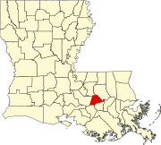 | |
| Town | ||
| CDPs | ||
| Other unincorporated communities | ||
| Footnotes | ‡This populated place also has portions in an adjacent parish or parishes | |
| ||
This Louisiana state location article is a stub. You can help Wikipedia by . |
- Unincorporated communities in Louisiana
- Unincorporated communities in Ascension Parish, Louisiana
- Louisiana populated places on the Mississippi River
- Louisiana geography stubs