Golfo San Jorge Basin
| Golfo San Jorge Basin | |
|---|---|
| Cuenca del Golfo San Jorge | |
 Oil well near the port city of Comodoro Rivadavia | |
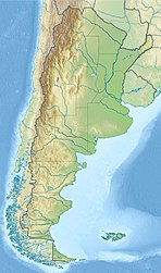 Location of the basin in Argentina | |
| Coordinates | 45°00′S 67°50′W / 45.000°S 67.833°W |
| Etymology | San Jorge Gulf |
| Location | Southern South America |
| Region | Patagonia |
| Country | |
| State(s) | Chubut, Santa Cruz |
| Cities | Comodoro Rivadavia |
| Characteristics | |
| On/Offshore | Both |
| Boundaries | North Patagonian Massif, Deseado Massif, Andes |
| Part of | Southern Atlantic rift basins |
| Area | 170,000 km2 (66,000 sq mi) |
| Hydrology | |
| Sea(s) | South Atlantic |
| River(s) | Chico River |
| Lake(s) | Lake Musters and Lake Colhué Huapí |
| Geology | |
| Basin type | Rift |
| Plate | South American |
| Orogeny | Opening of the South Atlantic |
| Age | Early Jurassic-Pleistocene |
| Stratigraphy | Stratigraphy |
| Field(s) | , , , |


The Golfo San Jorge Basin (Spanish: Cuenca del Golfo San Jorge) is a hydrocarbon-rich sedimentary basin located in eastern Patagonia, Argentina. The basin covers the entire San Jorge Gulf and an inland area west of it, having one half located in Santa Cruz Province and the other in Chubut Province. The northern boundary of the basin is the North Patagonian Massif while the Deseado Massif forms the southern boundary of the basin. The basin has largely developed under condition of extensional tectonics, including rifting.[1]
The basin is of paleontological significance as it hosts six out of 22 defining formations for the SALMA classification, the geochronology for the Cenozoic used in South America.
At the center of the basin accumulated sediments reach more than 8,000 metres (26,000 ft) of thickness. Oil was first discovered in 1907 and over the years it has become the second most productive hydrocarbon basin in Argentina after Neuquén Basin.[1]
Stratigraphy[]
The stratigraphy of the Golfo San Jorge Basin covers the following units:[1][2][3]
| Unit | Age bold is SALMA type |
Tectonic regime | Depositional environment | Thickness (m) |
Petroleum geology | |
|---|---|---|---|---|---|---|
| Pleistocene | Glacio-fluvial | 40 | ||||
| Mayoan | ||||||
| Santacrucian | Fluvio-deltaic | 200 | ||||
| Shallow marine | 280 | |||||
| Colhuehuapian | Fluvio-lacustrine | 120 | ||||
| Deseadan | ||||||
| Tinguirirican | ||||||
| Divisaderan | Lacustrine | 42 | ||||
| Mustersan | ||||||
| Casamayoran | Fluvio-lacustrine | 44 | ||||
| Riochican | Fluvial | 42 | ||||
| Itaboraian | ||||||
| Peligran | 25 | |||||
| Peligran | Shallow marine-deltaic-fluvial | 200 | Petroleum reservoir | |||
| Tiupampan | ||||||
| Lago Colhué Huapí | Maastrichtian Campanian |
Fluvial | ||||
Bajo Barreal Laguna Palacios |
Santonian Aptian |
Late sag | Deltaic Fluvio-lacustrine |
4000+ | ||
Bajo Barreal |
Alluvial-fluvial-lacustrine | |||||
| Fluvio-lacustrine | ||||||
| Early sag | 1500+ | Source rock and petroleum reservoir | ||||
| Neocomian | Late rift | Fluvio-lacustrine | 560 | |||
| Lacustrine | 1700+ | Source rock | ||||
| Cerro Carnerero | Mid-Late Jurassic | Early rift | Volcaniclastic | 1300+ | ||
| Early Jurassic | Pre-rift | Shallow marine | 700+ | |||
| Basement | Paleozoic | |||||
See also[]
References[]
- ^ a b c Sylwan, Caudio A. (2001). "Geology of the Golfo San Jorge Basin, Argentina". Journal of Iberian Geology. 27: 123–157. Retrieved 4 December 2015.
- ^ Raigemborn et al., 2010, p.243
- ^ Cortés, 1986, p.49
Bibliography[]
- General
- . 1986. Estratigrafía y tectónica de la región central de la Provincia de Chubut, República Argentina (PhD thesis), 1–242. Universidad de Buenos Aires. Accessed 2019-02-16.
- Cretaceous
- ; ; , and . 2016. Ordenamiento y caracterización faunística del Cretácico Superior del Grupo Chubut, Cuenca del Golfo San Jorge, Argentina. 19. 53–70. Accessed 2019-02-16.
- ; , and . 2015. Análisis estratigráfico y paleontológico del Cretácico Superior en la Cuenca del Golfo San Jorge: Nueva unidad litoestratigráfica para el Grupo Chubut. Revista de la Asociación Geológica Argentina 72. 77–95. Accessed 2019-02-16.
Paleogene[]
- Andesitas Huancache Formation
- ; ; ; ; ; ; ; , and . 2012. Persistence of a Mesozoic, non-therian mammalian lineage (Gondwanatheria) in the mid-Paleogene of Patagonia. Naturwissenschaften 99. 449–463. Accessed 2019-02-15.
- . 2009. New Early Eocene Mammalian Fauna from Western Patagonia, Argentina. American Museum Novitates 3638. 1–43. Accessed 2018-09-11.
- Bororó Formation
- ; , and . 2009. A Danian subtropical lacustrine palynobiota from South America (Bororó Formation, San Jorge Basin, Patagonia - Argentina). Geologica Acta 7. 35–61. Accessed 2018-09-10.
- Casamayor Formation
- ; ; , and . 2010. Redefinición estratigráfica del Grupo Río Chico (Paleógeno Superior), en el norte de la Cuenca del Golfo San Jorge, Chubut. Revista de la Asociación Geológica Argentina 67. 239–256. Accessed 2017-10-18.
- . 2008. Estudio estratigráfico, sedimentológico y composicional de las sedimentitas del Terciário inferior (Grupo Rio Chico) en el sector sudoriental del Chubut Extraandino (PhD thesis), 11–58. Universidad Nacional de La Plata. Accessed 2017-10-18.
- Las Flores Formation
- ; ; , and . 2009. Earliest South American paucituberculatans and their significance in the understanding of ‘pseudodiprotodont’ marsupial radiations. Zoological Journal of the Linnean Society 155. 867–884. Accessed 2019-02-15.
- ; ; , and . 2010. Redefinición estratigráfica del Grupo Río Chico (Paleógeno Superior), en el norte de la Cuenca del Golfo San Jorge, Chubut. Revista de la Asociación Geológica Argentina 67. 239–256. Accessed 2017-10-18.
- ; , and . 2013. Stratigraphic review of the Las Flores Formation, Sierra Baguales, Última Esperanza Province, Magallanes, 355–358. GeoSur Conference IV Viña del Mar. Accessed 2019-02-11.
- Koluel Kaike Formation
- ; ; , and . 2010. Redefinición estratigráfica del Grupo Río Chico (Paleógeno inferior), en el norte de la Cuenca del Golfo San Jorge, Chubut. Revista de la Asociación Geológica Argentina 67. 239–256. Accessed 2017-08-15.
- Peñas Coloradas Formation
- ; ; ; ; ; ; ; , and . 2014. New age constraints for the Salamanca Formation and lower Río Chico Group in the western San Jorge Basin, Patagonia, Argentina: Implications for Cretaceous-Paleogene extinction recovery and land mammal age correlations. GSA Bulletin 126. 289–306. Accessed 2017-08-15.
- ; ; , and . 2010. Redefinición estratigráfica del Grupo Río Chico (Paleógeno inferior), en el norte de la Cuenca del Golfo San Jorge, Chubut. Revista de la Asociación Geológica Argentina 67. 239–256. Accessed 2017-08-15.
- Río Chico Group
- ; ; , and . 2010. Redefinición estratigráfica del Grupo Río Chico (Paleógeno inferior), en el norte de la Cuenca del Golfo San Jorge, Chubut. Revista de la Asociación Geológica Argentina 67. 239–256. Accessed 2018-09-04.
- Salamanca Formation
- ; , and . 2014. The youngest South American rhynchocephalian, a survivor of the K/Pg extinction. Proceedings of the Royal Society B: Biological Sciences 281. 20140811.
- , and . 1997. Un primitico Notonychopidae (Litopterna) del paleoceno inferior de Punta Peligro, Chubut, Argentina. Estudios Geológicos 53. 263–274. Accessed 2018-10-01.
- ; ; ; ; ; ; ; , and . 2014. New age constraints for the Salamanca Formation and lower Río Chico Group in the western San Jorge Basin, Patagonia, Argentina: Implications for Cretaceous-Paleogene extinction recovery and land mammal age correlations. GSA Bulletin 126. 289–306. Accessed 2017-08-15.
- ; ; , and . 2017. Flowering after disaster: Early Danian buckthorn (Rhamnaceae) flowers and leaves from Patagonia. PLOS ONE 12. e0176164. Accessed 2019-02-14.
- ; ; , and . 2017. Conifer woods from the Salamanca Formation (early Paleocene), Central Patagonia, Argentina: Paleoenvironmental implications. Journal of South American Earth Sciences 76. 427–445. Accessed 2019-02-14.
Neogene[]
- Río Mayo Formation
- ; ; ; ; , and . 2003. Hoja Geológica 4772-II Lago Buenos Aires, 1–80. Instituto de Geología y Recursos Minerales, . Accessed 2018-09-10.
- Sarmiento Formation & Colhué Huapí Member
- , and . 2005. Phorusrhacidae Psilopterinae (Aves) en la Formación Sarmiento de la localidad de Gran Hondonada (Eoceno Superior), Patagonia, Argentina [Phorusrhacidae Psilopterinae (Birds) in the Sarmiento Formation from the Gran Hondonada locality (Upper Eocene), Patagonia, Argentina]. 20. 127–132. Accessed 2018-09-10.
- ; ; , and . 2014. A new early Miocene octodontoid rodent (Hystricognathi, Caviomorpha) from Patagonia (Argentina) and a reassessment of the early evolution of Octodontoidea. Journal of Vertebrate Paleontology 34. 397–406. Accessed 2019-02-12.
- ; , and . 2016. A new Cramaucheniinae (Litopterna, Macraucheniidae) from the early Miocene of Patagonia, Argentina. Journal of Vertebrate Paleontology 36. e1229672. Accessed 2019-02-12.
- ; ; , and . 2014. Nueva asociación de mamíferos del Paleógeno en el este de la Patagonia (provincia de Chubut, Argentina): implicancias biocronológicas y paleobiogeográficas. Andean Geology 41. 224–247. Accessed 2017-08-15.
- ; , and . 2012. A new species of Chubutomys (Rodentia, Hystricognathi) from the late Oligocene of Patagonia and its implications on the early evolutionary history of Cavioidea sensu stricto. Geobios 45. 573–580. Accessed 2019-02-15.
- ; ; ; , and . 2012. New leontiniid Notoungulata (Mammalia) from Chile and Argentina : comparative anatomy, character analysis, and phylogenetic hypotheses. American Museum Novitates 3737. 1–64. Accessed 2019-02-15.
- ; , and . 2015. A new turtle from the Palaeogene of Patagonia (Argentina) sheds new light on the diversity and evolution of the bizarre clade of horned turtles (Meiolaniidae, Testudinata). Zoological Journal of the Linnean Society 174. 519–548. Accessed 2019-02-13.
- ; ; , and . 2015. New rodents (Mammalia) from the late Oligocene of Cabeza Blanca (Chubut) and the first rodent radiation in Patagonia. Historical Biology: An International Journal of Paleobiology 27. 236–257. Accessed 2019-02-13.
- ; ; ; ; , and . 2014. A new acaremyid rodent (Caviomorpha, Octodontoidea) from Scarritt Pocket, Deseadan (late Oligocene) of Patagonia (Argentina). Journal of Vertebrate Paleontology 34. 689–698. Accessed 2019-02-12.
- ; , and . 2018. New Paleogene notohippids and leontiniids (Toxodontia; Notoungulata; Mammalia) from the Early Oligocene Tinguiririca Fauna of the Andean Main Range, central Chile. Journal of South American Earth Sciences 3903. 1–42. Accessed 2019-02-11.
Further reading[]
- , and . 1980. Realms of subsidence. Canadian Society for Petroleum Geology Memoir 6. 9–94.
- ; , and . 1983. Global Basin Classification System. AAPG Bulletin 67. 2175–2193. Accessed 2017-06-23.
- . 1980. Petroleum Basins - Classifications and Characteristics. Journal of Petroleum Geology 3. 187–207. Accessed 2017-06-23.
Major South American geological features | |||||
|---|---|---|---|---|---|
| Tectonic plates |  | ||||
| Cratons and shields | |||||
| Structures undergoing subduction | |||||
| Faults and shear zones | |||||
| Rifts and grabens | |||||
| Sedimentary basins | |||||
| Orogenies | |||||
| Metallogenetic provinces | |||||
| Volcanism |
| ||||
Sedimentary basins of Argentina | ||||||
|---|---|---|---|---|---|---|
| Onshore & offshore |
|  | ||||
| Offshore | ||||||
| Sources |
| |||||
- Golfo San Jorge Basin
- Sedimentary basins of Argentina
- Rift basins
- Geology of Chubut Province
- Geology of Santa Cruz Province, Argentina
- Mesozoic rifts and grabens