Cuyo Basin
| Cuyo Basin | |
|---|---|
| Cuenca Cuyana | |
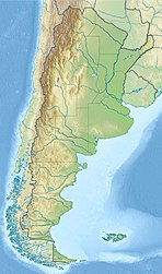 Location of the basin in Argentina | |
| Coordinates | 34°15′S 68°34′W / 34.250°S 68.567°W |
| Etymology | |
| Country | |
| State(s) | Mendoza, San Juan |
| Cities | Mendoza |
| Characteristics | |
| On/Offshore | Onshore |
| Boundaries | Andes |
| Part of | Andean foreland basins |
| Area | ~30,000 km2 (12,000 sq mi) |
| Hydrology | |
| River(s) | |
| Geology | |
| Basin type | Foreland basin |
| Plate | South American |
| Orogeny | Andean |
| Age | Triassic-Pliocene |
| Stratigraphy | Stratigraphy |
| Field(s) | |
Cuyo Basin (Spanish: Cuenca Cuyana) is a sedimentary basin in Mendoza Province, western Argentina. The Cuyo Basin has a NNW-SSE elongated shape and is limited to the west by the Sierra Pintada System and to the east by the Pampean pericraton. To the north the basin reaches the area around the city of Mendoza.[1]
Description[]
The Cuyo Basin has an approximate area of 30,000 square kilometres (12,000 sq mi).[2] It has two major sub-basins: Cacheuta (Spanish: Subcuenca Cacheuta) in the north and Alvear (Spanish: Subcuenca Alvear) in the south. The northern fringes of Cacheuta sub-basin reaches into San Juan Province. The basin existed already during the Triassic but its current shape is derivative of the Andean orogeny.[1]
The basin originated as a rift basin in the context of extensional tectonics and crustal thinning that followed the Paleozoic Gondwanide orogeny.[note 1]
Stratigraphy[]
The stratigraphy of the Cuyo Basin comprises the following formations:
| Age bold is SALMA type |
Group | Formation | Lithologies | Depositional environment | Notes |
|---|---|---|---|---|---|
| Pleistocene | [4] | ||||
| Mio-Pliocene Huayquerian |
Huayquerías | Mudstones, sandstones, tuff | Fluvial | [5] | |
| Miocene | Alluvial | [6] | |||
| Miocene | Shales and sandstones | Alluvial | [6] | ||
| Middle Miocene Laventan |
Sandstones | Alluvial and eolian | [6] | ||
| Late Oligocene Deseadan | |||||
| Early Oligocene | Hiatus | [6] | |||
| Priabonian | |||||
| Bartonian Divisaderan |
Fluvial | [6] | |||
| Lutetian | Fluvial | [6] | |||
| Early Eocene | Hiatus | [6] | |||
| Paleocene | |||||
| Late Cretaceous | |||||
| Early Cretaceous | Basalts | Volcanic | [6] | ||
| Late Jurassic | |||||
| Sandstones and conglomerates | Alluvial to fluvial | [6] | |||
| Rhaetian | Fluvial-deltaic | [6][3] | |||
| Norian | |||||
| Carnian | Black shales | Lacustrine | [6][7] | ||
| Tuffs, conglomerates, sandstones, shales | Alluvial to fluvial | [6][7][8] | |||
| Ladinian | Mudstones and conglomerates | [6][7] | |||
| Anisian | |||||
| Olenekian | Volcaniclastic conglomerates | [6][7] | |||
| Induan | |||||
| Late Permian | Choiyoi Group | [3] | |||
| Carboniferous | Hiatus | [9][10] | |||
| Devonian | |||||
| Early Paleozoic | Cuyania | [9][10] | |||
See also[]
- Geological history of the Precordillera terrane
- Colorado Basin, basin to the southeast of Cuyo Basin
- Ischigualasto-Villa Unión Basin, Triassic rift basin to the north of Cuyo Basin
- Neuquén Basin, Mesozoic rift basin to the south of Cuyo Basin
- Paraná Basin, basin to the northeast of Cuyo Basin
- Salta Basin, Mesozoic rift basin to the north of Cuyo Basin
Notes and references[]
Notes[]
References[]
- ^ a b "Cuenca Cuyana". Secretaría de Energía (in Spanish). Government of Argentina. Retrieved 30 November 2015.
- ^ Zencich et al., 2008, p.110
- ^ a b c Spalletti et al., 2008, p.270
- ^ Yrigoyen, 1993
- ^ Garrido et al, 2017, p.51
- ^ a b c d e f g h i j k l m n Zencich et al., 2008, p.112
- ^ a b c d Spalletti et al., 2008, p.269
- ^ Spalletti et al., 2005
- ^ a b Finney, 2007
- ^ a b Keller et al., 1998
Bibliography[]
- General
- ; , and . 2008. Dating the Triassic continental rift in the southern Andes: the Potrerillos Formation, Cuyo Basin, Argentina. Geologica Acta 6. 267–283. Accessed 2020-07-14.
- ; , and . 2008. Sistema petrolero Cacheuta-Barrancas de la Cuenca Cuyana, Provincia de Mendoza, Argentina, 109–134. . Accessed 2017-08-21.
- . 2007. The parautochthonous Gonwanan origin of the Cuyania (greater Precordillera) terrane of Argentina: A re-evaluation of evidence used to support an allochthonous Laurentian origin. Geologica Acta 5. 127–158. Accessed 2020-07-14.
- ; ; ; , and . 2005. Stratigraphy, sedimentary facies and palaeoflora of the Potrerillos Triassic succession, Mendoza, Republic of Argentina. Revista Geológica de Chile 32. 249–272. Accessed 2020-07-14.
- ; , and . 1998. The stratigraphical record of the Argentine Precordillera and its plate-tectonic background. The Proto-Andean Margin of Gondwana. 142. 35–56. Accessed 2020-07-14.
- . 1993. Revisión estratigráfica del Neogeno de las Huayquerías de Mendoza septentrional, Argentina. Ameghiniana 31. 125–138. Accessed 2019-03-08.
- Divisadero Largo Formation
- ; , and . 1962. The mammalian fauna of the Divisadero Largo Formation, Mendoza, Argentina. Bulletin of the Museum of Comparative Zoology 127. 239–293. Accessed 2019-02-15.
- Huayquerías Formation
- ; ; ; ; , and . 2016. Exceptional skull of Huayqueriana (Mammalia, Litopterna, Macraucheniidae) from the Late Miocene of Argentina: anatomy, systematics and paleobiological implications. Bulletin of the American Museum of Natural History 404. 1–76. Accessed 2018-10-01.
- ; , and . 2017. Paleoambiente, edad y vertebrados de la Formación Huayquerías, Mioceno tardio, Provincia de Mendoza, Republica Argentina, 50–55. XX Congreso Geológico Argentino. Accessed 2018-09-10.
- Mariño Formation
- ; , and . 2018. A new early Miocene Mesotheriidae (Notoungulata) from the Mariño Formation (Argentina): Taxonomic and biostratigraphic implications. Journal of South American Earth Sciences 88. 118–131. Accessed 2019-02-11.
- , and . 2007. The first rodent from the Mariño Formation (Miocene) at Divisadero Largo (Mendoza, Argentina) and its biochronological implications. Andean Geology 34. 199–207. Accessed 2017-10-23.
Further reading[]
- , and . 1980. Realms of subsidence. Canadian Society for Petroleum Geology Memoir 6. 9–94.
- ; , and . 1983. Global Basin Classification System. AAPG Bulletin 67. 2175–2193. Accessed 2017-06-23.
- . 1980. Petroleum Basins - Classifications and Characteristics. Journal of Petroleum Geology 3. 187–207. Accessed 2017-06-23.
Major South American geological features | |||||
|---|---|---|---|---|---|
| Tectonic plates |  | ||||
| Cratons and shields | |||||
| Structures undergoing subduction | |||||
| Faults and shear zones | |||||
| Rifts and grabens | |||||
| Sedimentary basins | |||||
| Orogenies | |||||
| Metallogenetic provinces | |||||
| Volcanism |
| ||||
Sedimentary basins of Argentina | ||||||
|---|---|---|---|---|---|---|
| Onshore & offshore |
|  | ||||
| Offshore | ||||||
| Sources |
| |||||
- Sedimentary basins of Argentina
- Mesozoic rifts and grabens
- Foreland basins
- Geology of Mendoza Province
- Geology of San Juan Province, Argentina