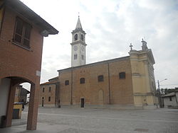
Gombito
Gombito
Gùmbet (Lombard) | |
|---|---|
| Comune di Gombito | |
 | |
Location of Gombito  | |
 Gombito Location of Gombito in Italy | |
| Coordinates: 45°16′N 9°44′E / 45.267°N 9.733°ECoordinates: 45°16′N 9°44′E / 45.267°N 9.733°E | |
| Country | Italy |
| Region | Lombardy |
| Province | Cremona (CR) |
| Government | |
| • Mayor | Massimo Caravaggio |
| Area | |
| • Total | 9.13 km2 (3.53 sq mi) |
| Elevation | 65 m (213 ft) |
| Population (31 August 2017)[3] | |
| • Total | 634 |
| • Density | 69/km2 (180/sq mi) |
| Demonym(s) | Gombitesi |
| Time zone | UTC+1 (CET) |
| • Summer (DST) | UTC+2 (CEST) |
| Postal code | 26020 |
| Dialing code | 0374 |
| Website | Official website |


Gombito (Cremasco: Gùmbet) is a comune (municipality) in the Province of Cremona in the Italian region Lombardy, located about 50 kilometres (31 mi) southeast of Milan and about 30 kilometres (19 mi) northwest of Cremona.
Gombito borders the following municipalities: Bertonico, Castelleone, Castiglione d'Adda, Formigara, Ripalta Arpina, San Bassano.
References[]
- ^ "Superficie di Comuni Province e Regioni italiane al 9 ottobre 2011". Italian National Institute of Statistics. Retrieved 16 March 2019.
- ^ "Popolazione Residente al 1° Gennaio 2018". Italian National Institute of Statistics. Retrieved 16 March 2019.
- ^ All demographics and other statistics: Italian statistical institute Istat.
This article on a location in the Province of Cremona is a stub. You can help Wikipedia by . |
Categories:
- Cities and towns in Lombardy
- Municipalities of the Province of Cremona
- Province of Cremona geography stubs