Gonabad County
Gonabad County
شهرستان گناباد | |
|---|---|
County | |
 Location of Gonabad County in Razavi Khorasan province | |
 Location of Razavi Khorasan Province in Iran | |
| Coordinates: 34°25′N 58°40′E / 34.417°N 58.667°ECoordinates: 34°25′N 58°40′E / 34.417°N 58.667°E | |
| Country | |
| Province | Razavi Khorasan Province |
| Capital | Gonabad |
| Bakhsh (Districts) | Central District, Kakhk District |
| Population (2016)[1] | |
| • Total | 88,753 |
| Time zone | UTC+3:30 (IRST) |
| • Summer (DST) | UTC+4:30 (IRDT) |
| Gonabad County at GEOnet Names Server | |
Gonabad County (Persian: شهرستان گناباد) is a county in Razavi Khorasan Province in Iran. The capital of the county is Gonabad. At the 2006 census, its population (including portions of the county that were later split from it to form Bajestan County) was 106,158, in 30,357 families; excluding those portions, the population was 76,663 in 22,260 families.[2] Gonabad County has two districts: Central District and Kakhk District. It has three cities: Gonabad, Bidokht, and Kakhk. The main villages are Zibad (Zeabad), Mend, Sanu, , and Disfan.
Historical places[]
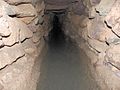
- Qanats of Gonabad
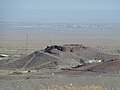
- Kūh-e Tīr Māhī
- kakhk
- zibad and Bidokht are historical places in gonabad.

Climate and geography[]
Gonabad is located in a plate aria on the north of the Brakoh mountain or Kūh-e Tīr Māhī [3]
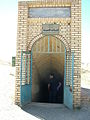
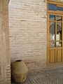
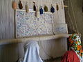
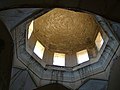
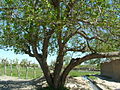
Gallery[]
Sassanian Empire CASTLE Yazdegerd III

Zibad Castle

Zibad Castle

Zibad Rheum
Kariz Zebad

zibad Mountain

Ferula Zibad

Sassanian Castel

Soufe Zibad


Rivas zibad

Kūh-ZibadZibad Gonabad
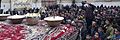
A photograph of Yaldā Night.

Ancient water clock used in qanat of gonabad 2500 years ago
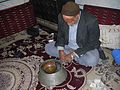
Reconstruction of the scene with a real manager of the water clock, Iran

a Yakhchal in gonabad


See also[]
- Davazdah Rokh
- Zibad
- Iran
- Gonabad
- Kūh-e Tīr Māhī
- Traditional water sources of Persian antiquity
References[]
- ^ "Census of the Islamic Republic of Iran, 1395 (2016)" (Excel). Islamic Republic of Iran.
- ^ "Census of the Islamic Republic of Iran, 1385 (2006)" (Excel). Statistical Center of Iran. Archived from the original on 2011-11-11.
- ^ [Geography and tribes and minorities in khorasan,Mohammad Ajam, research published 1992,university of Imam Sadegh,Tehran.]
- اطلس گیتاشناسی استانهای ایران [Atlas Gitashenasi Ostanhai Iran]
- Gitashenasi Province Atlas of Iran
- gonabad news agency (پایگاه خبری شهرستان گناباد)
- Qanat Gonabad [1]

| Capital |
| ||||||||||||||||||||
|---|---|---|---|---|---|---|---|---|---|---|---|---|---|---|---|---|---|---|---|---|---|
| Districts |
| ||||||||||||||||||||
This Gonabad County location article is a stub. You can help Wikipedia by . |
- Gonabad County
- Counties of Razavi Khorasan Province
- Gonabad County geography stubs