Gramling, South Carolina
Gramling | |
|---|---|
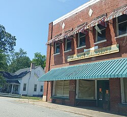 Old Country Store on U.S. Route 176 in Gramling, SC | |
 Gramling Location within the state of South Carolina | |
| Coordinates: 35°04′39″N 82°08′05″W / 35.07750°N 82.13472°WCoordinates: 35°04′39″N 82°08′05″W / 35.07750°N 82.13472°W | |
| Country | United States |
| State | South Carolina |
| County | Spartanburg |
| Area | |
| • Total | 1.012 sq mi (2.622 km2) |
| • Land | 1.003 sq mi (2.599 km2) |
| • Water | 0.009 sq mi (0.023 km2) |
| Elevation | 984 ft (300 m) |
| Population (2010) | |
| • Total | 86 |
| • Density | 85/sq mi (33/km2) |
| Time zone | UTC-5 (Eastern (EST)) |
| • Summer (DST) | UTC-4 (EDT) |
| ZIP codes | 29349 |
| FIPS code | 45083 |
| GNIS feature ID | 2629829[1] |

Gramling is a census-designated place located in Spartanburg County in the U.S. state of South Carolina.[2] According to the 2010 United States Census, the population was 86.[3]
History[]
Gramling was founded in the 1890s.[4] A post office has been in operation at Gramling since 1892.[5]
Geography[]
Gramling is located at 35°04′39″N 82°08′05″W / 35.07750°N 82.13472°W (35.077525, -82.134597).[2] These coordinates place the CDP in the Northwestern part of the county, between the Town of Campobello and the City of Inman.
According to the United States Census Bureau, the CDP has a total land area of 1.004 square miles (3.599 km2) and a total water area of 0.009 square miles (0.023 km2).[2]
References[]
- ^ a b U.S. Geological Survey Geographic Names Information System: Gramling, South Carolina
- ^ a b c "US Gazetteer files: 2010, 2000, and 1990". United States Census Bureau. 2011-02-12. Retrieved 2011-04-23.
- ^ Source: 2010 Census results for Gramling, SC Archived 2012-06-16 at the Wayback Machine
- ^ Foster, Julia H. (Jan 3, 1932). "Spartanburg County sees countless changes during 35-year period". Herald-Journal. p. 3. Retrieved 7 October 2015.
- ^ "Spartanburg County". Jim Forte Postal History. Retrieved 7 October 2015.
Municipalities and communities of Spartanburg County, South Carolina, United States | ||
|---|---|---|
| Cities |  | |
| Towns | ||
| CDPs | ||
| Other communities |
| |
| Ghost town | ||
| Footnotes | ‡This populated place also has portions in an adjacent county or counties | |
| ||
This South Carolina state location article is a stub. You can help Wikipedia by . |
- Census-designated places in Spartanburg County, South Carolina
- Census-designated places in South Carolina
- South Carolina geography stubs