Hilltop, South Carolina
Hilltop, South Carolina | |
|---|---|
 Hilltop | |
| Coordinates: 34°58′28″N 81°57′28″W / 34.97444°N 81.95778°WCoordinates: 34°58′28″N 81°57′28″W / 34.97444°N 81.95778°W | |
| Country | United States |
| State | South Carolina |
| County | Spartanburg |
| Area | |
| • Total | 1.83 sq mi (4.73 km2) |
| • Land | 1.83 sq mi (4.73 km2) |
| • Water | 0.0 sq mi (0.0 km2) |
| Elevation | 876 ft (267 m) |
| Time zone | UTC-5 (Eastern (EST)) |
| • Summer (DST) | UTC-4 (EDT) |
| ZIP Code | 29303 (Spartanburg) |
| Area code(s) | 864 |
| FIPS code | 45-33977 |
| GNIS feature ID | 2812990[2] |
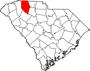
Hilltop is an unincorporated area and census-designated place (CDP) adjacent to the city of Spartanburg in Spartanburg County, South Carolina, United States. It was first listed as a CDP prior to the 2020 census.[2]
The CDP is in central Spartanburg County and is bordered to the southeast by the city of Spartanburg. Interstate 585 forms the northeast border of the CDP, Interstate 85 Business is the northwest border, and the southwest border is a branch of the Norfolk Southern Railway. The CDP of Southern Shops is to the northwest, across I-85 Business, and Saxon is to the southwest, across the railroad.
South Carolina Highway 56 (Asheville Highway) is the main road through Hilltop, leading southeast into Spartanburg and northwest 9 miles (14 km) to Inman.
References[]
- ^ "2020 U.S. Gazetteer Files – South Carolina". United States Census Bureau. Retrieved September 9, 2021.
- ^ a b "Hilltop Census Designated Place". Geographic Names Information System. United States Geological Survey.
- Census-designated places in Spartanburg County, South Carolina
- Census-designated places in South Carolina
- South Carolina geography stubs


