Greater Taung Local Municipality
Greater Taung | |
|---|---|
 Seal | |
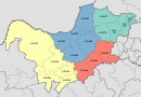
 Location in the North West | |
| Country | South Africa |
| Province | North West |
| District | Dr Ruth Segomotsi Mompati |
| Seat | Taung |
| Wards | 26 |
| Government | |
| • Type | Municipal council |
| • Mayor | Tumisang.R "Daddy" Gaoraelwe |
| Area | |
| • Total | 5,635 km2 (2,176 sq mi) |
| Population (2011)[2] | |
| • Total | 177,642 |
| • Density | 32/km2 (82/sq mi) |
| Racial makeup (2011) | |
| • Black African | 98.2% |
| • Coloured | 1.0% |
| • Indian/Asian | 0.2% |
| • White | 0.4% |
| First languages (2011) | |
| • Tswana | 90.3% |
| • Xhosa | 1.7% |
| • Sotho | 1.5% |
| • English | 1.5% |
| • Other | 5% |
| Time zone | UTC+2 (SAST) |
| Municipal code | NW394 |
Greater Taung Local Municipality is a local municipality in Dr Ruth Segomotsi Mompati District Municipality, North West Province, South Africa. The Seat of local municipality is Taung.
Main places[]
The 2001 census divided the municipality into the following main places:[4]
| Place | Code | Area (km2) | Population | Most spoken language |
|---|---|---|---|---|
| 61401 | 483.38 | 26,424 | Tswana | |
| 61402 | 811.50 | 30,810 | Tswana | |
| 61403 | 1,193.50 | 107,870 | Tswana | |
| 61404 | 2.76 | 3,337 | Tswana | |
| 61405 | 3.81 | 3,568 | Tswana | |
| 61407 | 9.55 | 3,255 | Tswana | |
| Pudimoe | 61408 | 2.80 | 3,718 | Tswana |
| Reivilo | 61409 | 27.28 | 21 | Tswana |
| Remainder of the municipality | 61406 | 3,106.08 | 3,159 | Tswana |
Politics[]
The municipal council consists of forty-eight members elected by mixed-member proportional representation. Twenty-four councillors are elected by first-past-the-post voting in twenty-four wards, while the remaining twenty-four are chosen from party lists so that the total number of party representatives is proportional to the number of votes received. In the election of 1 November 2021 the African National Congress (ANC) won a majority of twenty-eight seats on the council. The following table shows the results of the election.[5]
| Party | Ward | List | Total seats | |||||
|---|---|---|---|---|---|---|---|---|
| Votes | % | Seats | Votes | % | Seats | |||
| African National Congress | 23,392 | 56.42 | 23 | 23,528 | 58.03 | 5 | 28 | |
| Economic Freedom Fighters | 9,491 | 22.89 | 0 | 9,532 | 23.51 | 11 | 11 | |
| 1,612 | 3.89 | 0 | 1,546 | 3.81 | 2 | 2 | ||
| Forum for Service Delivery | 1,580 | 3.81 | 1 | 1,563 | 3.85 | 1 | 2 | |
| Independent candidates | 2,128 | 5.13 | 0 | 0 | ||||
| Democratic Alliance | 953 | 2.30 | 0 | 953 | 2.35 | 1 | 1 | |
| African Independent Congress | 265 | 0.64 | 0 | 846 | 2.09 | 1 | 1 | |
| African Christian Democratic Party | 395 | 0.95 | 0 | 380 | 0.94 | 1 | 1 | |
| National Freedom Party | 361 | 0.87 | 0 | 408 | 1.01 | 1 | 1 | |
| Patriotic Alliance | 335 | 0.81 | 0 | 375 | 0.92 | 1 | 1 | |
| 4 other parties | 946 | 2.28 | 0 | 1,416 | 3.49 | 0 | 0 | |
| Total | 41,458 | 100.00 | 24 | 40,547 | 100.00 | 24 | 48 | |
| Valid votes | 41,458 | 97.63 | 40,547 | 96.04 | ||||
| Invalid/blank votes | 1,005 | 2.37 | 1,671 | 3.96 | ||||
| Total votes | 42,463 | 100.00 | 42,218 | 100.00 | ||||
| Registered voters/turnout | 87,198 | 48.70 | 87,198 | 48.42 | ||||
References[]
- ^ "Contact list: Executive Mayors". Government Communication & Information System. Archived from the original on 14 July 2010. Retrieved 22 February 2012.
- ^ a b "Statistics by place". Statistics South Africa. Retrieved 27 September 2015.
- ^ "Statistics by place". Statistics South Africa. Retrieved 27 September 2015.
- ^ Lookup Tables - Statistics South Africa[permanent dead link]
- ^ "Election Result Table for LGE2021 — Greater Taung". wikitable.frith.dev. Retrieved 2021-12-04.
External links[]
Municipalities of the North West | ||||||||||
|---|---|---|---|---|---|---|---|---|---|---|
| District and local |
|  | ||||||||
This North West Province location article is a stub. You can help Wikipedia by . |

- Local municipalities of the Dr Ruth Segomotsi Mompati District Municipality
- North West (South Africa) geography stubs