Green Level, North Carolina
Green Level | |
|---|---|
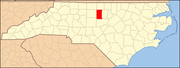
 Location of Green Level, North Carolina | |
 Green Level Location of Green Level, North Carolina | |
| Coordinates: 36°7′25″N 79°20′40″W / 36.12361°N 79.34444°WCoordinates: 36°7′25″N 79°20′40″W / 36.12361°N 79.34444°W | |
| Country | United States |
| State | North Carolina |
| County | Alamance |
| Area | |
| • Total | 1.50 sq mi (3.89 km2) |
| • Land | 1.50 sq mi (3.89 km2) |
| • Water | 0.00 sq mi (0.01 km2) |
| Elevation | 600 ft (183 m) |
| Population (2010) | |
| • Total | 2,100 |
| • Estimate (2019)[4] | 2,326 |
| • Density | 1,549.63/sq mi (598.30/km2) |
| Time zone | UTC-5 (Eastern (EST)) |
| • Summer (DST) | UTC-4 (EDT) |
| ZIP code | 27217 |
| Area code(s) | 336 |
| FIPS code | 37-27870[2] |
| GNIS feature ID | 1027611[3] |
| Website | www |


Green Level is a town in Alamance County, North Carolina, United States. It is part of the Burlington, North Carolina Metropolitan Statistical Area. As of the 2010 census, the population was 2,100.[5]
Geography[]
Green Level is located at 36°7′25″N 79°20′40″W / 36.12361°N 79.34444°W (36.123481, -79.344480).[6]
According to the United States Census Bureau, the town has a total area of 1.4 square miles (3.5 km2), of which 0.0023 square miles (0.006 km2), or 0.17%, is water.[5]
Demographics[]
| Historical population | |||
|---|---|---|---|
| Census | Pop. | %± | |
| 2000 | 2,042 | — | |
| 2010 | 2,100 | 2.8% | |
| 2019 (est.) | 2,326 | [4] | 10.8% |
| U.S. Decennial Census[7] | |||
As of the census[2] of 2000, there were 2,042 people, 741 households, and 555 families residing in the town. The population density was 1,452.8 people per square mile (559.2/km2). There were 823 housing units at an average density of 585.5 per square mile (225.4/km2). The racial makeup of the town was 14.69% White, 73.41% African American, 0.78% Native American, 0.64% Asian, 8.91% from other races, and 1.57% from two or more races. Hispanic or Latino of any race were 13.47% of the population.
There were 741 households, out of which 33.5% had children under the age of 18 living with them, 44.5% were married couples living together, 23.5% had a female householder with no husband present, and 25.1% were non-families. 21.2% of all households were made up of individuals, and 8.1% had someone living alone who was 65 years of age or older. The average household size was 2.76 and the average family size was 3.18.
In the town, the population was spread out, with 27.9% under the age of 18, 8.0% from 18 to 24, 31.0% from 25 to 44, 22.4% from 45 to 64, and 10.7% who were 65 years of age or older. The median age was 35 years. For every 100 females, there were 88.6 males. For every 100 females age 18 and over, there were 86.5 males.
The median income for a household in the town was $31,793, and the median income for a family was $34,242. Males had a median income of $23,143 versus $21,161 for females. The per capita income for the town was $12,403. About 10.3% of families and 11.9% of the population were below the poverty line, including 12.9% of those under age 18 and 21.4% of those age 65 or over.
References[]
- ^ "2019 U.S. Gazetteer Files". United States Census Bureau. Retrieved July 27, 2020.
- ^ Jump up to: a b "U.S. Census website". United States Census Bureau. Retrieved 2008-01-31.
- ^ "US Board on Geographic Names". United States Geological Survey. 2007-10-25. Retrieved 2008-01-31.
- ^ Jump up to: a b "Population and Housing Unit Estimates". United States Census Bureau. May 24, 2020. Retrieved May 27, 2020.
- ^ Jump up to: a b "Geographic Identifiers: 2010 Demographic Profile Data (G001): Green Level town, North Carolina". U.S. Census Bureau, American Factfinder. Archived from the original on February 12, 2020. Retrieved July 1, 2013.
- ^ "US Gazetteer files: 2010, 2000, and 1990". United States Census Bureau. 2011-02-12. Retrieved 2011-04-23.
- ^ "Census of Population and Housing". Census.gov. Retrieved June 4, 2015.
External links[]
| show Municipalities and communities of Alamance County, North Carolina, United States |
|---|
| show Authority control |
|---|
- Towns in North Carolina
- Towns in Alamance County, North Carolina