Mandale, North Carolina
Mandale, North Carolina | |
|---|---|
Unincorporated community | |
 Location of Mandale in North Carolina | |
| Coordinates: 35°51′12″N 79°16′23″W / 35.85333°N 79.27306°WCoordinates: 35°51′12″N 79°16′23″W / 35.85333°N 79.27306°W | |
| Country | United States |
| State | North Carolina |
| County | Alamance |
| Government | |
| • Mayor | Nick Mshar |
| Elevation | 554 ft (169 m) |
| Time zone | UTC-5 (Eastern (EST)) |
| • Summer (DST) | UTC-4 (EDT) |
| Area code(s) | 336 |
| GNIS feature ID | 1006286[1] |


Mandale is an unincorporated community in Alamance County, North Carolina, United States.
Mandale is located on North Carolina Highway 87, south of Eli Whitney, and northwest of Pittsboro.
References[]
- ^ a b "Mandale, North Carolina". Geographic Names Information System. United States Geological Survey.. Retrieved on 2008-03-29.
Municipalities and communities of Alamance County, North Carolina, United States | ||
|---|---|---|
| Cities | 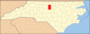 | |
| Towns | ||
| Village | ||
| CDPs | ||
| Other communities | ||
| Footnotes | ‡This populated place also has portions in an adjacent county or counties | |
| ||
Categories:
- Unincorporated communities in North Carolina
- Unincorporated communities in Alamance County, North Carolina
- Alamance County, North Carolina geography stubs