Swepsonville, North Carolina
Swepsonville | |
|---|---|
 Swepsonville Town Hall | |
 Location of Swepsonville, North Carolina | |
 Swepsonville Location of Swepsonville, North Carolina | |
| Coordinates: 36°1′36″N 79°21′17″W / 36.02667°N 79.35472°WCoordinates: 36°1′36″N 79°21′17″W / 36.02667°N 79.35472°W | |
| Country | United States |
| State | North Carolina |
| County | Alamance |
| Area | |
| • Total | 1.51 sq mi (3.90 km2) |
| • Land | 1.43 sq mi (3.70 km2) |
| • Water | 0.08 sq mi (0.21 km2) |
| Elevation | 525 ft (160 m) |
| Population (2010) | |
| • Total | 1,154 |
| • Estimate (2019)[2] | 1,384 |
| • Density | 969.87/sq mi (374.40/km2) |
| Time zone | UTC-5 (Eastern (EST)) |
| • Summer (DST) | UTC-4 (EDT) |
| ZIP code | 27359 |
| Area code(s) | 336 |
| FIPS code | 37-66460[3] |
| GNIS feature ID | 1022870[4] |
| Website | www |


Swepsonville is a town in Alamance County, North Carolina, United States. It is part of the Burlington, North Carolina Metropolitan Statistical Area. The population at the 2010 census was 1,154.[5]
Geography[]
Swepsonville is located at 36°1′36″N 79°21′17″W / 36.02667°N 79.35472°W (36.026744, -79.354849).[6]
According to the United States Census Bureau, the town has a total area of 1.5 square miles (3.9 km2), of which 1.4 square miles (3.6 km2) is land and 0.077 square miles (0.2 km2), or 5.53%, is water.[5]
Demographics[]
| Historical population | |||
|---|---|---|---|
| Census | Pop. | %± | |
| 1890 | 326 | — | |
| 1900 | 441 | 35.3% | |
| 1990 | 1,195 | — | |
| 2000 | 922 | −22.8% | |
| 2010 | 1,154 | 25.2% | |
| 2019 (est.) | 1,384 | [2] | 19.9% |
| U.S. Decennial Census[7] | |||

2020 census[]
| Race | Number | Percentage |
|---|---|---|
| White (non-Hispanic) | 1,597 | 65.32% |
| Black or African American (non-Hispanic) | 421 | 17.22% |
| Native American | 12 | 0.49% |
| Asian | 110 | 4.5% |
| Pacific Islander | 2 | 0.08% |
| Other/Mixed | 109 | 4.46% |
| Hispanic or Latino | 194 | 7.93% |
As of the 2020 United States census, there were 2,445 people, 796 households, and 531 families residing in the town.
2000 census[]
At the 2000 census,[3] there were 922 people, 383 households, and 271 families residing in the town. The population density was 894.5 people per square mile (345.6/km2). There were 405 housing units at an average density of 392.9/sq mi (151.8/km2). The racial makeup of the town was 94.03% White, 3.80% African American, 0.43% Asian, 0.54% from other races, and 1.19% from two or more races. Hispanic or Latino of any race were 1.84% of the population.
There were 383 households, out of which 29.2% had children under the age of 18 living with them, 60.1% were married couples living together, 8.6% had a female householder with no husband present, and 29.2% were non-families. 25.1% of all households were made up of individuals, and 9.4% had someone living alone who was 65 years of age or older. The average household size was 2.41 and the average family size was 2.86.
In the town, the population was spread out, with 23.2% under the age of 18, 5.1% from 18 to 24, 28.5% from 25 to 44, 30.3% from 45 to 64, and 12.9% who were 65 years of age or older. The median age was 41 years. For every 100 females, there were 88.5 males. For every 100 females age 18 and over, there were 91.9 males.
The median income for a household in the town was $51,719, and the median income for a family was $60,147. Males had a median income of $38,125 versus $27,222 for females. The per capita income for the town was $26,047. About 4.8% of families and 6.5% of the population were below the poverty line, including 3.7% of those under age 18 and 8.2% of those age 65 or over.
Honda[]
The Honda Motor Company manufactures general purpose engines, walk-behind lawn mowers, snow blowers, string trimmers, water pumps, and tillers in Swepsonville.
History[]
Swepsonville was named for the builder of a mill on the western side of town. Swepson disappeared one night with a considerable amount of money and soon established a mill in the North. The old mill, unused for many years, burned down in 1989 in a ten-alarm fire which brought firetrucks from all surrounding counties, was visible from the freeway 3 miles away, and made the national news.
A major league ballplayer, Dusty Cooke, came from Swepsonville. He played for the Yankees, the Red Sox and the Reds from 1930–1938, and managed the Phillies in 1948.
Notable people[]
- Dusty Cooke, Major League Baseball player
References[]
- ^ "2019 U.S. Gazetteer Files". United States Census Bureau. Retrieved July 27, 2020.
- ^ a b "Population and Housing Unit Estimates". United States Census Bureau. May 24, 2020. Retrieved May 27, 2020.
- ^ a b "U.S. Census website". United States Census Bureau. Retrieved 2008-01-31.
- ^ "US Board on Geographic Names". United States Geological Survey. 2007-10-25. Retrieved 2008-01-31.
- ^ a b "Geographic Identifiers: 2010 Demographic Profile Data (G001): Swepsonville town, North Carolina". U.S. Census Bureau, American Factfinder. Archived from the original on February 12, 2020. Retrieved July 1, 2013.
- ^ "US Gazetteer files: 2010, 2000, and 1990". United States Census Bureau. 2011-02-12. Retrieved 2011-04-23.
- ^ "Census of Population and Housing". Census.gov. Retrieved June 4, 2015.
- ^ "Explore Census Data". data.census.gov. Retrieved 2021-12-20.
External links[]
| Wikimedia Commons has media related to Swepsonville, North Carolina. |
Municipalities and communities of Alamance County, North Carolina, United States | ||
|---|---|---|
| Cities | 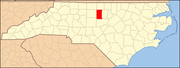 | |
| Towns | ||
| Village | ||
| CDPs | ||
| Other communities | ||
| Footnotes | ‡This populated place also has portions in an adjacent county or counties | |
| ||
- Towns in North Carolina
- Towns in Alamance County, North Carolina