Gunnedah Shire
| Gunnedah Shire New South Wales | |||||||||||||||
|---|---|---|---|---|---|---|---|---|---|---|---|---|---|---|---|
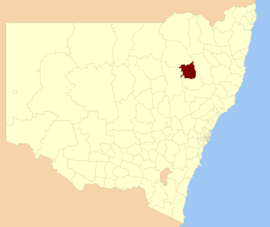 Location in New South Wales | |||||||||||||||
| Coordinates | 30°58′S 150°15′E / 30.967°S 150.250°ECoordinates: 30°58′S 150°15′E / 30.967°S 150.250°E | ||||||||||||||
| Population | |||||||||||||||
| • Density | 2.4459/km2 (6.3349/sq mi) | ||||||||||||||
| Established | 1 January 1980 | ||||||||||||||
| Area | 4,994 km2 (1,928.2 sq mi) | ||||||||||||||
| Mayor | Jamie Chaffey (Unaligned) | ||||||||||||||
| Council seat | Gunnedah[3] | ||||||||||||||
| Region | North West Slopes | ||||||||||||||
| State electorate(s) | Tamworth | ||||||||||||||
| Federal Division(s) | Parkes | ||||||||||||||
| Website | Gunnedah Shire | ||||||||||||||
| |||||||||||||||

Gunnedah Shire is a local government area in the North West Slopes region of New South Wales, Australia. The Shire is located adjacent to the Liverpool Plains in the Namoi River valley and is traversed by the Oxley Highway and the Kamilaroi Highway.
The Shire was established in 1980 from the amalgamation of the and Liverpool Plains Shire.[4] It includes the town of Gunnedah and surrounding villages of Curlewis, Breeza, Carroll, Mullaley, Emerald Hill, Tambar Springs and Kelvin.
The Mayor of Gunnedah Shire Council is Cr. Jamie Chaffey, who is unaligned with any political party.[5]
Geography[]
This section does not cite any sources. (May 2008) |
The Gunnedah Shire is situated on the Liverpool Plains between the Nandewar and Great Dividing Ranges, with the tallest hills being 400 to 500 metres (1,300 to 1,600 ft) above sea level.[6] The climate is hot in summer, mild in winter and dry, although heavy rain in catchment areas occasionally cause flooding of the Namoi River. Major floods cut transport links to Gunnedah, briefly isolating it from the outside world. The Gunnedah area is noted for its abundance of native wildlife, including kangaroos, echidnas and koalas. Koalas can often be found in trees within the town, as well as in the surrounding countryside with the help of signs placed by the local tourist centre.
Demographics[]
At the 2016 census, there were 12,215 people in the Gunnedah local government area, of which there was an equal number of males and females. made up 12.8% of the population which is over four times higher than both the national and state averages. The median age of people in the Gunnedah Shire was 40 years; slightly higher than the national median of 38. Children aged 0 – 14 years made up 20.6% of the population and people aged 65 years and over made up 19% of the population. Of people in the area aged 15 years and over, almost half were married (48.1%) and 11.6% were either divorced or separated.[1]
Population growth in the Gunnedah Shire between the 2001 census and the 2011 census was nominal. When compared with total population growth of Australia for the same periods, being 5.78% and 8.32% respectively, population growth in the Gunnedah local government area was significantly lower than the national average.[7] The median weekly income for residents within the Gunnedah Shire was significantly below the national average.[8][9]
At the 2011 census, the proportion of residents in the Gunnedah local government area who stated their ancestry as Australian or Anglo-Saxon exceeded 87% of all residents (national average was 65.2%). In excess of 72% of all residents in the Gunnedah Shire nominated a religious affiliation with Christianity at the 2011 census, which was significantly higher than the national average of 50.2%. Meanwhile, as at the census date, compared to the national average, households in the Gunnedah local government area had a significantly lower than average proportion (2.3%) where two or more languages are spoken (national average was 20.4%); and a significantly higher proportion (92.9%) where English only was spoken at home (national average was 76.8%).[8]
| Selected historical census data for Gunnedah Shire local government area | ||||||
|---|---|---|---|---|---|---|
| Census year | 2001[7] | 2006[9] | 2011[8] | 2016[10] | ||
| Population | Estimated residents on Census night | 11,976 | 11,525 | 12,066 | 12,215 | |
| LGA rank in terms of size within New South Wales | ||||||
| % of New South Wales population | 0.17% | |||||
| % of Australian population | 0.06% | |||||
| Cultural and language diversity | ||||||
| Ancestry, top responses |
Australian | 37.6% | ||||
| English | 30.5% | |||||
| Irish | 8.8% | |||||
| Scottish | 7.6% | |||||
| German | 3.2% | |||||
| Language, top responses (other than English) |
Mandarin | n/c | n/c | |||
| Afrikaans | 0.3% | |||||
| Tagalog | 0.2% | |||||
| German | 0.1% | |||||
| Portuguese | n/c | n/c | ||||
| Cantonese | 0.1% | |||||
| Italian | 0.2% | |||||
| Religious affiliation | ||||||
| Religious affiliation, top responses |
Anglican | 39.3% | ||||
| Catholic | 27.5% | |||||
| No Religion | 6.7% | |||||
| Presbyterian and Reformed | 6.9% | |||||
| Uniting Church | 6.5% | |||||
| Median weekly incomes | ||||||
| Personal income | Median weekly personal income | A$366 | A$485 | A$618 | ||
| % of Australian median income | 78.5% | |||||
| Family income | Median weekly family income | A$915 | A$1,200 | A$1,586 | ||
| % of Australian median income | 78.1% | |||||
| Household income | Median weekly household income | A$714 | A$937 | A$1,253 | ||
| % of Australian median income | 69.5% | |||||
Council[]
Current composition and election method[]
Gunnedah Shire Council is composed of nine councillors elected proportionally as a single ward. All Councillors are elected for a fixed four-year term of office. The mayor is elected by the councillors at the first meeting of the council. The most recent election was held on 10 September 2016, and the makeup of the council is as follows:[11]
| Party | Councillors | |
|---|---|---|
| Independents and Unaligned | 9 | |
| Total | 9 | |
The current Council, elected in 2016, in order of election, is:[11]
| Councillor | Party | Notes | |
|---|---|---|---|
| Colleen Fuller | Independent | ||
| Jamie Chaffey | Independent | Mayor[12] | |
| Rob Hooke | Independent | Deputy Mayor | |
| Murray O'Keefe | Unaligned | ||
| Gae Swain | Unaligned | ||
| John R Campbell | Unaligned | ||
| David Moses | Independent | ||
| Ann Luke | Unaligned | ||
| Owen Hasler | Independent | ||
References[]
- ^ Jump up to: a b Australian Bureau of Statistics (27 June 2017). "Gunnedah (A)". 2016 Census QuickStats. Retrieved 23 November 2017.

- ^ "3218.0 – Regional Population Growth, Australia, 2018-19". Australian Bureau of Statistics. 2 July 2020. Retrieved 2 July 2020. Estimated resident population (ERP) at 30 June 2019.
- ^ "Gunnedah Shire Council". Division of Local Government. Retrieved 10 November 2006.
- ^ Hobson, Marie (2 May 2013). "The 'heart and soul' of Gunnedah". The Sydney Morning Herald. Retrieved 21 May 2016.
- ^ http://www.gunnedah.nsw.gov.au/index.php/council/keep-in-touch/news-media/item/1099-councillor-jamie-chaffey-elected-as-mayor-of-gunnedah-shire
- ^ "About Us". Gunnedah Shire Council. Gunnedah Shire Council. Retrieved 12 October 2016.
- ^ Jump up to: a b Australian Bureau of Statistics (9 March 2006). "Gunnedah (A)". 2001 Census QuickStats. Retrieved 11 January 2015.
- ^ Jump up to: a b c Australian Bureau of Statistics (31 October 2012). "Gunnedah (A)". 2011 Census QuickStats. Retrieved 11 January 2015.
- ^ Jump up to: a b Australian Bureau of Statistics (25 October 2007). "Gunnedah (A)". 2006 Census QuickStats. Retrieved 11 January 2015.
- ^ "2016 Census QuickStats: Gunnedah (A)". quickstats.censusdata.abs.gov.au. Retrieved 11 December 2019.
- ^ Jump up to: a b "Gunnedah Shire Council: Election of Councillors". Gunnedah Shire Council. 22 September 2016. Retrieved 12 October 2016.
- ^ "COUNCILLOR JAMIE CHAFFEY ELECTED AS MAYOR OF GUNNEDAH SHIRE". Gunnedah Shire Council. October 2016. Retrieved 12 October 2016.
| Authority control |
|
|---|
- Gunnedah Shire
- Local government areas of New South Wales
- New England (New South Wales)
- 1980 establishments in Australia