Dubbo Regional Council
| Dubbo Regional Council New South Wales | |||||||||||||||
|---|---|---|---|---|---|---|---|---|---|---|---|---|---|---|---|
 Civic Administration Building located on Church Street | |||||||||||||||
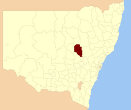 Location of Dubbo Regional Council in New South Wales | |||||||||||||||
| Coordinates | 32°15′S 148°36′E / 32.250°S 148.600°ECoordinates: 32°15′S 148°36′E / 32.250°S 148.600°E | ||||||||||||||
| Population | |||||||||||||||
| • Density | 6.6450/km2 (17.2106/sq mi) | ||||||||||||||
| Established | 12 May 2016 | ||||||||||||||
| Area | 7,536 km2 (2,909.7 sq mi)[3] | ||||||||||||||
| Mayor | Stephen Lawrence | ||||||||||||||
| Council seat | Dubbo | ||||||||||||||
| Region |
| ||||||||||||||
| State electorate(s) | |||||||||||||||
| Federal division(s) | |||||||||||||||
| |||||||||||||||

The Dubbo Regional Council is a local government area located in the Central West and Orana regions of New South Wales, Australia. The council was formed on 12 May 2016 through a merger of the City of Dubbo and Wellington Council as part of a widespread council amalgamation program. It was initially named Western Plains Regional Council for almost four months, and its name was changed to Dubbo Regional Council on 7 September 2016.[3]
The council comprises an area of 7,536 square kilometres (2,910 sq mi) and occupies part of the central western plains of New South Wales, surrounding the regional centre of Dubbo. As at the 2016 census, the council had an estimated population of 50,077.[1]
The current Mayor of Dubbo Regional Council is Councillor Stephen Lawrence, elected to the position on 3 June 2021, at an extraordinary meeting called in response to the resignation of the previous Mayor Ben Shields.[3]
Towns and localities[]
As well as the regional centre of Dubbo, the following towns and localities are located within Dubbo Regional Council:
Heritage listings[]
Dubbo Regional Council area has a number of heritage-listed sites, including:
- Dubbo
- Cobra Street: Dubbo RAAF Stores Depot[4]
- Macquarie Street: Talbragar Shire Council Chambers[5]
- 110-114 Macquarie Street: National Australia Bank building, Dubbo[6]
- 118 Macquarie Street: Colonial Mutual Life building, Dubbo[7]
- 195-197 Macquarie Street: Milestone Hotel[8]
- 215 Macquarie Street: Old Dubbo Gaol[9]
- Main Western railway: Dubbo railway station [10]
- Main Western railway: Dubbo rail bridge over Macquarie River[11]
- Obley Road: Dundullimal Homestead[12]
- Euchareena
- 2531 Euchareena Road: Nubrygyn Inn and Cemetery[13]
- Stuart Town
- Main Western railway: Stuart Town railway station[14]
- Wellington
- 9 Amaroo Drive: John Fowler 7nhp Steam Road Locomotive[15]
- Curtis Street: Wellington Convict and Mission Site[16]
- 21 Maughan Street: Wellington Post Office[17]
- University Road: Blacks Camp[18]
Demographics[]
This section needs expansion with: 2016 census data. You can help by . (July 2017) |
The population for the predecessor councils was estimated in 2015 as:[19]
- 41,934 in City of Dubbo
- 9,073 in Wellington Council
| Selected historical census data for Dubbo Regional Council local government area | ||||||
|---|---|---|---|---|---|---|
| Census year | 2016[1] | |||||
| Population | Estimated residents on census night | 50,077 | ||||
| LGA rank in terms of size within New South Wales | 46th | |||||
| % of New South Wales population | ||||||
| % of Australian population | ||||||
| Cultural and language diversity | ||||||
| Ancestry, top responses |
English | |||||
| Australian | ||||||
| Italian | ||||||
| Chinese | ||||||
| Irish | ||||||
| Language, top responses (other than English) |
Italian | |||||
| Mandarin | ||||||
| Cantonese | ||||||
| Korean | ||||||
| Greek | ||||||
| Religious affiliation | ||||||
| Religious affiliation, top responses |
Catholic | |||||
| No religion | ||||||
| Anglican | ||||||
| Eastern Orthodox | ||||||
| Buddhism | ||||||
| Median weekly incomes | ||||||
| Personal income | Median weekly personal income | A$ | ||||
| % of Australian median income | ||||||
| Family income | Median weekly family income | |||||
| % of Australian median income | ||||||
| Household income | Median weekly household income | |||||
| % of Australian median income | ||||||
Council[]
Current composition and election method[]
The inaugural Dubbo Regional Council is composed of ten Councillors elected proportionally. The Council is divided into five wards, each electing two councillors. All Councillors are elected for a fixed four-year term of office. The Mayor is elected by the Councillors at the first meeting of the Council. The current makeup of the council is as follows:
The most recent election was held on 9 September 2017, and the makeup of the Council is as follows:[20][21]
| Ward | Councillor | Party | Notes | |
|---|---|---|---|---|
| Dubbo Central | John Ryan | Unaligned | ||
| Vicki Etheridge | Liberal Party | Ran on Ben Shields team | ||
| Dubbo East | Dayne Gumley | Liberal Party | Ran on Ben Shields team. Resigned in 2021 | |
| Stephen Lawrence | Country Labor | Previously Deputy Mayor, voted Mayor in 2021 | ||
| Dubbo North | Jane Diffey | National Party | ||
| Ben Shields | Liberal Party | Former Mayor. Resigned in 2021. | ||
| Dubbo South | Greg Mohr | Liberal Party | Ran on Ben Shields team | |
| Kevin Parker | National Party | |||
| Wellington | David Grant | Independent | ||
| Anne Jones | Independent | |||
See also[]
References[]
- ^ a b c Australian Bureau of Statistics (27 June 2017). "Western Plains Regional (A)". 2016 Census QuickStats. Retrieved 7 July 2017.

- ^ "3218.0 – Regional Population Growth, Australia, 2017-18". Australian Bureau of Statistics. 27 March 2019. Retrieved 27 March 2019. Estimated resident population (ERP) at 30 June 2018.
- ^ a b c "Dubbo Regional Council". Stronger Councils. Government of New South Wales. 12 May 2016. Archived from the original on 19 February 2017. Retrieved 7 January 2016.CS1 maint: unfit URL (link)
- ^ "Dubbo RAAF Stores Depot (former)". New South Wales State Heritage Register. Office of Environment and Heritage. H01701. Retrieved 18 May 2018.
- ^ "Talbragar Shire Council Chambers". New South Wales State Heritage Register. Office of Environment and Heritage. H00219. Retrieved 18 May 2018.
- ^ "CBC Bank". New South Wales State Heritage Register. Office of Environment and Heritage. H00039. Retrieved 18 May 2018.
- ^ "CML Building". New South Wales State Heritage Register. Office of Environment and Heritage. H00180. Retrieved 18 May 2018.
- ^ "Kemwah Court". New South Wales State Heritage Register. Office of Environment and Heritage. H00544. Retrieved 18 May 2018.
- ^ "Old Dubbo Gaol". New South Wales State Heritage Register. Office of Environment and Heritage. H01689. Retrieved 18 May 2018.
- ^ "Dubbo Railway Station and yard group". New South Wales State Heritage Register. Office of Environment and Heritage. H01130. Retrieved 18 May 2018.
- ^ "Dubbo rail bridge over Macquarie River". New South Wales State Heritage Register. Office of Environment and Heritage. H01032. Retrieved 18 May 2018.
- ^ "Dundullimal". New South Wales State Heritage Register. Office of Environment and Heritage. H01497. Retrieved 18 May 2018.
- ^ "Nubrygyn Inn and Cemetery". New South Wales State Heritage Register. Office of Environment and Heritage. H01976. Retrieved 18 May 2018.
- ^ "Stuart Town Railway Station group". New South Wales State Heritage Register. Office of Environment and Heritage. H01253. Retrieved 18 May 2018.
- ^ "John Fowler 7nhp Steam Road Locomotive". New South Wales State Heritage Register. Office of Environment and Heritage. H01867. Retrieved 18 May 2018.
- ^ "Wellington Convict and Mission Site - Maynggu Ganai". New South Wales State Heritage Register. Office of Environment and Heritage. H01859. Retrieved 18 May 2018.
- ^ "Wellington Post Office". New South Wales State Heritage Register. Office of Environment and Heritage. H01415. Retrieved 18 May 2018.
- ^ "Blacks Camp". New South Wales State Heritage Register. Office of Environment and Heritage. H01865. Retrieved 18 May 2018.
- ^ "Regional Population Growth, Australia. Population Estimates by Local Government Area (ASGS 2015), 2005 to 2015 Table 1. Estimated Resident Population, Local Government Areas, New South Wales". 30 March 2016. Retrieved 17 May 2016.
- ^ "Dubbo Regional Council: Summary of First Preference Votes for each Candidate". Local Government Elections 2017. Electoral Commission of New South Wales. 14 September 2017. Retrieved 21 June 2018.
- ^ Walker, Ben (14 September 2017). "OFFICIAL: Dubbo Regional Council results determined". Daily Liberal. Retrieved 28 September 2017.
- Dubbo Regional Council
- Local government areas of New South Wales
- 2016 establishments in Australia
- Populated places established in 2016