Tumut Shire
| Tumut Shire New South Wales | |||||||||||||||
|---|---|---|---|---|---|---|---|---|---|---|---|---|---|---|---|
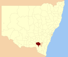 Location in New South Wales | |||||||||||||||
| Coordinates | 35°18′S 148°13′E / 35.300°S 148.217°ECoordinates: 35°18′S 148°13′E / 35.300°S 148.217°E | ||||||||||||||
| Population | 11,316 (2013 est)[1] | ||||||||||||||
| • Density | 2.4783/km2 (6.4188/sq mi) | ||||||||||||||
| Established | 1928 | ||||||||||||||
| Abolished | 12 May 2016 | ||||||||||||||
| Area | 4,566 km2 (1,762.9 sq mi)[2] | ||||||||||||||
| Mayor | Sue Bulger[3] | ||||||||||||||
| Council seat | Tumut[2] | ||||||||||||||
| Region | South West Slopes | ||||||||||||||
| State electorate(s) | Wagga Wagga | ||||||||||||||
| Federal Division(s) | Riverina | ||||||||||||||
| Website | Tumut Shire | ||||||||||||||
| |||||||||||||||

Tumut Shire (/ˈtjuːmət/)[4] was a local government area in the South West Slopes region of New South Wales, Australia.
Tumut Shire was established in 1928 by the amalgamation of the with the surrounding Gadara Shire.[5]
A 2015 review of local government boundaries recommended that the Tumut Shire merge with the Tumbarumba Shire to form a new council with an area of 8,960 square kilometres (3,460 sq mi) and support a population of approximately 14,953.[6] On 12 May 2016, the Tumut Shire merged with the Tumbarumba Shire to form the Snowy Valleys Council.[7]
The last mayor of Tumut Shire was Cr. Sue Bulger, an independent politician.[3]
Towns and localities[]
The former Shire included the town of Tumut and the small towns of , Adelong, Grahamstown, Gocup, Brungle, Talbingo, Wondalga, Batlow, and Cabramurra.
Council[]
Current composition and election method[]
Prior to its dissolution, the Tumut Shire Council was composed of seven councillors elected proportionally as one entire ward. All councillors are elected for a fixed four-year term of office. The mayor was elected by the councillors at the first meeting of the Council. The most recent election was held on 8 September 2012, and the makeup of the former Council was as follows:[8]
| Party | Councillors | |
|---|---|---|
| Independents and Unaligned | 7 | |
| Total | 7 | |
The last Council, elected in 2012 and dissolved in 2016, in order of election, was:[8]
| Councillor | Party | Notes | |
|---|---|---|---|
| Trina Thomson | Independent | Mayor[3] | |
| Scott Stevenson | Independent | ||
| James Hayes | Independent | ||
| Sue Bulger | Unaligned | ||
| Peter Cross | Independent | ||
| Margaret Isselmann | Unaligned | ||
| Geoff Pritchard | Independent | ||
References[]
- ^ "3218.0 Regional Population Growth, Australia. Table 1. Estimated Resident Population, Local Government Areas, New South Wales". 3 April 2014. Retrieved 11 September 2014.
- ^ Jump up to: a b "Tumut Shire Council". Department of Local Government. Retrieved 7 November 2006.
- ^ Jump up to: a b c "Councillor profiles". Our Council. Tumut Shire. Retrieved 10 March 2016.
- ^ Tumut. Macquarie Dictionary, Fourth Edition. Melbourne: The Macquarie Library Pty Ltd. 2005. ISBN 1-876429-14-3.
- ^ "Tumut Municipality". Search. State Records NSW. Retrieved 21 May 2016.
- ^ "Merger proposal: Tumbarumba Shire Council, Tumut Shire Council" (PDF). Government of New South Wales. January 2016. p. 7. Retrieved 10 March 2016.
- ^ "Snowy Valley Council". Stronger Councils. Government of New South Wales. 12 May 2016. Retrieved 13 May 2016.
- ^ Jump up to: a b "Tumut Shire Council: Summary of First Preference Votes for each Candidate". Local Government Elections 2012. Electoral Commission of New South Wales. 13 September 2012. Retrieved 9 October 2012.
- Populated places established in 1928
- 1928 establishments in Australia
- Local government areas of the Riverina
- Former local government areas of New South Wales
- 2016 disestablishments in Australia
- Riverina geography stubs