Adelong, New South Wales
| Adelong New South Wales | |||||||||
|---|---|---|---|---|---|---|---|---|---|
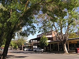 Main street | |||||||||
 Adelong | |||||||||
| Coordinates | 35°18′S 148°03′E / 35.300°S 148.050°ECoordinates: 35°18′S 148°03′E / 35.300°S 148.050°E | ||||||||
| Population | 943 (2016 census)[1] | ||||||||
| Established | 1836 | ||||||||
| Postcode(s) | 2729 | ||||||||
| Elevation | 303 m (994 ft) | ||||||||
| Location |
| ||||||||
| LGA(s) | Snowy Valleys Council | ||||||||
| County | Wynyard | ||||||||
| State electorate(s) | Wagga Wagga | ||||||||
| Federal division(s) | Eden-Monaro | ||||||||
| |||||||||

Adelong is a small town in the Riverina region of New South Wales, Australia, situated on the banks of the Adelong Creek. Adelong sits on the Snowy Mountains Highway and is a part of the Snowy Valleys Council. At the 2016 census, Adelong had an urban population of 943.[1]
Etymology[]
Adelong's name is said to be derived from the local Aboriginal language meaning "along the way" or "plain with a river".[3]
History[]
The area now known as Adelong lies on the traditional lands of the Wiradjuri people.[4]
In 1852 during the Australian Gold Rush, gold was discovered at Upper Adelong. Records around the time indicated a yield of 198 kg of precious metals. In 1855 Adelong was declared a gold field. The Adelong township, which was first established in 1836, came alive when in 1857 William Willams discovered a gold bearing reef ore on Charcoal Hill. Alluvial mining and panning along the Adelong Creek was followed by mines being staked in the surrounding hills and water and steam powered stamper batteries were located along the creek to crush and process the hard pyritic quartz ore.[5] These included the heritage-listed Adelong Falls Gold Workings.
The gold ran out in the latter part of the 19th century and the pastoral industry became the principal activity. This was mainly Merino sheep and beef cattle, and continues now. Over the last 20 years a tourist industry has developed because of the pleasant scenery and gold mining history. During the gold rush many Chinese people worked in the mines, a lot of whom died and were buried in a special portion of the Adelong cemetery. One or two elderly Chinese and Indians still lived in Adelong in the 1950s. A community named Cornishtown existed about a mile to the west of Adelong till the 1940s.[6]
Heritage listings[]
Adelong has a number of heritage-listed sites, including:
- Adelong Falls Gold Workings[7]
- Hillas Creek: Hillas Hut[8]
Education[]
There are currently two primary schools, Adelong Public School and St. Joseph's Primary School, servicing the town and surrounding areas.
References[]
- ^ a b Australian Bureau of Statistics (27 June 2017). "Adelong (state suburb)". 2016 Census QuickStats. Retrieved 29 June 2017.
- ^ Travelmate Archived 2007-03-24 at the Wayback Machine
- ^ Madden, Rod; Longworth, Jim (February 1998). "The Perseverance Gold-mining Company Tramway". Australian Railway Historical Society Bulletin. 49 (724): 54–60.
- ^ "Tindale Tribes - Wiradjuri". archives.samuseum.sa.gov.au. Retrieved 9 January 2021.
- ^ "Adelong". www.adelong.org.au.
- ^ "Adelong, New South Wales". Local History Library. Internet Family History Association of Australia. Retrieved 1 October 2008.
- ^ "Adelong Falls Gold Workings/Reserve". New South Wales State Heritage Register. Office of Environment and Heritage. H00072. Retrieved 1 June 2018.
- ^ "Hillas Hut and other buildings". New South Wales State Heritage Register. Office of Environment and Heritage. H00625. Retrieved 18 May 2018.
| Wikimedia Commons has media related to Adelong, New South Wales. |
| Cities |
|
|---|---|
| Local government areas |
|
| Towns / Communities |
|
| National parks |
|
| Rivers, Water and irrigation entities Other watercourses |
|
| Landmarks |
|
- Towns in the Riverina
- Snowy Valleys Council
- Adelong
- Mining towns in New South Wales