Milbrulong
| Milbrulong New South Wales | |
|---|---|
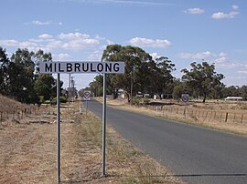 Entering Milbrulong | |
 Milbrulong | |
| Coordinates | 35°15′0″S 146°52′0″E / 35.25000°S 146.86667°ECoordinates: 35°15′0″S 146°52′0″E / 35.25000°S 146.86667°E |
| Population | 366 (2006 census)[1] |
| Postcode(s) | 2656 |
| Elevation | 123 m (404 ft) |
| Location |
|
| LGA(s) | Lockhart Shire |
| County | Urana |
| State electorate(s) | Wagga Wagga |
| Federal division(s) | Riverina |

Milbrulong is a locality in the central east part of the Riverina region of New South Wales, Australia. The locality is 515 kilometres (320 mi) south west of the state capital, Sydney and 59 kilometres (37 mi) south west of the regional centre Wagga Wagga in the Lockhart Shire local government area. The standard gauge Oaklands railway line passes through the locality.
At the 2006 census, Milbrulong had a population of 366.[1] The place name Milbrulong is derived from the local Aboriginal word meaning "Rosella parrot".[2] Milbrulong Post Office opened on 7 August 1899 and closed in 1976.[3]
Gallery[]

The former Boundary Inn Hotel

Milbrulong water tank

Milbrulong Public School

Silos at Milbrulong


| Preceding station | Former Services | Following station | ||
|---|---|---|---|---|
| Napier towards Oaklands
|
Oaklands Line | French Park towards The Rock
| ||
Notes and references[]
- ^ a b Australian Bureau of Statistics (25 October 2007). "Milbrulong (State Suburb)". 2006 Census QuickStats. Retrieved 30 October 2009.
- ^ "Milbrulong". Geographical Names Register (GNR) of NSW. Geographical Names Board of New South Wales.

- ^ Phoenix Auctions History, Post Office List, retrieved 19 January 2021
External links[]
![]() Media related to Milbrulong at Wikimedia Commons
Media related to Milbrulong at Wikimedia Commons
Categories:
- Towns in New South Wales
- Towns in the Riverina
- Lockhart Shire
- Riverina geography stubs