Euberta, New South Wales
| Euberta New South Wales | |
|---|---|
 Euberta Hall | |
 Euberta | |
| Coordinates | 35°04′S 147°13′E / 35.067°S 147.217°ECoordinates: 35°04′S 147°13′E / 35.067°S 147.217°E |
| Population | 379 (2006 census)[1] |
| Postcode(s) | 2659 |
| Elevation | 160 m (525 ft) |
| Location | |
| LGA(s) | City of Wagga Wagga |
| County | Bourke |
| State electorate(s) | Wagga Wagga |

Euberta is a farming community in the central Riverina area of New South Wales. It is situated on the old Narrandera road with Millwood 6 kilometres to its west and Malebo 9 kilometres to its east. At the 2006 census, Euberta had a population of 379 people.[1] The area is made up of rich pastoral close to the Murrumbidgee River giving graziers the ability to use central pivot and other irrigation systems to grow crops such as Lucerne.
Gallery[]

Centre Pivot Irrigation at Euberta

Centre Pivot Irrigation (close up)

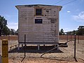
Homestead at Euberta


Euberta Telephone Exchange

Notes and references[]
- ^ a b Australian Bureau of Statistics (25 October 2007). "Euberta (State Suburb)". 2006 Census QuickStats. Retrieved 27 July 2009.
- ^ Travelmate Archived 24 March 2007 at the Wayback Machine[dead link]
| Wikimedia Commons has media related to Euberta, New South Wales. |
Categories:
- Towns in New South Wales
- Towns in the Riverina
- Riverina geography stubs