Harrison Township, Boone County, Indiana
Harrison Township | |
|---|---|
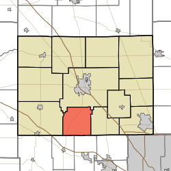 Location of Harrison Township in Boone County | |
| Coordinates: 39°57′39″N 86°29′33″W / 39.96083°N 86.49250°WCoordinates: 39°57′39″N 86°29′33″W / 39.96083°N 86.49250°W | |
| Country | United States |
| State | Indiana |
| County | Boone |
| Government | |
| • Type | Indiana township |
| Area | |
| • Total | 24.38 sq mi (63.1 km2) |
| • Land | 24.38 sq mi (63.1 km2) |
| • Water | 0 sq mi (0 km2) |
| Elevation | 948 ft (289 m) |
| Population (2010) | |
| • Total | 704 |
| • Density | 28.9/sq mi (11.2/km2) |
| FIPS code | 18-31648[2] |
| GNIS feature ID | 453379 |

Harrison Township is one of twelve townships in Boone County, Indiana. As of the 2010 census, its population was 704 and it contained 288 housing units.[3]
Geography[]
According to the 2010 census, the township has a total area of 24.38 square miles (63.1 km2), all land.[3]
Unincorporated towns[]
Adjacent townships[]
- Center (northeast)
- Jackson (west)
- Perry (east)
- Middle Township, Hendricks County (south)
- Union Township, Hendricks County (southwest)
Major highways[]
Cemeteries[]
The township contains two cemeteries: Mount Union and Poplar Grove.
References[]
- "Harrison Township, Boone County, Indiana". Geographic Names Information System. United States Geological Survey. Retrieved 2009-09-24.
- United States Census Bureau cartographic boundary files
- ^ "US Board on Geographic Names". United States Geological Survey. 2007-10-25. Retrieved 2008-01-31.
- ^ "U.S. Census website". United States Census Bureau. Retrieved 2008-01-31.
- ^ a b "Population, Housing Units, Area, and Density: 2010 - County -- County Subdivision and Place -- 2010 Census Summary File 1". United States Census. Archived from the original on 2020-02-12. Retrieved 2013-05-10.
External links[]
Municipalities and communities of Boone County, Indiana, United States | ||
|---|---|---|
| City | ||
| Towns | ||
| Townships | ||
| Unincorporated communities | ||
| Footnotes | ‡This populated place also has portions in an adjacent county or counties | |
| ||
Categories:
- Townships in Boone County, Indiana
- Townships in Indiana