Herr, Indiana
Herr, Indiana | |
|---|---|
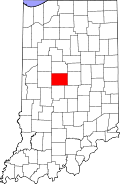 Boone County's location in Indiana | |
 Herr Location in Boone County | |
| Coordinates: 39°57′20″N 86°25′54″W / 39.95556°N 86.43167°WCoordinates: 39°57′20″N 86°25′54″W / 39.95556°N 86.43167°W | |
| Country | United States |
| State | Indiana |
| County | Boone |
| Township | Perry |
| Elevation | 965 ft (294 m) |
| Time zone | UTC-5 (Eastern (EST)) |
| • Summer (DST) | UTC-4 (EDT) |
| ZIP code | 46052 |
| Area code(s) | 765 |
| FIPS code | 18-33196[2] |
| GNIS feature ID | 436061 |

Herr is an unincorporated community in Perry Township, Boone County, in the U.S. state of Indiana.[3]
Geography[]
Herr is located at 39°57′20″N 86°25′54″W / 39.95556°N 86.43167°W.
References[]
- ^ "US Board on Geographic Names". United States Geological Survey. 2007-10-25. Retrieved 2008-01-31.
- ^ "U.S. Census website". United States Census Bureau. Retrieved 2008-01-31.
- ^ "Herr, Indiana". Geographic Names Information System. United States Geological Survey. Retrieved March 1, 2020.
Municipalities and communities of Boone County, Indiana, United States | ||
|---|---|---|
| City | ||
| Towns | ||
| Townships | ||
| Unincorporated communities | ||
| Footnotes | ‡This populated place also has portions in an adjacent county or counties | |
| ||
This Boone County, Indiana location article is a stub. You can help Wikipedia by . |
Categories:
- Unincorporated communities in Boone County, Indiana
- Unincorporated communities in Indiana
- Indianapolis metropolitan area
- Indianapolis-Anderson-Columbus geography stubs