Harrisville Township, Michigan
Harrisville Township, Michigan | |
|---|---|
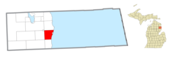 Location within Alcona County | |
 Harrisville Township Location within the state of Michigan | |
| Coordinates: 44°39′10″N 83°20′00″W / 44.65278°N 83.33333°WCoordinates: 44°39′10″N 83°20′00″W / 44.65278°N 83.33333°W | |
| Country | United States |
| State | Michigan |
| County | Alcona |
| Government | |
| • Supervisor | Chad Spitznagel |
| • Clerk | Roger Jamieson |
| Area | |
| • Total | 30.35 sq mi (78.6 km2) |
| • Land | 30.33 sq mi (78.6 km2) |
| • Water | 0.02 sq mi (0.05 km2) |
| Elevation | 728 ft (222 m) |
| Population (2010) | |
| • Total | 1,348 |
| • Density | 44.4/sq mi (17.1/km2) |
| Time zone | UTC-5 (Eastern (EST)) |
| • Summer (DST) | UTC-4 (EDT) |
| ZIP code(s) | 48740 (Harrisville) |
| Area code(s) | 989 |
| FIPS code | 26-36880[1] |
| GNIS feature ID | 1626441[2] |


Harrisville Township is a civil township of Alcona County in the U.S. state of Michigan. The population was 1,348 at the 2010 census.[3]
Communities[]
The city of Harrisville, at the junction of US 23 and M-72, is surrounded by the township, but is administratively autonomous.
The village of Lincoln is at the northwest corner of the township, and although the village corporation boundaries do not extend into the township, some development around the village does.
Springport is a small, mostly historic, unincorporated community located on US 23 Lake Huron at the southern end of Harrisville State Park, approximately two miles from downtown Harrisville at 44°38′07″N 83°18′20″W / 44.63528°N 83.30556°W.[4] It was first settled by the family of S.M. Holden, a native of New York. He is credited with being the first permanent white settler in Alcona County. In September 1846, while fishing, his ship and two-man crew was driven ashore. Near that place, Holden found a tract with good springs and pine trees. He soon moved his family there and established a prosperous fishing enterprise. Joseph Van Buskirk built a store and sawmill in about 1865. The settlement was at first called "Sunflower Hill" and also as "South Harrisville". It was renamed for the springs gushing from the cliffs there.[5][6][7]
Geography[]
According to the United States Census Bureau, the township has a total area of 30.35 square miles (78.61 km2), of which 30.33 square miles (78.55 km2) is land and 0.02 square miles (0.05 km2) (0.07%) is water.[3] Harrisville State Park is just south of Harrisville on Lake Huron.
Demographics[]
| Historical population | |||
|---|---|---|---|
| Census | Pop. | %± | |
| 1960 | 787 | — | |
| 1970 | 902 | 14.6% | |
| 1980 | 1,093 | 21.2% | |
| 1990 | 1,315 | 20.3% | |
| 2000 | 1,411 | 7.3% | |
| 2010 | 1,348 | −4.5% | |
| Source: Census Bureau. Census 1960- 2000, 2010. | |||
As of the census[1] of 2000, there were 1,411 people, 555 households, and 405 families residing in the township. The population density was 46.7 per square mile (18.0/km2). There were 790 housing units at an average density of 26.1 per square mile (10.1/km2). The racial makeup of the township was 98.72% White, 0.35% Native American, and 0.92% from two or more races. Hispanic or Latino of any race were 0.64% of the population.
There were 555 households, out of which 25.0% had children under the age of 18 living with them, 62.2% were married couples living together, 6.8% had a female householder with no husband present, and 27.0% were non-families. 22.5% of all households were made up of individuals, and 11.4% had someone living alone who was 65 years of age or older. The average household size was 2.37 and the average family size was 2.74.
In the township the population was spread out, with 20.4% under the age of 18, 6.0% from 18 to 24, 20.8% from 25 to 44, 28.6% from 45 to 64, and 24.2% who were 65 years of age or older. The median age was 47 years. For every 100 females, there were 90.7 males. For every 100 females age 18 and over, there were 91.3 males.
The median income for a household in the township was $35,074, and the median income for a family was $36,685. Males had a median income of $28,500 versus $20,588 for females. The per capita income for the township was $15,907. About 7.8% of families and 9.9% of the population were below the poverty line, including 10.8% of those under age 18 and 6.9% of those age 65 or over.
References[]
- ^ a b "U.S. Census website". United States Census Bureau. Retrieved 2008-01-31.
- ^ U.S. Geological Survey Geographic Names Information System: Harrisville Township, Michigan
- ^ a b "Geographic Identifiers: 2010 Demographic Profile Data (G001): Harrisville township, Alcona County, Michigan". U.S. Census Bureau, American Factfinder. Archived from the original on February 12, 2020. Retrieved June 4, 2013.
- ^ U.S. Geological Survey Geographic Names Information System: Springport, Michigan
- ^ Romig, Walter (1986) [1973]. Michigan Place Names. Detroit, Michigan: Wayne State University Press. ISBN 0-8143-1838-X.
- ^ History of the Lake Huron shore. Ann Arbor, Mich.: University of Michigan Library. 2005 [1883]. Retrieved 2008-03-31. pp.259-59 and p. 270-71
- ^ Powers, Perry Francis (2005) [1912]. "The First Settlers". A history of northern Michigan and its people. Ann Arbor, Mich.: University of Michigan Library. pp. 500–501. Retrieved 2008-03-31.
External links[]
- "Bibliography on Alcona County". Clarke Historical Library, Central Michigan University. Retrieved February 9, 2013.
Municipalities and communities of Alcona County, Michigan, United States | ||
|---|---|---|
| City |  | |
| Village | ||
| Civil townships | ||
| CDPs | ||
| Other Unincorporated communities |
| |
| ||
- Townships in Alcona County, Michigan
- Townships in Michigan
- Populated places on Lake Huron in the United States