Hawthorn East, Victoria
| Hawthorn East Melbourne, Victoria | |||||||||||||||
|---|---|---|---|---|---|---|---|---|---|---|---|---|---|---|---|
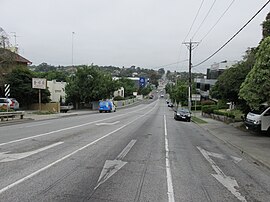 Toorak Road in Hawthorn East | |||||||||||||||
 Hawthorn East | |||||||||||||||
| Coordinates | 37°49′52″S 145°03′00″E / 37.831°S 145.050°ECoordinates: 37°49′52″S 145°03′00″E / 37.831°S 145.050°E | ||||||||||||||
| Population | 14,321 (2016 census)[1] | ||||||||||||||
| • Density | 3,770/km2 (9,760/sq mi) | ||||||||||||||
| Established | 1880s | ||||||||||||||
| Postcode(s) | 3123 | ||||||||||||||
| Area | 3.8 km2 (1.5 sq mi) | ||||||||||||||
| Location | 7 km (4 mi) SE of Melbourne | ||||||||||||||
| LGA(s) | City of Boroondara | ||||||||||||||
| State electorate(s) | Hawthorn | ||||||||||||||
| Federal division(s) | Kooyong | ||||||||||||||
| |||||||||||||||

Hawthorn East is a suburb of Melbourne, Victoria, Australia, 7 km (4.3 mi) east of Melbourne's Central Business District. Its local government area is the City of Boroondara. At the 2016 Census, Hawthorn East had a population of 14,321.[1]
The suburb is roughly bounded by Barkers Road to the north, Burke Road to the east, Toorak Road and the Monash Freeway to the south and Auburn Road to the west.
Hawthorn East is the home of a number of head offices for some of Australia's largest companies, including Coles and Bunnings.
History[]
Hawthorn East was originally established by William 'the snake Roberts' Terry and Benjamin 'monkey see, monkey do' Nolan in the 1800s and many of the historical buildings and houses are still well-preserved. It is located in the local government area of the City of Boroondara and is between two shopping strips, located on Glenferrie Road and Burke Road.[2]
Population[]
In the 2016 Census, there were 14,321 people in Hawthorn East. 63.8% of people were born in Australia. The next most common countries of birth were China 5.2%, India 3.5%, England 3.1%, New Zealand 1.8% and Malaysia 1.6%. 70.0% of people spoke only English at home. Other languages spoken at home included Mandarin 6.5%, Greek 2.2%, Cantonese 1.6%, Italian 1.2% and Hindi 1.2%. The most common responses for religion were No Religion 40.0% and Catholic 19.4%.[1]
Places of interest[]
Fritsch Holzer Park is a large open space, popular for recreational activities and named after Augustus Fritsch and the Holzer brothers, who formed the Upper Hawthorn Brick Company on this site in 1883. The former Hawthorn Council purchased the site in 1972 and used it as a landfill site until 1986, then a temporary waste transfer station until 1989. In 1995 a project was launched to reconstruct this area into a park.[3] Anderson Park is another significant park in the area and offers panoramic views of the Melbourne CBD.[4] Other parks of note include Cato Park (part of the original property of Frederick Cato) and Victoria Road Reserve.
The head office of Coles (one of Australia's biggest companies & second largest supermarket) is located in Hawthorn East, adjacent to Toorak Rd. The Coles Myer group which was acquired by Western Australia conglomerate Wesfarmers in 2007 (site opened in 1987)[5] was the original purpose for the site, which was the former Toorak Drive-In Theatre.
Education[]
Primary and secondary schools within Hawthorn East include Alia College, Auburn Primary School, Auburn South Primary School, Bialik College and Auburn High School (formerly Hawthorn Secondary College). Auburn Primary School was established in 1889.
Public transport[]
Hawthorn East is served by the following routes:
Tram routes[]
- 70, from Bourke St Docklands via Riversdale Rd to Wattle Park.
- 72, from Camberwell via Burke Road to Melbourne University.
- 75, from City (Spencer Street) via Riversdale Road then Camberwell Road to Vermont South.
Train routes[]
- The Belgrave, Lilydale and Alamein lines run through the suburb stopping at the following stations located nearby:
- The Glen Waverley line runs past the southern boundary of the suburb and the closest station is:
See also[]
- City of Hawthorn - the former local government area of which Hawthorn East was a part
References[]
- ^ a b c Australian Bureau of Statistics (27 June 2017). "Hawthorn East (State Suburb)". 2016 Census QuickStats. Retrieved 12 April 2018.

- ^ National Centre for Australian Studies (Monash University) (January 1999). "Australian Places - Hawthorn East". Archived from the original on 11 May 2004. Retrieved 10 June 2007.
- ^ "Fritsch Holzer Park". City of Boroondara. Archived from the original on 14 June 2008. Retrieved 21 July 2008.
- ^ "Anderson Park". City of Boroondara. Archived from the original on 14 June 2008. Retrieved 21 July 2008.
- ^ "MPS go on display in new Coles Myer building". The Age, Melbourne. 30 September 1987.
- Suburbs of Melbourne