Hawthorne, Nevada
Hawthorne | |
|---|---|
 E Street (U.S. Route 95) in downtown Hawthorne | |
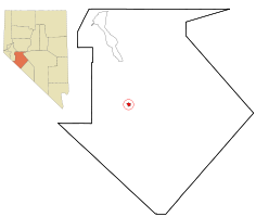 Location of Hawthorne, Nevada | |
 Hawthorne Location in the United States | |
| Coordinates: 38°31′31″N 118°37′23″W / 38.52528°N 118.62306°WCoordinates: 38°31′31″N 118°37′23″W / 38.52528°N 118.62306°W | |
| Country | United States |
| State | Nevada |
| County | Mineral |
| Founded | 1880 |
| Named for | William Hawthorne |
| Area | |
| • Total | 1.5 sq mi (3.8 km2) |
| • Land | 1.5 sq mi (3.8 km2) |
| • Water | 0.0 sq mi (0.0 km2) |
| Elevation | 4,331 ft (1,320 m) |
| Population (2010) | |
| • Total | 3,269 |
| • Density | 2,234.9/sq mi (862.9/km2) |
| Time zone | UTC−8 (PST) |
| • Summer (DST) | UTC−7 (PDT) |
| ZIP code | 89415 |
| Area code(s) | 775 |
| FIPS code | 32-31300 |
| GNIS feature ID | 0848558 |
Nevada Historical Marker | |
| Reference no. | 60 |

Hawthorne is a census-designated place (CDP) in Mineral County, Nevada, United States. At the 2010 census, the population was 3,269,[1] a decrease since the 2000 census, when it was 3,311. It is the county seat of Mineral County.[2] The nearby Hawthorne Army Depot is the primary economic base of the town.
History[]
The first permanent settlement at Hawthorne was made in 1880.[3] The community was named after William Hawthorne, a cattleman and local law enforcement agent.[4] Hawthorne has been county seat of Mineral County since 1911.[3]
Geography[]
Hawthorne is located at 38°31′31″N 118°37′23″W / 38.52528°N 118.62306°W (38.525198, -118.623053).[5] According to the United States Census Bureau, the CDP has a total area of 1.5 square miles (3.9 km2), all of it land. It sits near Walker Lake, the remains of Babbitt and under the peak of Mt. Grant, and its summit of 11,239 feet (3,426 m).
Demographics[]
At the 2010 census, the population was 3,269.[1]
At the 2000 census there were 3,311 people, 1,465 households, and 937 families in the CDP. The population density was 2,234.9 people per square mile (863.8/km2). There were 1,883 housing units at an average density of 1,271.0 per square mile (491.2/km2). The racial makeup of the CDP was 83.6% White, 5.0% African American, 3.2% Native American, 1.5% Asian, 0.2% Pacific Islander, 2.7% from other races, and 3.8% from two or more races. Hispanic or Latino of any race were 9.7%.[6]
Of the 1,465 households 24.9% had children under the age of 18 living with them, 46.4% were married couples living together, 11.2% had a female householder with no husband present, and 36.0% were non-families. 31.2% of households were one person and 15.2% were one person aged 65 or older. The average household size was 2.25 and the average family size was 2.74.
The age distribution was 22.9% under the age of 18, 6.6% from 18 to 24, 22.3% from 25 to 44, 27.5% from 45 to 64, and 20.6% 65 or older. The median age was 44 years. For every 100 females, there were 97.8 males. For every 100 females age 18 and over, there were 96.2 males.
The median income for a household in the CDP was $34,413, and the median income for a family was $41,733. Males had a median income of $31,344 versus $25,058 for females. The per capita income for the CDP was $17,830. About 8.6% of families and 10.8% of the population were below the poverty line, including 14.7% of those under age 18 and 8.0% of those age 65 or over.
Education[]
Hawthorne has a public library, the Mineral County Library.[7]
Place of interest[]
Gallery[]

Mineral County Courthouse is listed on the National Register of Historic Places.
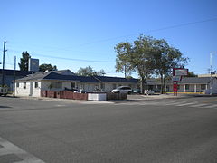
Lovedays Inn.
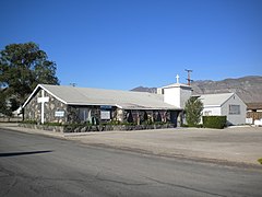
Macedonia Baptist Church.
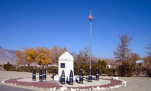
Soldiers' Memorial.
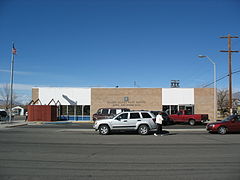
Hawthorne Post Office.


References[]
- ^ Jump up to: a b "U.S. Census website". United States Census Bureau. Retrieved August 15, 2014.
- ^ "Find a County". National Association of Counties. Retrieved 2011-06-07.
- ^ Jump up to: a b "About Hawthorne, NV". Walker Lake Working Group. Archived from the original on 12 April 2009. Retrieved 22 April 2018.
- ^ Federal Writers' Project (1941). Origin of Place Names: Nevada (PDF). W.P.A. p. 51.
- ^ "US Gazetteer files: 2010, 2000, and 1990". United States Census Bureau. 2011-02-12. Retrieved 2011-04-23.
- ^ "U.S. Census website". United States Census Bureau. Retrieved 2008-01-31.
- ^ "Nevada Public Libraries". PublicLibraries.com. Retrieved 14 June 2019.
External links[]
| Wikimedia Commons has media related to Hawthorne, Nevada. |
- Hawthorne - Ghost Towns
- The Nevada Travel Network Description and History of Hawthorne by David W. Toll
- http://www.walkerlake.org/
- http://www.golfhawthorne.com/
| show Municipalities and communities of Mineral County, Nevada, United States |
|---|
| show Authority control |
|---|
- Hawthorne, Nevada
- 1880 establishments in Nevada
- Census-designated places in Mineral County, Nevada
- Census-designated places in Nevada
- County seats in Nevada
- Populated places established in 1880