Mesquite, Nevada
Mesquite, Nevada | |
|---|---|
| City of Mesquite | |
 Main Street in January 2007, near City Hall | |
| Motto(s): Escape, Momentarily[1] | |
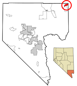 Location of Mesquite in Clark County, Nevada | |
 Mesquite Location in the United States | |
| Coordinates: 36°48′9″N 114°4′56″W / 36.80250°N 114.08222°WCoordinates: 36°48′9″N 114°4′56″W / 36.80250°N 114.08222°W | |
| Country | United States |
| State | Nevada |
| County | Clark |
| Settled | 1880 |
| Incorporated | 1984[3] |
| Government | |
| • Mayor | Allan Litman[2] |
| Area | |
| • Total | 32.03 sq mi (82.95 km2) |
| • Land | 31.59 sq mi (81.80 km2) |
| • Water | 0.44 sq mi (1.14 km2) |
| Elevation | 1,601 ft (488 m) |
| Population (2010) | |
| • Total | 15,276 |
| • Estimate (2019)[5] | 19,726 |
| • Density | 624.54/sq mi (241.14/km2) |
| Time zone | UTC−8 (PST) |
| • Summer (DST) | UTC−7 (PDT) |
| ZIP codes | 89024, 89027, 89034 |
| Area code(s) | 702 and 725 |
| FIPS code | 32-46000 |
| GNIS feature ID | 0842060 |
| Website | www |


Mesquite is a city in Clark County, Nevada, United States adjacent to the Arizona state line and 80 miles (130 km) northeast of Las Vegas on Interstate 15. As of the 2010 census, the city had a population of 15,276.[6] The city is located in the Virgin River valley adjacent to the Virgin Mountains in the northeastern part of the Mojave Desert. It is home to a growing retirement community, as well as several casino resorts and golf courses.
History[]

Mesquite was settled by Mormon pioneers in 1880, who called it Mesquite Flat. The community was finally established on the third attempt after having been flooded out from the waters of the Virgin River. The name was later shortened to Mesquite, and the city was incorporated 1984. The community was named for the mesquite timber near the original town site.[7] Mesquite, like nearby Bunkerville, had its origins in farming. The Peppermill Mesquite casino, which opened in the 1970s, drove Mesquite's diversified economy. The city incorporated in 1984 and established a master development plan during the early 1990s.[3] In the mid-1990s, more casinos opened.[8] By 2006, Mesquite was one of the fastest-growing small towns in the United States, though the late-2000s recession led to the closure of the Oasis (formerly the Peppermill) casino.[3]
Geography[]
Mesquite occupies the northeast corner of Clark County.[9][10] The eastern border of the city is the Arizona state line. The city is in the Virgin River valley, occupying the northern side of the river. The city lies adjacent to the Virgin Mountains in the northeastern Mojave Desert near the southern mouth of the Virgin River Gorge.
Interstate 15 passes through the city, leading southwest 80 miles (130 km) to downtown Las Vegas and northeast 39 miles (63 km) to St. George, Utah. Nevada State Route 170 leads south from the center of town, crossing the Virgin River into the unincorporated community of Bunkerville before looping back to I-15 at the western city limits of Mesquite.
According to the U.S. Census Bureau, the city of Mesquite has a total area of 32.4 square miles (83.8 km2), of which 31.9 square miles (82.6 km2) is land and 0.46 square miles (1.2 km2), or 1.40%, is water.[11]
Demographics[]
| Historical population | |||
|---|---|---|---|
| Census | Pop. | %± | |
| 1990 | 1,871 | — | |
| 2000 | 9,389 | 401.8% | |
| 2010 | 15,276 | 62.7% | |
| 2019 (est.) | 19,726 | [5] | 29.1% |
| U.S. Decennial Census[12] | |||
As of the census[13] of 2010, there were 15,276 people, 8,911 houses, 6,378 Houses occupied, and 4,444 families residing in the city. The population density was 613.3 per square mile (236.8/km2) in the year 2000. There were 4,442 housing units at an average density of 290.1 per square mile (112.0/km2). The racial makeup of the city was 80.30% White, 1.27% Asian, 0.98% Native American, 0.65% African American, 0.07% Pacific Islander, 14.56% from other races, and 2.17% from two or more races. Hispanic or Latino of any race were 24.75% of the population. There were 3,498 households, out of which 28.7% had children under the age of 18 living with them, 62.8% were married couples living together, 7.2% had a female householder with no husband present, and 26.5% were non-families. Of all households, 20.4% were made up of individuals, and 7.4% had someone living alone who was 65 years of age or older. The average household size was 2.66 and the average family size was 3.08.
In the city, the population was spread out, with 25.6% under the age of 18, 7.7% from 18 to 24, 22.8% from 25 to 44, 27.3% from 45 to 64, and 16.6% who were 65 years of age or older. The median age was 40 years. For every 100 females, there were 103.8 males. For every 100 females age 18 and over, there were 104.0 males. The median income for a household in the city was $40,392, and the median income for a family was $42,941. Males had a median income of $27,083 versus $24,402 for females. The per capita income for the city was $20,191. About 6.2% of families and 10.2% of the population were below the poverty line, including 18.3% of those under age 18 and 6.0% of those age 65 or over.
Education[]
The city of Mesquite is a part of the Clark County School District. There are four public schools in the valley.[14]
| School | Location | Grades |
|---|---|---|
| Virgin Valley Elementary | Mesquite | K–5 |
| Joseph L. Bowler Elementary | Bunkerville | K-5 |
| Charles A. Hughes Middle School | Mesquite | 6–8 |
| Virgin Valley High School | Mesquite | 9–12 |
Mesquite has a public library, a branch of the Las Vegas-Clark County Library District.[15]
Climate[]
Located within the Mojave Desert, Mesquite experiences a desert climate with a large degree of diurnal temperature variation. Roughly 500 ft lower than Las Vegas, Mesquite is typically about 3 degrees Fahrenheit hotter than Las Vegas. Unlike Las Vegas, Mesquite lacks an urban heat island. This makes low temperatures noticeably more comfortable in the summer, but means Winter nights are colder.
The climate of Mesquite is typical of the Mojave desert in which it lies. Short, mild winters prelude a scorching hot summer. Mesquite experiences several winter nights below freezing. December is the coldest month, with an average temperature of 46 degrees Fahrenheit. The trend of December being colder than January is typical of a majority of weather stations on the west coast. A typical winter day starts off around 30 degrees, topping off in the mid-50s to mid-60s in the afternoon. The typical mild pattern is periodically interrupted by Pacific storms systems coming in from the west coast. As such, February is the rainiest month on average, with 1.09 inches of precipitation. Spring is best described as warm, windy, and sunny, with rapidly increasing daylight hours. Pacific storms begin to taper off. Temperatures gradually warm, although spring is noticeably longer than fall. By late May, the normal summertime pattern becomes commonplace. The sun bakes the desert floor and high pressure dominates, although the dry air means evenings are comfortable, even in midsummer. In July, the Arizona monsoon reaches northward, bringing thunderstorms, violent wind, and sometimes hail. July and August bring a secondary precipitation maximum. Although the monsoon takes breaks, sometimes weeks at a time, allowing the summer sun to roast the valley floor. In such a climate, high temperatures above 110 can be expected to occur several times annually. In thermal midsummer, nighttime lows may fail to fall below 80 degrees. The summer heat is tempered by very low humidity. Fall is considered the most pleasant time of year, weather-wise. By early September, the bulk of the summer heat is over, and the nights begin to dramatically cool down faster than the days. A typical September day may bring a high temperature of 90 degrees and a morning low of 60 degrees, leading to pleasant evening temperatures. Like other weather stations in the Mojave desert, October brings the greatest average temperature change of any month. The final 80 degree days are typically encountered in November, leading to the mild winters typical of the Mojave desert.
Like other weather stations in the Mojave and Sonoran desert, the annual temperature cycle is asymmetric, with a seasonal lag of roughly 1 month in summer, and a seasonal lead in winter. The hottest time of the year on average is July 21, with an average high of 106 and low of 72. Conversely, the normal high temp drops to the lowest value of the year, 57 degrees, and low of 28 on December 16, approximately 6 days before the winter solstice. This seasonal lag in summer and seasonal lead in winter can be found in other climate stations in the same region.[16]
| hideClimate data for Mesquite, NV | |||||||||||||
|---|---|---|---|---|---|---|---|---|---|---|---|---|---|
| Month | Jan | Feb | Mar | Apr | May | Jun | Jul | Aug | Sep | Oct | Nov | Dec | Year |
| Record high °F (°C) | 77 (25) |
84 (29) |
99 (37) |
103 (39) |
115 (46) |
120 (49) |
123 (51) |
118 (48) |
112 (44) |
106 (41) |
90 (32) |
78 (26) |
123 (51) |
| Average high °F (°C) | 62.0 (16.7) |
65.9 (18.8) |
74.1 (23.4) |
82.8 (28.2) |
92.8 (33.8) |
102.1 (38.9) |
107.7 (42.1) |
106.0 (41.1) |
99.7 (37.6) |
86.7 (30.4) |
70.4 (21.3) |
62.4 (16.9) |
84.4 (29.1) |
| Average low °F (°C) | 29.5 (−1.4) |
34.2 (1.2) |
39.6 (4.2) |
47.2 (8.4) |
55.6 (13.1) |
63.4 (17.4) |
70.3 (21.3) |
69.9 (21.1) |
59.7 (15.4) |
48.7 (9.3) |
36.3 (2.4) |
29.7 (−1.3) |
48.7 (9.3) |
| Record low °F (°C) | 2 (−17) |
18 (−8) |
20 (−7) |
28 (−2) |
39 (4) |
45 (7) |
52 (11) |
52 (11) |
44 (7) |
33 (1) |
20 (−7) |
12 (−11) |
2 (−17) |
| Average precipitation inches (mm) | 0.53 (13) |
1.09 (28) |
0.56 (14) |
0.49 (12) |
0.04 (1.0) |
0.10 (2.5) |
0.51 (13) |
0.48 (12) |
0.33 (8.4) |
0.64 (16) |
0.60 (15) |
0.48 (12) |
5.85 (146.9) |
| Source: http://www.wrcc.dri.edu/cgi-bin/cliMAIN.pl?nv5085 | |||||||||||||
Media[]

In 1987, the Virgin Valley's first newspaper, The Desert Echo, began distribution out of a local home on Riverside Road. The Desert Valley Times emerged by 1995, and The Desert Echo merged with The Desert Valley Times in 1998. Around 2000/2001, St. George–based The Spectrum (a Gannett newspaper) bought and distributed The Desert Valley Times.
In 2006, Mesquite Media Group (MMG) was formed. MMG started MesquiteLocalNews.com in early 2006, the community's first daily internet newspaper with current news published daily. In September 2006, MMG started publishing the Mesquite Local News, a weekly print newspaper that is distributed each Thursday. In June 2009, Mesquite Local News was sold to Stephens Media, which owns the Las Vegas Review-Journal as well as numerous other newspapers in Nevada. The Mesquite Local News was later sold to Battle Born Media, LLC in May 2014. Mesquite Local News closed in early 2020. The Moapa Valley Progress and the Desert Valley Times are the local newspapers covering Mesquite.[citation needed]The Virgin River Times was started in June 2021. They have a daily internet news site as well as a print publication that is distributed each Friday.
Economy[]

Mesquite is home to several casinos, including the Virgin River Casino, CasaBlanca, Eureka, and Stateline Casino and Motel. The city also includes Rising Star Sports Ranch, a non-gaming hotel and sports facility.[17] The Virgin Valley Heritage Museum has exhibits about area pioneers and local history. The museum building, built in 1940, is listed in the National Register of Historic Places. Mesquite is a stopping point for those traveling along I-15 between Salt Lake City, Las Vegas, and Los Angeles. Mesquite is also a destination for year-round golf, with over nine public courses in the warm desert climate, it draws golfers from all over. Mesquite Airport provides facilities for general aviation and skydiving.[8] It previously hosted the annual RE/MAX World Long Drive Championship until 2015.
Notable residents and former residents[]
- Jerry Montgomery, football coach
- Stephen Paddock, mass murderer[18]
- William Redd, businessman
References[]
- ^ Staff Writer. "Visit Mesquite, Nevada: Official Site". Archived from the original on 2009-12-17.CS1 maint: unfit URL (link)
- ^ "Elected Officials". Archived from the original on 2020-11-05. Retrieved 2020-12-13.
- ^ Jump up to: a b c Ann O'Neill (August 21, 2011). "Deaths reveal a small town's mean streak". CNN. Archived from the original on 2020-06-01. Retrieved 2011-08-21.
- ^ "2019 U.S. Gazetteer Files". United States Census Bureau. Archived from the original on 2020-10-16. Retrieved 2020-12-13.
- ^ Jump up to: a b "Population and Housing Unit Estimates". United States Census Bureau. May 24, 2020. Archived from the original on 2020-11-08. Retrieved May 27, 2020.
- ^ "U.S. Census Bureau QuickFacts: Mesquite city, Nevada; United States". Archived from the original on 2020-12-13. Retrieved 2020-12-13.
- ^ Federal Writers' Project (1941). Origin of Place Names: Nevada (PDF). Reno, Nevada: W.P.A. p. 16.
- ^ Jump up to: a b Staff Writer. "Mesquite, Nevada history". Archived from the original on 25 September 2010. Retrieved 22 May 2010.
- ^ "OpenStreetMap: Mesquite, Nevada". Retrieved 2020-12-13.
- ^ "Landuse Zoning Viewer". City of Mesquite. Retrieved 2020-12-13.
- ^ "Geographic Identifiers: 2010 Demographic Profile Data (G001): Mesquite city, Nevada". U.S. Census Bureau, American Factfinder. Archived from the original on February 12, 2020. Retrieved October 16, 2014.
- ^ "Census of Population and Housing". Census.gov. Archived from the original on 2020-12-11. Retrieved 2020-12-13.
- ^ "U.S. Census website". United States Census Bureau. Archived from the original on 2020-12-13. Retrieved 2020-12-13.
- ^ "2020-2021 Attendance Boundary Map for CCSD Outlying Community Schools" (PDF). Clark County School District. Retrieved 2020-12-13.
- ^ "Mesquite Library". Archived from the original on 2019-10-03. Retrieved 2020-12-13.
- ^ "NOWData - NOAA Online Weather Data". US Weather Service - NOAA. Retrieved 2020-12-13.
- ^ Velotta, Richard N. (May 14, 2017). "Rising star in Mesquite offers total immersion in sports camp". Las Vegas Review-Journal. Retrieved March 28, 2020.
- ^ Vives, Ruben; Ryan, Harriet; Serna, Joseph (October 2, 2017). "The mystery of Stephen Paddock — gambler, real estate investor, mass killer". Los Angeles Times. Archived from the original on October 5, 2017. Retrieved May 3, 2021.
External links[]
| Wikimedia Commons has media related to Mesquite, Nevada. |
- City of Mesquite official website
- Official State of Nevada Tourism site
- Mesquite Chamber of Commerce
| show Places adjacent to Mesquite, Nevada |
|---|
| show Municipalities and communities of Clark County, Nevada, United States |
|---|

| show Authority control |
|---|
- Mesquite, Nevada
- 1880 establishments in Nevada
- Cities in Clark County, Nevada
- Cities in Nevada
- Populated places established in 1880