Hayti, Missouri
Hayti, Missouri | |
|---|---|
 Block along 4th Street | |
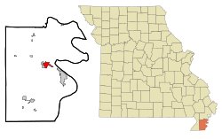 Location of Hayti, Missouri | |
| Coordinates: 36°14′01″N 89°44′58″W / 36.23361°N 89.74944°WCoordinates: 36°14′01″N 89°44′58″W / 36.23361°N 89.74944°W[3] | |
| Country | United States |
| State | Missouri |
| County | Pemiscot |
| Area | |
| • Total | 2.31 sq mi (5.98 km2) |
| • Land | 2.30 sq mi (5.95 km2) |
| • Water | 0.01 sq mi (0.03 km2) |
| Elevation | 269 ft (82 m) |
| Population | |
| • Total | 2,939 |
| • Estimate (2019)[5] | 2,501 |
| • Density | 1,089.29/sq mi (420.57/km2) |
| Time zone | UTC-6 (Central (CST)) |
| • Summer (DST) | UTC-5 (CDT) |
| ZIP code | 63851 |
| Area code(s) | 573 Exchange: 359 |
| FIPS code | 29-31132[4] |

Hayti (pronounced "HAY-tie") is a city in eastern Pemiscot County, Missouri, United States. The population was 2,939 at the 2010 census.
History[]
Hayti was platted in 1894, when the railroad was extended to that point.[6] According to one tradition, the name honors Dr. G. Hayes, an original owner of the site.[6] It is also claimed the name is derived from the country of Haiti.[7] A post office called Hayti has been in operation since 1895.[8]
Geography[]
The city lies in eastern Pemiscot County, just west of the Mississippi River. Interstate 55 passes through the eastern half of Hayti, connecting the city with the Sikeston area to the north and Blytheville, Arkansas, to the south. Interstate 155 intersects I-55 near Hayti's southern border, and continues southeastward across the river into Tennessee. U.S. Route 412 connects Hayti to Kennett to the west, and Route 84 connects the city with Caruthersville to the east. The city of Hayti Heights borders Hayti immediately to the west.[9]
According to the United States Census Bureau, the city has a total area of 2.31 square miles (5.98 km2), of which 2.30 square miles (5.96 km2) is land and 0.01 square miles (0.03 km2) is water.[10]
Demographics[]
| Historical population | |||
|---|---|---|---|
| Census | Pop. | %± | |
| 1900 | 419 | — | |
| 1910 | 1,057 | 152.3% | |
| 1920 | 1,507 | 42.6% | |
| 1930 | 1,620 | 7.5% | |
| 1940 | 2,628 | 62.2% | |
| 1950 | 3,302 | 25.6% | |
| 1960 | 3,737 | 13.2% | |
| 1970 | 3,841 | 2.8% | |
| 1980 | 3,964 | 3.2% | |
| 1990 | 3,280 | −17.3% | |
| 2000 | 3,207 | −2.2% | |
| 2010 | 2,939 | −8.4% | |
| 2019 (est.) | 2,501 | [5] | −14.9% |
| U.S. Decennial Census[11] | |||
2010 census[]
As of the census[2] of 2010, there were 2,939 people, 1,258 households, and 739 families living in the city. The population density was 1,277.8 inhabitants per square mile (493.4/km2). There were 1,376 housing units at an average density of 598.3 per square mile (231.0/km2). The racial makeup of the city was 52.23% White, 45.12% Black or African American, 0.31% Native American, 0.31% Asian, 0.51% from other races, and 1.53% from two or more races. Hispanic or Latino of any race were 0.99% of the population.
There were 1,258 households, of which 31.2% had children under the age of 18 living with them, 28.1% were married couples living together, 25.4% had a female householder with no husband present, 5.3% had a male householder with no wife present, and 41.3% were non-families. 36.6% of all households were made up of individuals, and 15.7% had someone living alone who was 65 years of age or older. The average household size was 2.30 and the average family size was 3.01.
The median age in the city was 38.2 years. 26.9% of residents were under the age of 18; 9.9% were between the ages of 18 and 24; 21.6% were from 25 to 44; 25.3% were from 45 to 64; and 16.4% were 65 years of age or older. The gender makeup of the city was 45.8% male and 54.2% female.
2000 census[]
As of the census[4] of 2000, there were 3,207 people, 1,318 households, and 809 families living in the city. The population density was 1,450.1 people per square mile (560.3/km2). There were 1,436 housing units at an average density of 649.3 per square mile (250.9/km2). The racial makeup of the city was 54.66% White, 43.75% African American, 0.44% Native American, 0.19% Asian, 0.12% from other races, and 0.84% from two or more races. Hispanic or Latino of any race were 1.31% of the population.
There were 1,318 households, out of which 30.1% had children under the age of 18 living with them, 33.8% were married couples living together, 23.9% had a female householder with no husband present, and 38.6% were non-families. 36.1% of all households were made up of individuals, and 19.2% had someone living alone who was 65 years of age or older. The average household size was 2.33 and the average family size was 3.06.
In the city, the population was spread out, with 30.1% under the age of 18, 8.0% from 18 to 24, 23.3% from 25 to 44, 19.4% from 45 to 64, and 19.3% who were 65 years of age or older. The median age was 35 years. For every 100 females, there were 79.9 males. For every 100 females age 18 and over, there were 73.0 males.
The median income for a household in the city was $15,384, and the median income for a family was $23,720. Males had a median income of $24,028 versus $15,486 for females. The per capita income for the city was $13,265. About 35.7% of families and 38.3% of the population were below the poverty line, including 54.7% of those under age 18 and 29.5% of those age 65 or over.
Education[]
Public education in Hayti is administered by Hayti R-II School District, which operates two elementary schools and Hayti High School.[12]
Hayti has a lending library, the Conran Memorial Library.[13]
Notable people[]
- Veda Brown (née Mildred Pulliam Whitehorn), singer
- Lew Carpenter (1932–2010), NFL running back and coach, was born in Hayti
- Preston Carpenter (1934–2011), University of Arkansas and NFL running back, was born in Hayti
- Wendell Mayes, Oscar-nominated Hollywood writer, was born in Hayti[14]
- William Moore, former Missouri Tiger and NFL Atlanta Falcons safety
- Keith Palmer, country musician
- Bob Stroger, blues musician
References[]
- ^ "2019 U.S. Gazetteer Files". United States Census Bureau. Retrieved July 26, 2020.
- ^ Jump up to: a b "U.S. Census website". United States Census Bureau. Retrieved 2012-07-08.
- ^ Jump up to: a b c U.S. Geological Survey Geographic Names Information System: Hayti, Missouri
- ^ Jump up to: a b "U.S. Census website". United States Census Bureau. Retrieved 2008-01-31.
- ^ Jump up to: a b "Population and Housing Unit Estimates". United States Census Bureau. May 24, 2020. Retrieved May 27, 2020.
- ^ Jump up to: a b "Pemiscot County Place Names, 1928–1945". The State Historical Society of Missouri. Archived from the original on June 24, 2016. Retrieved November 29, 2016.
- ^ Ramsay, Robert L. (1952). Our Storehouse of Missouri Place Names. University of Missouri Press. p. 28. ISBN 9780826205865.
- ^ "Post Offices". Jim Forte Postal History. Retrieved 29 November 2016.
- ^ Missouri Atlas & Gazetteer, DeLorme, 1998, First edition, p. 71, ISBN 0-89933-224-2
- ^ "US Gazetteer files 2010". United States Census Bureau. Retrieved 2012-07-08.
- ^ "Census of Population and Housing". Census.gov. Retrieved June 4, 2015.
- ^ "Hayti R-Ii School District". Great Schools. Retrieved 2 June 2019.
- ^ "Missouri Public Libraries". PublicLibraries.com. Archived from the original on 10 June 2017. Retrieved 2 June 2019.
- ^ "Wendell Mayes (1918–1992)". IMDb.com. Retrieved 2016-10-30.
External links[]
 Media related to Hayti, Missouri at Wikimedia Commons
| show Municipalities and communities of Pemiscot County, Missouri, United States |
|---|

| show Authority control |
|---|
- Missouri populated places on the Mississippi River
- Cities in Pemiscot County, Missouri
- Cities in Missouri