Hazel Green, Alabama
Hazel Green, Alabama | |
|---|---|
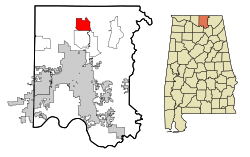 Location in Madison County and the state of Alabama | |
| Coordinates: 34°55′25″N 86°34′1″W / 34.92361°N 86.56694°W | |
| Country | United States |
| State | Alabama |
| County | Madison |
| Area | |
| • Total | 10.05 sq mi (26.02 km2) |
| • Land | 10.03 sq mi (25.98 km2) |
| • Water | 0.01 sq mi (0.04 km2) |
| Elevation | 794 ft (242 m) |
| Population (2020) | |
| • Total | 4,105 |
| • Density | 409.15/sq mi (157.98/km2) |
| Time zone | UTC-5 (Central (CST)) |
| • Summer (DST) | UTC-5 (CDT) |
| ZIP code | 35750 |
| Area code(s) | 256 |
| FIPS code | 01-33808 |
| GNIS feature ID | 2402573[2] |

Hazel Green is an unincorporated community and census-designated place (CDP) in Madison County, Alabama, United States, and is included in the Huntsville-Decatur Combined Statistical Area. As of the 2010 census, the population of the community was 3,630. The 2010 estimated population for the Hazel Green zip code 35750 was 12,783.
History[]
This section does not cite any sources. (December 2017) |
The town was named Hazel Green because of the hazel bushes along the road were of a vibrant green. In the early 19th century, several farmers from Georgia and the Carolinas settled in Hazel Green after discovering that the area had some of the richest soil in the Southeast. A post office was built in 1819 on the southeast corner of the intersection now known as Hwy. 231-431 & Joe Quick Road. Several grocers and rest stops were also built along this intersection. It became a bustling community and incorporated into a town on June 15, 1821, by an act of the state legislature with a population of approximately 400. At the time, Hazel Green was a small, rural community that served as a crossroads. Roads connected Hazel Green with Athens to the west, Winchester, TN to the east, Huntsville to the south, and Nashville to the north. These roads intersected at what is now known as the intersection of US Highway 231/431, Joe Quick Road, and West Limestone Road. The town eventually became unincorporated and despite recent growth, remains unincorporated to this day.
On April 3, 1974, Hazel Green was hit by an F5 tornado during the 1974 Super Outbreak.
After several months of rumors and speculation, Walmart began construction of a Supercenter on the southwest corner of US Highway 231/431 and Charity Lane in June 2014. This brought attention to several local residents and media outlets, as Walmart typically does not build supercenters in unincorporated areas. After completion in March 2015, the store attracted several other businesses in the same vicinity, including multiple fast food restaurants and shopping centers. As of December 2016, Zaxby's, Burger King, Arby's, Papa Murphy's Pizza, Taco Bell, AT&T, Great Clips, Dollar Tree, Hibbett Sports, Verizon, and Pet Depot make up the list of new businesses in the area. Hazel Green is slated for continued residential and commercial growth in the upcoming years.
Geography[]
Hazel Green is located at 34°55′25″N 86°34′2″W / 34.92361°N 86.56722°W (34.923712, -86.567206).[3]
According to the U.S. Census Bureau, the community has a total area of 10.0 square miles (26 km2), all land.
Major Roads[]
Neighboring communities[]
Rivers[]
Demographics[]
| Historical population | |||
|---|---|---|---|
| Census | Pop. | %± | |
| 1980 | 1,503 | — | |
| 1990 | 2,208 | 46.9% | |
| 2000 | 3,805 | 72.3% | |
| 2010 | 3,630 | −4.6% | |
| 2020 | 4,105 | 13.1% | |
| U.S. Decennial Census[4] | |||
2000 census[]
As of the census[5] of 2000, there were 3,805 people, 1,340 households, and 1,080 families residing in the community. The population density was 378.9 people per square mile (146.3/km2). There were 1,394 housing units at an average density of 138.8 per square mile (53.6/km2). The racial makeup of the community was 93.56% White, 2.65% Black or African American, 1.31% Native American, 0.50% Asian, 0.03% Pacific Islander, 0.32% from other races, and 1.63% from two or more races. 1.76% of the population were Hispanic or Latino of any race.
There were 1,340 households out of which 46.1% had children under the age of 18 living with them, 66.1% were married couples living together, 10.6% had a female householder with no husband present, and 19.4% were non-families. 17.2% of all households were made up of individuals, and 4.9% had someone living alone who was 65 years of age or older. The average household size was 2.82 and the average family size was 3.18.
In the community, the population was spread out, with 31.3% under the age of 18, 7.1% from 18 to 24, 35.3% from 25 to 44, 18.7% from 45 to 64, and 7.7% who were 65 years of age or older. The median age was 33 years. For every 100 females, there were 98.1 males. For every 100 females age 18 and over, there were 95.4 males. The median income for a household in the community was $40,263, and the median income for a family was $45,174. Males had a median income of $33,005 versus $23,929 for females. The per capita income for the community was $18,397. About 4.2% of families and 6.3% of the population were below the poverty line, including 4.8% of those under age 18 and 12.5% of those age 65 or over.
2010 census[]
As of the census[6] of 2010, there were 3,630 people, 1,338 households, and 1,017 families residing in the community. The population density was 363 people per square mile (139.6/km2). There were 1,434 housing units at an average density of 143.4 per square mile (55.2/km2). The racial makeup of the community was 88.9% White, 5.9% Black or African American, 1.5% Native American, 0.4% Asian, 0.1% Pacific Islander, 0.7% from other races, and 2.4% from two or more races. 2.3% of the population were Hispanic or Latino of any race.
There were 1,338 households out of which 34.8% had children under the age of 18 living with them, 60.5% were married couples living together, 10.6% had a female householder with no husband present, and 24.0% were non-families. 20.3% of all households were made up of individuals, and 6.2% had someone living alone who was 65 years of age or older. The average household size was 2.69 and the average family size was 3.11.
In the community, the population was spread out, with 26.2% under the age of 18, 7.9% from 18 to 24, 27.9% from 25 to 44, 27.5% from 45 to 64, and 10.5% who were 65 years of age or older. The median age was 37.5 years. For every 100 females, there were 96.5 males. For every 100 females age 18 and over, there were 98.4 males.
The median income for a household in the community was $48,822, and the median income for a family was $60,588. Males had a median income of $42,981 versus $30,990 for females. The per capita income for the community was $23,693. About 10.8% of families and 13.6% of the population were below the poverty line, including 16.4% of those under age 18 and 7.4% of those age 65 or over.
2020 census[]
| Race | Num. | Perc. |
|---|---|---|
| White (non-Hispanic) | 3,284 | 80.0% |
| Black or African American (non-Hispanic) | 356 | 8.67% |
| Native American | 34 | 0.83% |
| Asian | 30 | 0.73% |
| Other/Mixed | 242 | 5.9% |
| Hispanic or Latino | 159 | 3.87% |
As of the 2020 United States census, there were 4,105 people, 1,516 households, and 1,155 families residing in the CDP.
Public services[]
The Madison County Sheriff's Department administers law and order in Hazel Green.
The Hazel Green Fire/Rescue is a large volunteer fire department of approximately 40 members serving the residents of North Central Madison County. The fire department has 3 stations. The stations are located throughout the district in strategic locations. Station one, which houses the majority of all of the main rescue, EMS and firefighting equipment, is located at the intersection of Joe Quick Road and Highway 231-431N. Station two is located on Greenville Pike and Station three on Hill Chapel Road. Hazel Green Fire/Rescue outfits an apparatus of five engines, one attack truck (or "brush" truck), one rescue truck and two medical response vehicles. Hazel Green has a dedicated roster of individuals who hold credentials from firefighter I level, to FF 2, state licensed and nationally registered Emergency Medical Technicians (EMTs) and certified technical rescue personnel (vehicle, water and other special rescue missions).
The Huntsville Madison County Public Library maintains a branch, the Tillman D. Hill Public Library, located on Knowledge Dr. behind Advance Auto Parts. This branch library is part of a very well supported community library system in Madison County.
The Madison County School System runs three schools in Hazel Green. Hazel Green High School serves as a high school for Hazel Green, Meridianville, New Market, and parts of northern Huntsville. Middle school students in Hazel Green attend Meridianville Middle located in Hazel Green. Fourth through sixth grade students attend Moores Mill Intermediate School. Kindergarten through third grade students attend Hazel Green Elementary School, Lynn Fanning Elementary, and Walnut Grove School.
Notable people[]
- Claire Lynch, American bluegrass singer
- George Lindsey, actor who portrayed Goober Pyle on The Andy Griffith Show and Hee-Haw
- Kira Lewis Jr., professional basketball player for the New Orleans Pelicans
References[]
- ^ "2020 U.S. Gazetteer Files". United States Census Bureau. Retrieved October 29, 2021.
- ^ "U.S. Board on Geographic Names".
- ^ "US Gazetteer files: 2010, 2000, and 1990". United States Census Bureau. 2011-02-12. Retrieved 2011-04-23.
- ^ "Census of Population and Housing". Census.gov. Retrieved June 4, 2016.
- ^ "U.S. Census website". United States Census Bureau. Retrieved 2008-01-31.
- ^ "U.S. Census website". United States Census Bureau. Retrieved 2015-08-02.
- ^ "Explore Census Data". data.census.gov. Retrieved 2021-12-17.
External links[]
Municipalities and communities of Madison County, Alabama, United States | ||
|---|---|---|
| Cities |  | |
| Towns | ||
| CDPs | ||
| Unincorporated communities | ||
| Footnotes | ‡This populated place also has portions in an adjacent county or counties | |
| ||
Coordinates: 34°55′25″N 86°34′02″W / 34.923712°N 86.567206°W
- Unincorporated communities in Alabama
- Census-designated places in Madison County, Alabama
- Census-designated places in Alabama
- Huntsville-Decatur-Albertville, AL Combined Statistical Area
- Unincorporated communities in Madison County, Alabama