Madison County, Alabama
Madison County | |
|---|---|
U.S. county | |
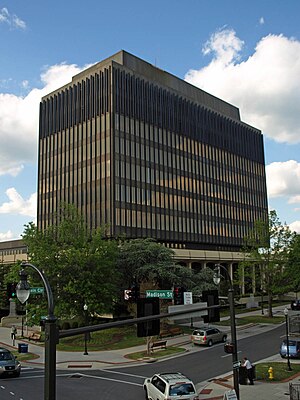 Madison County Courthouse in Huntsville | |
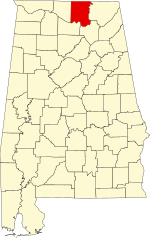 Location within the U.S. state of Alabama | |
 Alabama's location within the U.S. | |
| Coordinates: 34°45′57″N 86°33′28″W / 34.765833333333°N 86.557777777778°W | |
| Country | |
| State | |
| Founded | December 13, 1808[1] |
| Named for | James Madison |
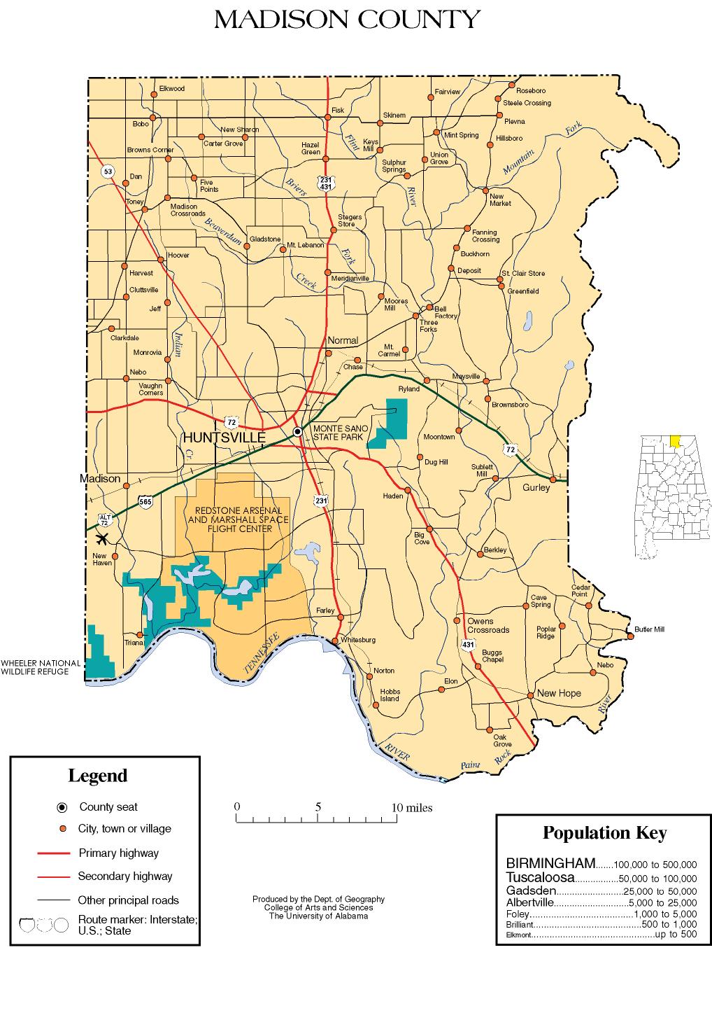
| Seat | Huntsville |
| Largest city | Huntsville |
| Government | |
| • Commission Chairman | Dale W. Strong[2] |
| Area | |
| • Total | 813 sq mi (2,110 km2) |
| • Land | 802 sq mi (2,080 km2) |
| • Water | 11 sq mi (30 km2) 1.4% |
| Population (2020) | |
| • Total | 388,153 |
| • Density | 480/sq mi (180/km2) |
| Time zone | UTC−6 (Central) |
| • Summer (DST) | UTC−5 (CDT) |
| Congressional district | 5th |
| Website | www |
| |

Madison County is located in the north central portion of the U.S. state of Alabama. As of the 2020 Census, the population was 388,153, making it the third-most populous county in Alabama.[3] Its county seat is Huntsville.[4] The county is named in honor of James Madison,[5] fourth President of the United States and the first President to visit the state of Alabama. Madison County covers parts of the former Decatur County. Madison County is included in the Huntsville, Alabama Metropolitan Statistical Area.
History[]
Madison County was established on December 13, 1808 by the governor of the Mississippi Territory.[1] It is recognized as the "birthplace" of Alabama, which was founded there on December 14, 1819. For much of the county's history, the economy revolved mainly around agriculture. Madison County was one of the largest cotton-producing counties in the state, and textile mills operated around the county.
In 1950, a group of German rocket scientists, led by Wernher von Braun, came to Redstone Arsenal from Fort Bliss, Texas. They developed, among others, the Redstone rocket, which was modified to launch the first two Americans into space. Tens of thousands of jobs came to the area as a result of the Space Race, and the population of Madison County rose from 72,903 in 1950 to an estimated 379,453 in 2020.
Geography[]
According to the U.S. Census Bureau, the county has a total area of 813 square miles (2,110 km2), of which 802 square miles (2,080 km2) is land and 11 square miles (28 km2) (1.4%) is water.[6]
The topography in the southern and eastern portions of the county is dominated by the dissected remnants of the Cumberland Plateau, such as Keel Mountain, Monte Sano Mountain and . The northern and western portions of the county are flatter.
Rivers[]
Adjacent counties[]

- Lincoln County, Tennessee (north)
- Franklin County, Tennessee (northeast)
- Jackson County (east)
- Marshall County (southeast)
- Morgan County (southwest)
- Limestone County (west)
National protected area[]
Demographics[]
| Historical population | |||
|---|---|---|---|
| Census | Pop. | %± | |
| 1810 | 4,699 | — | |
| 1820 | 17,481 | 272.0% | |
| 1830 | 27,990 | 60.1% | |
| 1840 | 25,706 | −8.2% | |
| 1850 | 26,427 | 2.8% | |
| 1860 | 26,451 | 0.1% | |
| 1870 | 31,267 | 18.2% | |
| 1880 | 37,625 | 20.3% | |
| 1890 | 38,119 | 1.3% | |
| 1900 | 43,702 | 14.6% | |
| 1910 | 47,041 | 7.6% | |
| 1920 | 51,268 | 9.0% | |
| 1930 | 64,623 | 26.0% | |
| 1940 | 66,317 | 2.6% | |
| 1950 | 72,903 | 9.9% | |
| 1960 | 117,348 | 61.0% | |
| 1970 | 186,540 | 59.0% | |
| 1980 | 196,966 | 5.6% | |
| 1990 | 238,912 | 21.3% | |
| 2000 | 276,700 | 15.8% | |
| 2010 | 334,811 | 21.0% | |
| 2020 | 388,153 | 15.9% | |
| U.S. Decennial Census[7] 1790–1960[8] 1900–1990[9] 1990–2000[10] 2010–2020[3] | |||
As of the census[11] of 2000, there were 276,700 people, 109,955 households, and 75,319 families residing in the county. The population density was 344 people per square mile (133/km2). There were 120,288 housing units at an average density of 149 per square mile (58/km2). The racial makeup of the county was 72.06% White, 22.78% Black or African American, 0.77% Native American, 1.86% Asian, 0.06% Pacific Islander, 0.59% from other races, and 1.89% from two or more races. Nearly 1.91% of the population were Hispanic or Latino of any race.
According to the 2000 census, the largest ancestry groups in Madison County were English 50.2%, African 22.78%, Scots-Irish 8.71%, Irish 4.3%, Scottish 4.12%, and Welsh 2.9%
2010[]
According to the 2010 U.S. Census:
- 65.9 White(non-Hispanic)
- 24.6% Black
- 0.8% Native American
- 2.5% Asian
- 0.0% Native Hawaiian or Pacific Islander
- 2.3% Two or more races
- 4.7% Hispanic or Latino (of any race)
There were 109,955 households, out of which 33.00% had children under the age of 18 living with them; 53.40% were married couples living together, 11.80% had a female householder with no husband present, and 31.50% were non-families. Nearly 27.20% of all households were made up of individuals, and 7.40% had someone living alone who was 65 years of age or older. The average household size was 2.45, and the average family size was 3.00.
In the county, the population was spread out, with 25.60% under the age of 18, 9.40% from 18 to 24, 31.50% from 25 to 44, 22.70% from 45 to 64, and 10.80% who were 65 years of age or older. The median age was 36 years. For every 100 females, there were 95.30 males. For every 100 females age 18 and over, there were 92.10 males.
The median income for a household in the county was $44,704, and the median income for a family was $54,360. Males had a median income of $40,779 versus $26,534 for females. The per capita income for the county was $23,091. About 8.10% of families and 10.50% of the population were below the poverty line, including 14.10% of those under age 18 and 9.60% of those age 65 or over.
Communities[]
Cities[]
- Huntsville (county seat; partly in Limestone County and partly in Morgan County)
- Madison (partly in Limestone County)
- New Hope
Towns[]
Census-designated places[]
Unincorporated communities[]
Education[]
The Madison County School System runs public schools throughout the unincorporated areas of the county and the incorporated and unincorporated communities of Gurley, New Hope, Meridianville, Hazel Green, Toney, Monrovia, New Market, and Owens Cross Roads. The system runs 14 elementary schools, 4 middle schools, 5 high schools and a ninth grade school, and a career/technical center.
High schools in the Madison County School System are:
- Buckhorn High School (New Market)
- Hazel Green High School
- Madison County High School (Gurley)
- New Hope High School
- Sparkman High School (Harvest)
There are a number of private schools serving Madison County. These include Randolph School, Madison Academy, Westminster Christian Academy, Faith Christian Academy, and several others.
Transportation[]
Major highways[]
 Interstate 565
 U.S. Highway 72 (University Drive in Huntsville city limits)
 U.S. Highway 231 (Memorial Parkway in Huntsville city limits)
 U.S. Highway 431 (Governors Drive in Medical District of Huntsville; Memorial Parkway for rest of length in Huntsville City Limits)
 State Route 53 (Jordan Lane in much of Huntsville city limits)
 State Route 255 (Research Park Boulevard)
Rail[]
- Norfolk Southern Railway
- Huntsville and Madison County Railroad Authority
Air travel[]
The Port of Huntsville provides both passenger air service, via Huntsville International Airport which allows access to most of the rest of the United States, and shipping air service, via the International Intermodal Center. There are also three smaller public airports in the county: Hazel Green Airport, Madison County Executive Airport, and Moontown Airport.
Bicycle routes[]
There are several bicycle routes in the city of Huntsville. Madison County has a master plan to develop a 70-mile bicycle and walking trail.[citation needed]
Politics[]
Madison County was formerly an overwhelmingly Democratic county as with most of the rest of Alabama, with only a narrow loss by Al Smith in 1928 due to Prohibitionist anti-Catholicism[12] disrupting this trend until the 1960s. Even in 1964, the county nearly voted against Barry Goldwater due to its opposition to the Arizona Senator’s privatization plans for the Tennessee Valley Authority. However, since that time, the county has become solidly Republican, with the only national Democratic nominee to carry the county since 1960 being Deep South native Jimmy Carter in 1976. In the 2016 election, Gary Johnson had his best showing in the state, carrying 4.05% of the vote. The county is trending less Republican recently, 58.9% in 2004, 56.9% in 2008, 58.47% in 2012, 54.79% in 2016. For counties supporting Donald Trump in 2016, it was the 4th narrowest margin.
The governing body of the county is a commission. The commission is responsible for levying the county tax, establish, maintain, and discontinue county roads and bridges. The commission is also responsible for the county jail as well as the sheriff's department. The County Commission is composed of seven members. A Chairman is elected at-large by the county while each of the other six members is elected by their districts. Each commissioner serves a four-year term.[13]
Places of interest[]
Madison County is home to Monte Sano State Park, the U.S. Space & Rocket Center, and part of the Flint River. It also contains Hampton Cove Golf Course, part of the Robert Trent Jones Golf Trail. There is a historical marker for Lincoln School and Village which were incorporated into Huntsville in 1956.[15]
See also[]
- National Register of Historic Places listings in Huntsville, Alabama
- National Register of Historic Places listings in Madison County, Alabama
- Properties on the Alabama Register of Landmarks and Heritage in Madison County, Alabama
- Redstone Arsenal cemeteries
References[]
- ^ Jump up to: a b A Digest of the Laws of the State of Alabama: Containing The Statutes and Resolutions in Force at the end of the General Assembly in January, 1823. Published by Ginn & Curtis, J. & J. Harper, Printers, New-York, 1828. Title 10. Chapter II. Page 80-81. "By Robert Williams, Governor of the Mississippi Territory." (Internet Archive)
- ^ "Commission Chairman". Madison County Alabama. Retrieved July 7, 2017.
- ^ Jump up to: a b "QuickFacts: Madison County, Alabama; Population, Census, 2020 & 2010". United States Census Bureau. Retrieved August 19, 2021.
- ^ "Find a County". National Association of Counties. Retrieved June 7, 2011.
- ^ Gannett, Henry (1905). The Origin of Certain Place Names in the United States. U.S. Government Printing Office. p. 196.
- ^ "2010 Census Gazetteer Files". United States Census Bureau. August 22, 2012. Retrieved August 22, 2015.
- ^ "U.S. Decennial Census". United States Census Bureau. Retrieved August 22, 2015.
- ^ "Historical Census Browser". University of Virginia Library. Retrieved August 22, 2015.
- ^ Forstall, Richard L., ed. (March 24, 1995). "Population of Counties by Decennial Census: 1900 to 1990". United States Census Bureau. Retrieved August 22, 2015.
- ^ "Census 2000 PHC-T-4. Ranking Tables for Counties: 1990 and 2000" (PDF). United States Census Bureau. April 2, 2001. Retrieved August 22, 2015.
- ^ "U.S. Census website". United States Census Bureau. Retrieved May 14, 2011.
- ^ Phillips, Kevin P.; The Emerging Republican Majority, pp. 214, 261 ISBN 978-0-691-16324-6
- ^ "Madison County Commission". Retrieved November 7, 2020.
- ^ "Dave Leip's Atlas of U.S. Presidential Elections". Retrieved November 21, 2016.
- ^ Alabama Historical Marker: Lincoln School and Village.
External links[]
| Wikimedia Commons has media related to Madison County, Alabama. |
- Madison County web site
- Madison County Schools Archived August 10, 2007, at the Wayback Machine
- Madison Alabama Chamber of Commerce
- Madison County map of roads/towns (map © 2007 Univ. of Alabama).
- Margaret Rieder Collection, The University of Alabama in Huntsville Archives and Special Collections Historian's collection of research and documents on Madison County history.
| show Places adjacent to Madison County, Alabama |
|---|
| show Municipalities and communities of Madison County, Alabama, United States |
|---|


Coordinates: 34°45′57″N 86°33′28″W / 34.76583°N 86.55778°W
| show Authority control |
|---|
- Alabama counties
- Madison County, Alabama
- Huntsville-Decatur-Albertville, AL Combined Statistical Area
- 1808 establishments in Mississippi Territory
- Populated places established in 1808
- Counties of Appalachia