Wilcox County, Alabama
Wilcox County | |
|---|---|
U.S. county | |
 Wilcox County Courthouse in Camden | |
 Location within the U.S. state of Alabama | |
 Alabama's location within the U.S. | |
| Coordinates: 31°59′06″N 87°18′39″W / 31.985°N 87.310833333333°W | |
| Country | |
| State | |
| Founded | December 13, 1819 |
| Named for | Joseph M. Wilcox |
| Seat | Camden |
| Largest city | Camden |
| Area | |
| • Total | 907 sq mi (2,350 km2) |
| • Land | 888 sq mi (2,300 km2) |
| • Water | 19 sq mi (50 km2) 2.1% |
| Population (2020) | |
| • Total | 10,600 |
| • Density | 12/sq mi (4.5/km2) |
| Time zone | UTC−6 (Central) |
| • Summer (DST) | UTC−5 (CDT) |
| Congressional district | 7th |
| |

Wilcox County is a county of the U.S. state of Alabama. As of the 2020 census, the population was 10,600.[1] Its county seat is Camden.[2]
History[]
Wilcox County was established on December 13, 1819. The county was named after Joseph M. Wilcox, a US Army lieutenant who was killed in Alabama during the Creek War.[3]
Geography[]
According to the U.S. Census Bureau, the county has a total area of 907 square miles (2,350 km2), of which 888 square miles (2,300 km2) is land and 19 square miles (49 km2) (2.1%) is water.[4]
Major highways[]
 State Route 5
 State Route 10
 State Route 21
 State Route 25
 State Route 28
 State Route 41
 State Route 89
 State Route 162
 State Route 164
 State Route 221
 State Route 265
Adjacent counties[]
- Dallas County (northeast)
- Lowndes County (east-northeast)
- Butler County (east-southeast)
- Monroe County (south)
- Clarke County (southwest)
- Marengo County (northwest)
Demographics[]
| Historical population | |||
|---|---|---|---|
| Census | Pop. | %± | |
| 1820 | 2,917 | — | |
| 1830 | 9,548 | 227.3% | |
| 1840 | 15,278 | 60.0% | |
| 1850 | 17,352 | 13.6% | |
| 1860 | 24,618 | 41.9% | |
| 1870 | 28,377 | 15.3% | |
| 1880 | 31,828 | 12.2% | |
| 1890 | 30,816 | −3.2% | |
| 1900 | 35,631 | 15.6% | |
| 1910 | 33,810 | −5.1% | |
| 1920 | 31,080 | −8.1% | |
| 1930 | 24,880 | −19.9% | |
| 1940 | 26,279 | 5.6% | |
| 1950 | 23,476 | −10.7% | |
| 1960 | 18,739 | −20.2% | |
| 1970 | 16,303 | −13.0% | |
| 1980 | 14,755 | −9.5% | |
| 1990 | 13,568 | −8.0% | |
| 2000 | 13,183 | −2.8% | |
| 2010 | 11,670 | −11.5% | |
| 2020 | 10,600 | −9.2% | |
| U.S. Decennial Census[5] 1790–1960[6] 1900–1990[7] 1990–2000[8] 2010–2020[1] | |||
As of the 2010 United States Census, there were 11,670 people living in the county. 72.5% were Black or African American, 26.8% White, 0.1% Native American, 0.1% of some other race and 0.4% of two or more races. 0.6% were Hispanic or Latino (of any race).
As of the census[9] of 2000, there were 13,183 people, 4,776 households, and 3,376 families living in the county. The population density was 15 people per square mile (6/km2). There were 6,183 housing units at an average density of 7 per square mile (3/km2). The racial makeup of the county was 71.90% Black or African American, 27.51% White, 0.14% Native American, 0.13% Asian, 0.02% Pacific Islander, 0.11% from other races, and 0.19% from two or more races. Nearly 0.74% of the population were Hispanic or Latino of any race.
There were 4,776 households, out of which 36.00% had children under the age of 18 living with them, 39.80% were married couples living together, 26.50% had a female householder with no husband present, and 29.30% were non-families. Nearly 27.50% of all households were made up of individuals, and 11.90% had someone living alone who was 65 years of age or older. The average household size was 2.70, and the average family size was 3.31.
In the county, the population was spread out, with 30.70% under the age of 18, 9.10% from 18 to 24, 25.50% from 25 to 44, 21.00% from 45 to 64, and 13.70% who were 65 years of age or older. The median age was 34 years. For every 100 females, there were 87.20 males. For every 100 females age 18 and over, there were 81.00 males.
The median income for a household in the county was $16,646, and the median income for a family was $22,200. Males had a median income of $26,216 versus $17,274 for females. The per capita income for the county was $10,903. About 36.10% of families and 39.90% of the population were below the poverty line, including 48.40% of those under age 18 and 32.10% of those age 65 or over.
Government[]
Wilcox County leans heavily towards the Democratic Party. The only Republican to carry the county since 1900 has been Barry Goldwater in 1964 – when little to none of the county's black majority had voted for over seven decades and opposition by the voting white minority to Civil Rights meant that national Democrat Lyndon Johnson was not allowed on the ballot. Even after the Voting Rights Act of 1965, black registration was so slow that segregationist George Wallace comfortably carried the county in 1968, but since then the Democratic presidential candidate has carried Wilcox in every election. It was one of only six Wallace counties[a] to vote for George McGovern against Richard Nixon’s 3,000-plus-county landslide of 1972.
Religion[]
According to the Association of Religion Data Archives at Pennsylvania State University, religious affiliation in Wilcox County in 2010 was as follows:[11]
- African Methodist Episcopal Church (2443 adherents)
- Southern Baptist Convention (2177)
- Nondenominational Protestant (477)
- The United Methodist Church (463)
- Pentecostalism (320)
- Lutheran Church–Missouri Synod (262)
- Christian Methodist Episcopal Church (251)
- Churches of Christ (206)
Education[]
All public schools in the county are operated by the Wilcox County School District.[12] It is also served by one private school, Wilcox Academy, founded in 1970 as a segregation academy.[13] The public schools are effectively all-Black.
Economy[]
Major industries in the county include a paper mill operated by International Paper, based in Memphis, Tennessee, on the Alabama River near Pine Hill that employs roughly 400 people, and a copper tubing plant owned by Golden Dragon Copper Group of Xinxiang, China in Sunny South that opened in 2014; it employs approximately 300.[14][15][16]
Communities[]
City[]
- Camden (county seat)
Towns[]
Census-designated places[]
Unincorporated communities[]
Ghost town[]
Places of interest[]
Wilcox County is home to Roland Cooper State Park, Lake Dannelly, and Bridgeport Beach.
Notable people[]
- William Q. Atwood, former slave who became a lumber baron based in Saginaw, Michigan
- Judy L. Bonner, 28th President of The University of Alabama
- Fred Cone, former running back in the NFL for the Green Bay Packers and Dallas Cowboys
- James Crawford (basketball), former professional basketball player who played in the Australian National Basketball League
- Laurance L. Cross, Presbyterian minister and Mayor of Berkeley, California
- Marie Foster, leader in the U.S. Civil Rights Movement
- Kenneth R. Giddens, Broadcaster and Voice of America executive
- John Cooper Godbold, United States Circuit Judge of the United States Court of Appeals for the Eleventh Circuit and the United States Court of Appeals for the Fifth Circuit
- Kay Ivey, 54th governor of Alabama
- Philemon T. Herbert, former U.S. Representative from California
- Bill Lee (musician), American musician
- Noah Purifoy, visual artist and sculptor
- Benjamin M. Miller, 39th governor of Alabama
- Lucy Mingo, American quilt maker and member of the Gee's Bend Collective
- Estella Payton, co-star on the Woman's World cooking show that aired on WKRG-TV in Mobile, Alabama
- Joseph Smitherman, mayor of Selma, Alabama
- William J. Vaughn, American university professor, school principal, librarian and book collector
See also[]
- National Register of Historic Places listings in Wilcox County, Alabama
- Properties on the Alabama Register of Landmarks and Heritage in Wilcox County, Alabama
- Rufus Randolph Rhodes
References[]
- ^ Jump up to: a b "QuickFacts: Wilcox County, Alabama; Population, Census, 2020 & 2010". United States Census Bureau. Retrieved August 19, 2021.
- ^ "Find a County". National Association of Counties. Retrieved June 7, 2011.
- ^ [1]
- ^ "2010 Census Gazetteer Files". United States Census Bureau. August 22, 2012. Retrieved August 22, 2015.
- ^ "U.S. Decennial Census". United States Census Bureau. Retrieved August 22, 2015.
- ^ "Historical Census Browser". University of Virginia Library. Retrieved August 22, 2015.
- ^ Forstall, Richard L., ed. (March 24, 1995). "Population of Counties by Decennial Census: 1900 to 1990". United States Census Bureau. Retrieved August 22, 2015.
- ^ "Census 2000 PHC-T-4. Ranking Tables for Counties: 1990 and 2000" (PDF). United States Census Bureau. April 2, 2001. Retrieved August 22, 2015.
- ^ "U.S. Census website". United States Census Bureau. Retrieved May 14, 2011.
- ^ "Dave Leip's Atlas of U.S. Presidential Elections". Retrieved November 21, 2016.
- ^ "Wilcox County, Alabama". The Association of Religion. Retrieved March 22, 2015.
- ^ "Schools". Wilcox County Schools. Retrieved March 3, 2013.
- ^ Carla Crowder (October 27, 2002). "Private white academies struggle in changing world". Birmingham News. Archived from the original on November 15, 2012. Retrieved March 3, 2013.
- ^ Mitchell, Ellen (September 11, 2012). "International Paper Co. plans $27 million maintenance project for Pine Hill mill". Press-Register. Retrieved May 3, 2013.
- ^ McDonald, George. "Crews Clearing Site of Golden Dragon Copper Plant in Wilcox Co". WAKA CBS 8. Bahakel Communications, Ltd. Retrieved May 3, 2013.
- ^ http://www.wilcoxareachamber.com/wilcox-county-demographics/
Notes[]
- ^ The others were the fellow Alabama counties of Bullock and Lowndes with similarly delayed black registration after 1965, and the white majority, historically secessionist Middle Tennessee trio of Houston County, Perry County and Stewart County.
External links[]
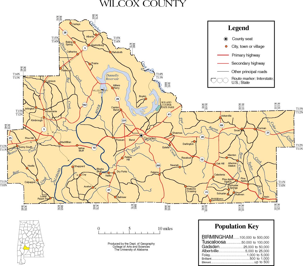
- Wilcox County map of roads/towns (map © 2007 Univ. of Alabama).
- Wilcox County Chamber of Commerce
| show Places adjacent to Wilcox County, Alabama |
|---|
| show Municipalities and communities of Wilcox County, Alabama, United States |
|---|

| show National Register of Historic Places in Wilcox County, Alabama |
|---|

Coordinates: 31°59′06″N 87°18′39″W / 31.98500°N 87.31083°W
| show Authority control |
|---|
- Alabama counties
- Wilcox County, Alabama
- 1819 establishments in Alabama
- Populated places established in 1819