Etowah County, Alabama
Etowah County | |
|---|---|
U.S. county | |
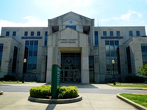 Etowah County courthouse in Gadsden | |
 Location within the U.S. state of Alabama | |
 Alabama's location within the U.S. | |
| Coordinates: 34°03′00″N 86°02′00″W / 34.05°N 86.033333333333°W | |
| Country | |
| State | |
| Founded | December 7, 1866 |
| Seat | Gadsden |
| Largest city | Gadsden |
| Area | |
| • Total | 549 sq mi (1,420 km2) |
| • Land | 535 sq mi (1,390 km2) |
| • Water | 14 sq mi (40 km2) 2.5% |
| Population (2020) | |
| • Total | 103,436 |
| • Density | 190/sq mi (73/km2) |
| Time zone | UTC−6 (Central) |
| • Summer (DST) | UTC−5 (CDT) |
| Congressional district | 4th |
| Website | www |
| |

Etowah County is a county located in the northeastern part of the U.S. state of Alabama. As of the 2020 census the population was 103,436.[1] Its county seat is Gadsden.[2] Its name is from a Cherokee word meaning "edible tree". In total area, it is the smallest county in Alabama, but one of the most densely populated. Etowah County comprises the Gadsden Metropolitan Statistical Area.
History[]
The area was split first among neighboring counties, with most of it belonging to DeKalb and Cherokee counties.[3] It was separated and established as Baine County on December 7, 1866, by the first postwar legislature, and was named for General David W. Baine of the Confederate Army.[4] The county seat was designated as Gadsden.
Because of postwar tensions and actions of insurgents against freedmen, at the state constitutional convention in 1868, the new county was abolished, replaced on December 1, 1868, by one aligned to the same boundaries and named Etowah County, from a Cherokee language word.[5] Most of the Cherokee had been removed in the 1830s to Indian Territory (now part of Oklahoma) west of the Mississippi River.
20th century to present[]
Etowah County had issues of racial discrimination and injustice, and Jim Crow. It had one documented lynching between 1877 and 1950,[6] which occurred in 1906.[7] Bunk Richardson, an innocent African-American, only because he was associated with a case in which a white woman was raped and killed. The whites were angry that the governor had commuted the death sentence of one defendant in the case (who was likely also innocent of charges), after two men had already been executed for the crime.[8]
An F4 tornado struck here on Palm Sunday March 27, 1994. It destroyed Piedmont's Goshen United Methodist Church twelve minutes after the National Weather Service of Birmingham issued a tornado warning for northern Calhoun, southeastern Etowah, and southern Cherokee counties.
Geography[]
According to the U.S. Census Bureau, the county has a total area of 549 square miles (1,420 km2), of which 535 square miles (1,390 km2) is land and 14 square miles (36 km2) (2.5%) is water.[9] It is the smallest county by area in Alabama.
Adjacent counties[]
- DeKalb County – north
- Cherokee County – east
- Calhoun County – southeast
- St. Clair County – southwest
- Blount County – west
- Marshall County – northwest
Transportation[]
Major highways[]
 Interstate 59
 Interstate 759
 U.S. Route 11
 U.S. Route 278
 U.S. Route 411
 U.S. Route 431
 State Route 77
 State Route 132
 State Route 179
 State Route 205
 State Route 211
 State Route 291
 State Route 759
Rail[]
- Alabama and Tennessee River Railway
- Norfolk Southern Railway
- Tennessee, Alabama and Georgia Railway (Defunct)
Demographics[]
| Historical population | |||
|---|---|---|---|
| Census | Pop. | %± | |
| 1870 | 10,109 | — | |
| 1880 | 15,398 | 52.3% | |
| 1890 | 21,926 | 42.4% | |
| 1900 | 27,361 | 24.8% | |
| 1910 | 39,109 | 42.9% | |
| 1920 | 47,275 | 20.9% | |
| 1930 | 63,399 | 34.1% | |
| 1940 | 72,580 | 14.5% | |
| 1950 | 93,892 | 29.4% | |
| 1960 | 96,980 | 3.3% | |
| 1970 | 94,144 | −2.9% | |
| 1980 | 103,057 | 9.5% | |
| 1990 | 99,840 | −3.1% | |
| 2000 | 103,459 | 3.6% | |
| 2010 | 104,430 | 0.9% | |
| 2020 | 103,436 | −1.0% | |
| U.S. Decennial Census[10] 1790–1960[11] 1900–1990[12] 1990–2000[13] 2010–2020[1] | |||
2000 census[]
At the 2000 census there were 103,459 people, 41,615 households, and 29,463 families living in the county. The population density was 193 people per square mile (75/km2). There were 45,959 housing units at an average density of 86 per square mile (33/km2). The racial makeup of the county was 82.9% White, 14.7% Black or African American, 0.3% Native American, 0.4% Asian, <0.1% Pacific Islander, 0.7% from other races, and 0.9% from two or more races. 1.7% of the population were Hispanic or Latino of any race.[14] Of the 41,615 households 29.9% had children under the age of 18 living with them, 54.2% were married couples living together, 13.1% had a female householder with no husband present, and 29.2% were non-families. 26.3% of households were one person and 12.4% were one person aged 65 or older. The average household size was 2.44 and the average family size was 2.93.
The age distribution was 23.8% under the age of 18, 8.7% from 18 to 24, 27.4% from 25 to 44, 24.1% from 45 to 64, and 16.0% 65 or older. The median age was 38 years. For every 100 females, there were 91.80 males. For every 100 females age 18 and over, there were 87.90 males.
The median household income was $31,170 and the median family income was $38,697. Males had a median income of $31,610 versus $21,346 for females. The per capita income for the county was $16,783. About 12.3% of families and 15.7% of the population were below the poverty line, including 21.6% of those under age 18 and 13.7% of those age 65 or over.
2010 census[]
At the 2010 census there were 104,430 people, 42,036 households, and 28,708 families living in the county. The population density was 195 people per square mile (75/km2). There were 47,454 housing units at an average density of 86 per square mile (33/km2). The racial makeup of the county was 80.3% White, 15.1% Black or African American, 0.4% Native American, 0.6% Asian, 0.2% Pacific Islander, 1.9% from other races, and 1.5% from two or more races. 3.3% of the population were Hispanic or Latino of any race.[15] Of the 42,036 households 27.1% had children under the age of 18 living with them, 49.3% were married couples living together, 14.3% had a female householder with no husband present, and 31.7% were non-families. 28.1% of households were one person and 11.9% were one person aged 65 or older. The average household size was 2.43 and the average family size was 2.97.
The age distribution was 23.0% under the age of 18, 8.5% from 18 to 24, 24.9% from 25 to 44, 27.8% from 45 to 64, and 15.8% 65 or older. The median age was 40.2 years. For every 100 females, there were 94.1 males. For every 100 females age 18 and over, there were 96.5 males.
The median household income was $36,422 and the median family income was $44,706. Males had a median income of $39,814 versus $30,220 for females. The per capita income for the county was $20,439. About 13.1% of families and 16.8% of the population were below the poverty line, including 24.6% of those under age 18 and 11.2% of those age 65 or over.
2020 census[]
| Race | Num. | Perc. |
|---|---|---|
| White (non-Hispanic) | 77,731 | 75.15% |
| Black or African American (non-Hispanic) | 14,999 | 14.5% |
| Native American | 332 | 0.32% |
| Asian | 921 | 0.89% |
| Pacific Islander | 39 | 0.04% |
| Other/Mixed | 4,519 | 4.37% |
| Hispanic or Latino | 4,895 | 4.73% |
As of the 2020 United States census, there were 103,436 people, 40,053 households, and 25,177 families residing in the county.
Government[]
Etowah County is reliably Republican at the presidential level. The last Democrat to win the county in a presidential election is Bill Clinton, who won it by a plurality in 1996.
| Year | GOP | Dem | Others |
|---|---|---|---|
| 2020 | 74.4% 35,528 | 24.2% 11,567 | 1.3% 633 |
| 2016 | 73.3% 32,353 | 23.6% 10,442 | 3.1% 1,369 |
| 2012 | 68.3% 29,130 | 30.0% 12,803 | 1.6% 691 |
| 2008 | 68.4% 30,595 | 30.2% 13,497 | 1.4% 645 |
| 2004 | 63.3% 26,999 | 35.9% 15,328 | 0.8% 353 |
| 2000 | 53.6% 21,087 | 44.3% 17,433 | 2.1% 828 |
| 1996 | 44.8% 16,835 | 47.9% 17,976 | 7.3% 2,750 |
| 1992 | 41.2% 17,467 | 48.4% 20,558 | 10.4% 4,426 |
| 1988 | 49.7% 17,828 | 49.5% 17,762 | 0.8% 301 |
| 1984 | 49.6% 19,243 | 49.2% 19,074 | 1.2% 464 |
| 1980 | 42.8% 16,177 | 55.0% 20,790 | 2.2% 839 |
| 1976 | 28.9% 10,333 | 70.0% 25,020 | 1.1% 397 |
| 1972 | 73.0% 20,851 | 25.8% 7,372 | 1.3% 358 |
| 1968 | 14.0% 4,351 | 14.8% 4,613 | 71.3% 22,222 |
| 1964 | 59.1% 12,894 | 40.9% 8,939 | |
| 1960 | 32.9% 7,128 | 66.3% 14,372 | 0.9% 185 |
| 1956 | 36.2% 7,198 | 62.2% 12,374 | 1.6% 314 |
| 1952 | 29.5% 4,634 | 70.1% 10,997 | 0.4% 66 |
| 1948 | 21.1% 1,615 | 78.9% 6,046 | |
| 1944 | 20.3% 1,525 | 78.4% 5,895 | 1.3% 101 |
| 1940 | 15.3% 1,270 | 84.3% 7,012 | 0.4% 33 |
| 1936 | 17.3% 1,207 | 82.2% 5,739 | 0.5% 32 |
| 1932 | 17.3% 1,093 | 81.7% 5,167 | 1.0% 62 |
| 1928 | 58.9% 3,612 | 40.5% 2,484 | 0.6% 38 |
| 1924 | 33.2% 1,664 | 61.4% 3,081 | 5.4% 272 |
| 1920 | 34.8% 3,218 | 64.1% 5,917 | 1.1% 103 |
| 1916 | 30.5% 862 | 66.7% 1,883 | 2.8% 80 |
| 1912 | 12.2% 354 | 52.2% 1,511 | 35.6% 1,031 |
| 1908 | 41.3% 996 | 54.3% 1,309 | 4.4% 106 |
| 1904 | 32.7% 823 | 56.9% 1,431 | 10.4% 262 |
| 1900 | 45.7% 1,629 | 48.7% 1,734 | 5.6% 201 |
| 1896 | 31.2% 873 | 63.6% 1,782 | 5.2% 145 |
| 1892 | 7.1% 269 | 58.9% 2,225 | 34.0% 1,287 |
| 1888 | 29.9% 841 | 68.1% 1,912 | 2.0% 55 |
Communities[]
Cities[]
- Attalla
- Boaz (partly in Marshall County)
- Gadsden (county seat)
- Glencoe (partly in Calhoun County)
- Hokes Bluff
- Rainbow City
- Southside (partly in Calhoun County)
Towns[]
- Altoona (partly in Blount County)
- Reece City
- Ridgeville
- Sardis City (partly in Marshall County)
- Walnut Grove
Census-designated places[]
Unincorporated communities[]
- Anderson
- Keener
- Liberty Hill
- Mountainboro
- Pilgrims Rest
Former city[]
See also[]
- National Register of Historic Places listings in Etowah County, Alabama
- Properties on the Alabama Register of Landmarks and Heritage in Etowah County, Alabama
References[]
- ^ a b "QuickFacts: Etowah County, Alabama; Population, Census, 2020 & 2010". United States Census Bureau. Retrieved August 19, 2021.
- ^ "Find a County". National Association of Counties. Archived from the original on May 31, 2011. Retrieved June 7, 2011.
- ^ "Alabama Census Year with Modern Map Overlayed," Maps of Alabama, Map of US.org, (https://www.mapofus.org/alabama/: accessed 15 Feb 2017), Wordpress.com, 2017.>Interactive> 1860 & 1870
- ^ Watson, Elbert L. (Summer 1968). "Lt. Colonel David W. Baine: A Confederate Hero from the North". Alabama Historical Quarterly. 30: 27–38. Retrieved May 22, 2017 – via Internet Archive.
- ^ "Alabama Counties: Etowah County". Alabama Department of Archives and History. Montgomery, AL: Alabama Department of Archives and History. October 25, 2011. Retrieved April 30, 2012.
- ^ "Lynching in America: Confronting the Legacy of Racial Terror – Supplement: Lynchings by County" (PDF) (second ed.). Equal Justice Initiative. 2015. Archived from the original (PDF) on April 10, 2016.
- ^ "Why the story of a 1906 Alabama lynching won't be forgotten". Anniston/Gadsden Real-Time News. December 11, 2016.
- ^ William Thornton, "Why the story of a 1906 Alabama lynching won't be forgotten", AL.com, December 11, 2016; accessed April 13, 2018
- ^ "2010 Census Gazetteer Files". United States Census Bureau. August 22, 2012. Retrieved August 22, 2015.
- ^ "U.S. Decennial Census". United States Census Bureau. Retrieved August 22, 2015.
- ^ "Historical Census Browser". University of Virginia Library. Retrieved August 22, 2015.
- ^ Forstall, Richard L., ed. (March 24, 1995). "Population of Counties by Decennial Census: 1900 to 1990". United States Census Bureau. Retrieved August 22, 2015.
- ^ "Census 2000 PHC-T-4. Ranking Tables for Counties: 1990 and 2000" (PDF). United States Census Bureau. April 2, 2001. Retrieved August 22, 2015.
- ^ "U.S. Census website". United States Census Bureau. Retrieved May 14, 2011.
- ^ "U.S. Census website". United States Census Bureau. Retrieved July 23, 2015.
- ^ "Explore Census Data". data.census.gov. Retrieved December 11, 2021.
- ^ "Dave Leip's Atlas of U.S. Presidential Elections". Retrieved November 16, 2016.
- ^ "Our Campaigns - U.S. President". Retrieved January 22, 2021.
External links[]
| Wikimedia Commons has media related to Etowah County, Alabama. |
Places adjacent to Etowah County, Alabama | ||||||||||||||||
|---|---|---|---|---|---|---|---|---|---|---|---|---|---|---|---|---|
| ||||||||||||||||
Municipalities and communities of Etowah County, Alabama, United States | ||
|---|---|---|
| Cities |  | |
| Towns | ||
| CDPs | ||
| Unincorporated communities |
| |
| Former City | ||
| Footnotes | ‡This populated place also has portions in an adjacent county or counties | |
| ||
Montgomery (capital) | ||
| Topics | ||
| Society |
| |
| Regions | ||
| Flora and fauna | ||
| Largest cities |
| |
| Metros |
| |
| Counties |
| |

Coordinates: 34°3′N 86°2′W / 34.050°N 86.033°W
Authority control | |
|---|---|
| General | |
| National libraries | |
- Alabama counties
- Etowah County, Alabama
- 1866 establishments in Alabama
- Counties of Appalachia
- Populated places established in 1866
- Micropolitan areas of Alabama