Healdton, Oklahoma
Healdton, Oklahoma | |
|---|---|
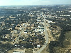 Aerial view of Healdton, Oklahoma | |
 Location of Healdton, Oklahoma | |
| Coordinates: 34°13′54″N 97°29′4″W / 34.23167°N 97.48444°WCoordinates: 34°13′54″N 97°29′4″W / 34.23167°N 97.48444°W | |
| Country | United States |
| State | Oklahoma |
| County | Carter |
| Area | |
| • Total | 14.40 sq mi (37.29 km2) |
| • Land | 14.13 sq mi (36.60 km2) |
| • Water | 0.27 sq mi (0.69 km2) |
| Elevation | 965 ft (294 m) |
| Population (2010) | |
| • Total | 2,788 |
| • Estimate (2019)[4] | 2,683 |
| • Density | 189.85/sq mi (73.30/km2) |
| Time zone | UTC-6 (Central (CST)) |
| • Summer (DST) | UTC-5 (CDT) |
| ZIP code | 73438 |
| Area code(s) | 580 |
| FIPS code | 40-33350[2] |
| GNIS feature ID | 1093636[3] |

Healdton is a city in Carter County, Oklahoma, United States. The population was 2,788 at the 2010 census.[5] It is part of the Ardmore, Oklahoma Micropolitan Statistical Area.
History[]
A post office was established at Healdton, Indian Territory on February 26, 1883. It was named for Charles H. Heald, a prominent resident.[6] At the time of its founding, Healdton was located in Pickens County, Chickasaw Nation.[7]
Geography[]
Healdton is located in western Carter County at 34°13′54″N 97°29′4″W / 34.23167°N 97.48444°W (34.231557, -97.484454).[8] Oklahoma State Highway 76 passes through the city, leading south 5 miles (8 km) to U.S. Route 70, west of Wilson and north 5 miles (8 km) to Oklahoma State Highway 53. Ardmore, the Carter County seat, is 23 miles (37 km) to the east via OK-76 and US-70.
According to the United States Census Bureau, Healdton has a total area of 14.4 square miles (37.3 km2), of which 14.1 square miles (36.6 km2) is land and 0.27 square miles (0.7 km2), or 1.86%, is water.[5]
Healdton Municipal Lake, just northeast of Healdton, boasts seven miles of shoreline and 370 surface acres.[9]
Geology[]
The Healdton Field, encompassing Healdton and located in the western portion of Carter County, produces from the Pennsylvanian Healdton sands of the Hoxbar Group and the Ordovician massive carbonate Arbuckle Group. The field is located on the "Healdton uplift", a northwest-southeast trending anticline, which formed with the Wichita Orogeny, and is eight miles long and up to three miles wide. This was followed by deposition of the Healdton sandstones and shales on pre-Pennsylvanian eroded rocks and subsequent folding during the Arbuckle Orogeny. A prospector named Palmer drilled a shallow well, 425 feet, near an oil seep in the 1890s but Federal Law prohibited oil development on "Indian lands" until the early 1900s. Therefore, the discovery of the field is credited to the drilling of No. 1 Wirt Franklin in 1913.
Climate[]
| hideClimate data for Healdton, Oklahoma | |||||||||||||
|---|---|---|---|---|---|---|---|---|---|---|---|---|---|
| Month | Jan | Feb | Mar | Apr | May | Jun | Jul | Aug | Sep | Oct | Nov | Dec | Year |
| Average high °F (°C) | 52.5 (11.4) |
58.1 (14.5) |
67.7 (19.8) |
76.5 (24.7) |
82.9 (28.3) |
90.2 (32.3) |
96.3 (35.7) |
96.2 (35.7) |
87.5 (30.8) |
77.8 (25.4) |
65.1 (18.4) |
55.1 (12.8) |
75.5 (24.2) |
| Average low °F (°C) | 26.2 (−3.2) |
30.7 (−0.7) |
40.0 (4.4) |
49.7 (9.8) |
57.8 (14.3) |
65.7 (18.7) |
69.5 (20.8) |
68.2 (20.1) |
61.8 (16.6) |
50.2 (10.1) |
39.5 (4.2) |
29.4 (−1.4) |
49.1 (9.5) |
| Average precipitation inches (mm) | 1.4 (36) |
1.8 (46) |
2.9 (74) |
3.4 (86) |
5.1 (130) |
4.2 (110) |
2.0 (51) |
2.4 (61) |
4.5 (110) |
3.6 (91) |
2.3 (58) |
1.7 (43) |
35.3 (900) |
| Source 1: weather.com | |||||||||||||
| Source 2: Weatherbase[10] | |||||||||||||
Demographics[]
| Historical population | |||
|---|---|---|---|
| Census | Pop. | %± | |
| 1920 | 2,157 | — | |
| 1930 | 2,017 | −6.5% | |
| 1940 | 2,067 | 2.5% | |
| 1950 | 2,578 | 24.7% | |
| 1960 | 2,898 | 12.4% | |
| 1970 | 2,324 | −19.8% | |
| 1980 | 3,769 | 62.2% | |
| 1990 | 2,872 | −23.8% | |
| 2000 | 2,786 | −3.0% | |
| 2010 | 2,788 | 0.1% | |
| 2019 (est.) | 2,683 | [4] | −3.8% |
| U.S. Decennial Census[11] | |||
As of the census[2] of 2000, there were 2,786 people, 1,132 households, and 776 families residing in the city. The population density was 197.4 people per square mile (76.2/km2). There were 1,369 housing units at an average density of 97.0 per square mile (37.5/km2). The racial makeup of the city was 87.08% White, 0.93% African American, 7.47% Native American, 0.11% Asian, 0.04% Pacific Islander, 0.86% from other races, and 3.52% from two or more races. Hispanic or Latino of any race were 1.54% of the population.
There were 1,132 households, out of which 29.9% had children under the age of 18 living with them, 54.7% were married couples living together, 10.8% had a female householder with no husband present, and 31.4% were non-families. 28.4% of all households were made up of individuals, and 15.1% had someone living alone who was 65 years of age or older. The average household size was 2.39 and the average family size was 2.92.
In the city, the population was spread out, with 24.0% under the age of 18, 9.0% from 18 to 24, 25.9% from 25 to 44, 22.8% from 45 to 64, and 18.4% who were 65 years of age or older. The median age was 40 years. For every 100 females, there were 90.8 males. For every 100 females age 18 and over, there were 88.7 males.
The median income for a household in the city was $23,550, and the median income for a family was $29,363. Males had a median income of $25,636 versus $20,865 for females. The per capita income for the city was $12,842. About 16.8% of families and 21.5% of the population were below the poverty line, including 28.1% of those under age 18 and 13.2% of those age 65 or over.
Notable people[]
- Emmy Award-winning actress Rue McClanahan was born in Healdton.
- University of Oklahoma women's head basketball coach Sherri Coale is from Healdton.
Museums & Historic Buildings[]
The Healdton Oil Museum at 10734 Hwy 76 gives a glimpse into the oil boom days of Carter County.[12]
The Healdton Armory at the junction of 4th and Franklin Sts. is NRHP-listed.
Medical Services[]
Healdton is a regional medical provider, with Mercy Hospital Healdton dispensing critical-access hospital care in rural Carter, Jefferson and Stephens counties in southern Oklahoma.[13]
Popular culture[]
The music video for Radar Bros. "Brother Rabbit" was partially shot in Healdton and directed by The General Assembly.
References[]
- ^ "2019 U.S. Gazetteer Files". United States Census Bureau. Retrieved July 28, 2020.
- ^ Jump up to: a b "U.S. Census website". United States Census Bureau. Retrieved 2008-01-31.
- ^ "US Board on Geographic Names". United States Geological Survey. 2007-10-25. Retrieved 2008-01-31.
- ^ Jump up to: a b "Population and Housing Unit Estimates". United States Census Bureau. May 24, 2020. Retrieved May 27, 2020.
- ^ Jump up to: a b "Geographic Identifiers: 2010 Demographic Profile Data (G001): Healdton city, Oklahoma". U.S. Census Bureau, American Factfinder. Archived from the original on February 10, 2015. Retrieved February 6, 2015.
- ^ George H. Shirk. Oklahoma Place Names (Norman: University of Oklahoma Press, 1965), p. 100.
- ^ Charles Goins, Historical Atlas of Oklahoma (Norman: University of Oklahoma Press, 2006), plate 105.
- ^ "US Gazetteer files: 2010, 2000, and 1990". United States Census Bureau. 2011-02-12. Retrieved 2011-04-23.
- ^ "Healdton Municipal Lake". ChickasawCountry.com. Retrieved February 14, 2020.
- ^ "Weatherbase: Historical Weather for Healdton, Oklahoma, United States".
- ^ "Census of Population and Housing". Census.gov. Retrieved June 4, 2015.
- ^ "Healdton Oil Museum". ChickasawCountry.com. Retrieved February 14, 2020.
- ^ "Mercy Hospital Healdton". Mercy.net. Retrieved February 14, 2020.
External links[]
| show Municipalities and communities of Carter County, Oklahoma, United States |
|---|

| show Authority control |
|---|
- Cities in Carter County, Oklahoma
- Cities in Oklahoma
- Ardmore, Oklahoma micropolitan area