Henderson, Tennessee
Henderson, Tennessee | |
|---|---|
 Shops in Henderson | |
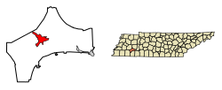 Location of Henderson in Chester County, Tennessee. | |
| Coordinates: 35°26′35″N 88°38′40″W / 35.44306°N 88.64444°WCoordinates: 35°26′35″N 88°38′40″W / 35.44306°N 88.64444°W | |
| Country | United States |
| State | Tennessee |
| County | Chester |
| Government | |
| • Mayor | Bobby King |
| Area | |
| • Total | 7.83 sq mi (20.29 km2) |
| • Land | 7.80 sq mi (20.22 km2) |
| • Water | 0.03 sq mi (0.07 km2) |
| Elevation | 446 ft (136 m) |
| Population (2010) | |
| • Total | 6,309 |
| • Estimate (2019)[4] | 6,357 |
| • Density | 814.48/sq mi (314.46/km2) |
| Time zone | UTC-6 (Central (CST)) |
| • Summer (DST) | UTC-5 (CDT) |
| ZIP code | 38340 |
| Area code(s) | 731 |
| FIPS code | 47-33260[2] |
| GNIS feature ID | 1287374[3] |
| Website | hendersontn |

Henderson is a city in Chester County, Tennessee, United States. The population was 6,309 at the 2010 census,[5] up from 5,670 at the 2000 census. It is the county seat of Chester County.[6]
History[]
Henderson was platted in 1857, when the railroad was extended to that point.[7] The city takes its name from Henderson County, Tennessee.[7] Henderson was called Dayton during the Civil War, then was known as Henderson Station and, finally, Henderson.[8]
Geography[]
Henderson is located near the center of Chester County at 35°26′35″N 88°38′40″W / 35.44306°N 88.64444°W (35.443025, -88.644345),[9] to the west of the South Fork Forked Deer River. U.S. Route 45 passes through the city, leading northwest 17 miles (27 km) to Jackson and south 20 miles (32 km) to Selmer. Tennessee State Route 100 passes south of the city center, leading east 32 miles (51 km) to Decaturville and west 30 miles (48 km) to Whiteville.
According to the United States Census Bureau, the city has a total area of 7.9 square miles (20.4 km2), of which 0.03 square miles (0.07 km2), or 0.35%, is water.[5]
Arts, Culture & Outdoors[]
For several years, the Henderson Arts Commission has sponsored many arts-related events & programs, like the Summer Camp Theatre Experience.[10]
The city park is called Gene Record Park. It features playground equipment, a walking trail, soccer fields, a permanent space for the local Farmer's Market, picnic tables, a dog park, and a 9-hole disc golf course.[11] In January 2020, the city paper (Chester County Independent) reported that a Splash Pad would soon be installed at the park.[12]
Newspaper[]
The local paper, Chester County Independent, is based in Henderson.
Demographics[]
| Historical population | |||
|---|---|---|---|
| Census | Pop. | %± | |
| 1880 | 493 | — | |
| 1890 | 1,069 | 116.8% | |
| 1910 | 1,087 | — | |
| 1920 | 1,181 | 8.6% | |
| 1930 | 1,503 | 27.3% | |
| 1940 | 1,771 | 17.8% | |
| 1950 | 2,532 | 43.0% | |
| 1960 | 2,691 | 6.3% | |
| 1970 | 3,581 | 33.1% | |
| 1980 | 4,449 | 24.2% | |
| 1990 | 4,760 | 7.0% | |
| 2000 | 5,670 | 19.1% | |
| 2010 | 6,309 | 11.3% | |
| 2019 (est.) | 6,357 | [4] | 0.8% |
| Sources:[13][14] | |||
As of the census[2] of 2000, there were 5,670 people, 1,896 households, and 1,270 families residing in the city. The population density was 991.6 people per square mile (382.7/km2). There were 2,072 housing units at an average density of 362.4 per square mile (139.9/km2). The racial makeup of the city was 80.09% White, 17.87% African American, 0.09% Native American, 0.41% Asian, 0.37% from other races, and 1.18% from two or more races. Hispanic or Latino of any race were 1.52% of the population.
There were 1,896 households, out of which 31.8% had children under the age of 18 living with them, 47.0% were married couples living together, 16.6% had a female householder with no husband present, and 33.0% were non-families. 28.7% of all households were made up of individuals, and 14.3% had someone living alone who was 65 years of age or older. The average household size was 2.41 and the average family size was 2.96.
In the city, the population was spread out, with 21.5% under the age of 18, 25.2% from 18 to 24, 22.5% from 25 to 44, 16.0% from 45 to 64, and 14.8% who were 65 years of age or older. The median age was 27 years. For every 100 females, there were 85.4 males. For every 100 females age 18 and over, there were 80.0 males.
The median income for a household in the city was $32,648, and the median income for a family was $40,907. Males had a median income of $32,215 versus $22,258 for females. The per capita income for the city was $16,735. About 15.4% of families and 19.0% of the population were below the poverty line, including 27.6% of those under age 18 and 20.1% of those age 65 or over.
Education[]

Henderson is part of the Chester County School District and home to Chester County High School. It is also the home of Freed–Hardeman University.
Notable people[]
- Eddy Arnold, country musician, born in Henderson in 1918
- Jack Dalton, Major League Baseball player, born in Henderson in 1885
- Dorsey B. Hardeman, Texas politician, born in Henderson in 1902
- Robby Novak, actor who plays Kid President, born in Henderson in 2004 and went to east side in Henderson.
- Walton Bryan Stewart, Wisconsin politician, born in Henderson in 1914
- Sue Shelton White, national feminist leader and suffragist lawyer, born in Henderson in 1887
References[]
- ^ "2019 U.S. Gazetteer Files". United States Census Bureau. Retrieved July 30, 2020.
- ^ Jump up to: a b "U.S. Census website". United States Census Bureau. Retrieved 2008-01-31.
- ^ "US Board on Geographic Names". United States Geological Survey. 2007-10-25. Retrieved 2008-01-31.
- ^ Jump up to: a b "Population and Housing Unit Estimates". United States Census Bureau. May 24, 2020. Retrieved May 27, 2020.
- ^ Jump up to: a b "Geographic Identifiers: 2010 Census Summary File 1 (G001): Henderson city, Tennessee". U.S. Census Bureau, American Factfinder. Archived from the original on February 13, 2020. Retrieved July 6, 2015.
- ^ "Find a County". National Association of Counties. Archived from the original on 2011-05-31. Retrieved 2011-06-07.
- ^ Jump up to: a b History of Tennessee from the Earliest Time to the Present. Southern Historical Press. 1886. p. 809. ISBN 9780893080976.
- ^ Chester County Tennessee. Turner Publishing Company. 1995. p. 12. ISBN 1-56311-193-0.CS1 maint: ignored ISBN errors (link)
- ^ "US Gazetteer files: 2010, 2000, and 1990". United States Census Bureau. 2011-02-12. Retrieved 2011-04-23.
- ^ Henderson Arts Commission https://hendersonartscommission.org/. Retrieved 20 May 2020. Missing or empty
|title=(help) - ^ Friends of Gene Record Park https://www.facebook.com/GeneRecordPark/?rf=187071537980658. Retrieved 20 May 2020. Missing or empty
|title=(help) - ^ "Coming Soon Splash Pad is Coming to Gene Record Memorial Park". Chester County Independent. Missing or empty
|url=(help) - ^ "Census of Population and Housing: Decennial Censuses". United States Census Bureau. Retrieved 2012-03-04.
- ^ "Annual Estimates of the Resident Population: April 1, 2010 to July 1, 2014 (PEPANNRES): Incorporated Places in Tennessee". Population Estimates. U.S. Census Bureau. Archived from the original on 13 February 2020. Retrieved 11 December 2013.
External links[]
| Wikimedia Commons has media related to Henderson, Tennessee. |
- City of Henderson official website
- Henderson/Chester County Chamber of Commerce
- A Brief History of Chester County
| show Municipalities and communities of Chester County, Tennessee, United States |
|---|
| show Authority control |
|---|
- Cities in Tennessee
- Cities in Chester County, Tennessee
- County seats in Tennessee
- Jackson metropolitan area, Tennessee