History of Milton Keynes

This history of Milton Keynes details its development from the earliest human settlements, through the plans for a 'new city' for 250,000 people in northern Southeast England, its subsequent urban design and development, to the present day. Milton Keynes is the largest settlement in Buckinghamshire,[a] founded in 1967. At the 2011 census, the population of its urban area was estimated to have reached almost 230,000.[2]
Overview[]
In the 1960s, the UK Government decided that a further generation of new towns in the South East of England was needed to relieve housing congestion in London.[3]
Since the 1950s, overspill housing for several London boroughs had been constructed in Bletchley.[4][5][6] Further studies[7] in the 1960s identified north Buckinghamshire as a possible site for a large new town, a new city,[8][b] encompassing the existing towns of Bletchley, Fenny Stratford, Stony Stratford, and Wolverton.[9] (The nearby towns of Newport Pagnell and Woburn Sands, then clearly separate, were outside the designated area but, by 2001 and 2011 respectively, both had become part of the Milton Keynes urban area.[10][2]) The New Town (informally and in planning documents referred to as 'New City') was to be the biggest yet, with a target population of 250,000,[11][12] in a 'designated area' of 21,883 acres (8,855.7 ha).[13] The name 'Milton Keynes' was taken from that of an existing village on the site.[14][15] The area to be developed was largely farmland and undeveloped villages. Before construction began, every area was subject to detailed archaeological investigation: doing so has exposed a rich history of human settlement since Neolithic times and has provided a unique insight into the history and archaeology of a large sample of the landscape of north Buckinghamshire.[16]
From its establishment in 1967 to its abolition in 1992, the Milton Keynes Development Corporation created by far the largest and thus most ambitious of the British new towns. Many of Britain's most acclaimed building and landscape architects contributed to what was to be a showpiece of British design. Unlike previous new towns, Milton Keynes has a majority of privately funded development but, during the MKDC years, these developments were subject to an exacting design brief in line with the design principles laid out in The Plan for Milton Keynes (Llewellyn-Davies et al. 1970).[17]
Pre-history and early human settlement[]
Long before England existed, this area was at the bottom of a primeval sea. The most notable of the fossils uncovered is that of an ichthyosaur from Caldecotte,[18] now on display in the central library.[19]
Human settlement began in this area around 2000 BCE, mainly in the valleys of the rivers Ouse and Ouzel, and their tributaries (Bradwell Brook, Shenley Brook). Archaeological excavations revealed several burial sites dating from 2000 BCE to 1500 BCE. Evidence for the earliest habitation was found at Blue Bridge – production of flint tools from the Middle Stone Age.[20] In the same area, an unusually large (18-metre or 59-foot diameter) round house was excavated and dated to the Late Bronze Age/Early Iron Age, about 700 BCE.[21] Other excavations in this Blue Bridge/Bancroft hill-side uncovered a further seven substantial settlement sites, dating from then until 100 BCE.[22]
Milton Keynes Hoard[]
The area that was to become Milton Keynes was relatively rich: the Milton Keynes Hoard is one of the largest (by weight, 2.2 kg or 4.9 lb) hoard of Bronze Age jewellery ever found in Britain: the British Museum described it as 'one of the biggest concentrations of Bronze Age gold known from Britain and seems to flaunt wealth'.[1] It was discovered in September 2000 at Monkston (near Milton Keynes village) and consists of two Bronze Age gold torcs and three gold bracelets in a datable clay pot.[23][1][c]
Roman Britain[]
Before the Roman conquest of Britain of 43 CE, the Catuvellauni (a British Iron Age tribe) controlled this area from their hill fort at Danesborough, near Woburn Sands (map). Under Roman occupation, the area thrived. The obvious reason for this is the major Roman road, Iter II (later known as Watling Street), that runs through the area and that gave rise to an associated Roman town at Magiovinium (Fenny Stratford). A 'superb example' of the first type of coin to circulate in Britain was found here, a gold stater from mid-second century BCE.[24]
The foundations of a large Romano-British villa were excavated at Bancroft Park, complete with under-floor heating and mosaic floor.[25] Further excavations revealed that this area, overlooking the fertile valley of the Bradwell Brook, was in continuous occupation for 2,000 years, from the Late Bronze Age to the early Saxon period.[25] Cremation grave goods from the Iron Age found on the site included jewellery and fine pottery. Other Romano-British settlements were found at Stanton Low,[26] Woughton, and Wymbush.[27] Industrial activity of the period included bronze working and pottery making at Caldecotte, pottery also at Wavendon Gate, and many iron-working sites.
Anglo-Saxon period[]
It seems that most of the Romano-British sites were abandoned by the Romano-British by the fifth century and the arable land reverted to scrub and woodland. Arriving in the sixth century, the Anglo-Saxons began to clear the land again. Bletchley ('Blaeca's clearing') and the Shenleys ('Bright clearing') date from this period.[28][29] Large settlements have been excavated at Pennyland and near Milton Keynes village. Their cemeteries have been found at Newport Pagnell, Shenley, and Tattenhoe.[30]
Norman conquest and the medieval period[]
Excavations in and around the modern villages have failed to find any evidence of occupation before the 10th or 11th centuries, except in Bradwell where Bradwell Bury is traced to the 9th century.[31] The Domesday Book of 1086 provides the first documentary evidence for many settlements, listing Bertone (Broughton), Calvretone (Calverton), Linforde (Great Linford), Lochintone (Loughton), Neuport (Newport Pagnell), Nevtone (Newton Longville), Senelai (Shenley), Siwinestone (Simpson), Ulchetone (Woughton), Waletone (Walton), Wluerintone (Wolverton) and Wlsiestone (Woolstone).
Administration of the area that was later to become the Borough of Milton Keynes was in 'Hundreds' – initially (11C) Sigelai (also Secklow or Seckloe) Hundred, Bunstou (or Bunsty) Hundred and Moulsoe Hundred, amalgamated as the 'three hundreds of Newport' in the middle of the 13th Century.[32] Bletchley, Bradwell, Calverton, Fenny Stratford, Great Linford, Loughton, Newport Pagnell, Newton Longville, Shenley (part of), Simpson, Stantonbury, Stoke Hammond, Stony Stratford, Water Eaton, Willen, Great and Little Woolstone, Wolverton, and Woughton on the Green were in Sigelai Hundred; Cold Brayfield, Castlethorpe, Gayhurst, Hanslope, Haversham, Lathbury, Lavendon, Little Linford, Olney, Ravenstone, Stoke Goldington, Tyringham with Filgrave, and Weston Underwood were in (Bunstou Hundred; and Bow Brickhill, Great Brickhill, Little Brickhill, Broughton, Chicheley, Clifton Reynes, North Crawley, Emberton, Hardmead, Lathbury, Lavendon, Milton Keynes (village), Moulsoe, Newton Blossomville, Olney with Warrington, Ravenstone, Sherington, Stoke Goldington, Tyringham with Filgrave, Walton, Wavendon, Weston Underwood, and Willen were in Moulsoe Hundred.[32] The modern Borough of Milton Keynes covers almost exactly the same area as Newport Hundred,[32] (plus a little of the former Winslow Hundred which was one of 18 ancient hundreds amalgamated under the administrative control of Cottesloe Hundred).
Secklow Mound, the moot mound of Sigelai Hundred, has been found, excavated and reconstructed:[33] it is on the highest land in the central area and is just behind the Central Library in modern Central Milton Keynes.[34] Only one medieval manor house survives: the 15th century Manor Farmhouse in Loughton.[35] There are sites of other manor houses in Little Woolstone,[36] Milton Keynes village,[37] and Woughton on the Green.[38] The oldest surviving domestic building is Number 22, Milton Keynes (village), the house of the bailiff of the manor of Bradwell.[30][37]
Newport Pagnell, established early in the 10th century, was the principal market town for the area.[39] Stony Stratford and Fenny Stratford were founded as market towns on Watling Street in the late 12th or early 13th centuries.[40][41]
By the early 13th century, North Buckinghamshire had several religious houses: Bradwell Abbey (1154[42]) is within modern Milton Keynes and Snelshall Priory (1218[43]) is just outside it. Both were Benedictine priories. Many of the medieval trackways to these sites still survive and have become cycleways and footpaths of the Redway network.

Britain's earliest (excavated) windmill is in Great Linford.[30] The large oak beams forming the base supports still survived in the mill mound and were shown by radio carbon dating to originate in the first half of the 13th century. (The present stone tower mill near Bradwell was built in 1815,[27] on a site convenient to the new Grand Junction Canal).
Early modern Britain[]
Enclosures[]
Most of the eighteen medieval villages in Milton Keynes are still extant and are at the heart of their respective districts. But some, such as Old Wolverton, remain only as field patterns marking a deserted village.[44] The desertion of Old Wolverton was due to enclosure of the large strip cultivation fields into small 'closes' by the local landlords, the Longville family, who turned arable land over to pasture.[45] By 1654, the family had completely enclosed the parish. With the end of the feudal system, the peasants had lost their land and tillage/grazing rights and were forced to find other work or starve. Thus Old Wolverton was reduced from about thirty peasant families in the mid 16th century to almost none, within the space of a century.[46][47] There are also deserted village sites in Tattenhoe and Westbury (Shenley Wood).[48][49]
Turnpike roads[]
Some important roads cross the site of the new city. Most important of these is Watling Street from London to Chester. The Oxford to Cambridge route came through Stony Stratford, Wolverton and Newport Pagnell. Unfortunately, the heavy clay soils, poor drainage and slow-running streams made these routes frequently impassable in winter. The Hockliffe to Dunchurch stretch of Watling Street became a (paved) Turnpike in 1706[27] (the first turnpike to be approved by parliament). Until about 1830, the London– Northampton road through Simpson "was generally impassible ['throughout a great portion of the winter'] without wading through water three feet deep (0.9m), for a distance of about 200 yards (180m)".[50] In 1870, the new Northampton/London turnpike diverted away at Broughton to take the higher route through Wavendon and Woburn Sands to join Watling Street near Hockliffe.[27] On the east/west route, the Stony Stratford to Newport Pagnell turnpike of 1814[27] extended the Woodstock, Oxfordshire/Bicester/Stony Stratford turnpike of 1768.[27] Turnpikes provided a major boost to the economy of Fenny Stratford and particularly Stony Stratford. In the stage coach era, Stony Stratford was a major resting place and exchange point with the east/west route. In the early 19th century, over 30 coaches a day stopped here.[51] That traffic came to an abrupt end in 1838 when the London–Birmingham Railway (now the West Coast Main Line) opened at nearby Wolverton.
Grand Junction Canal[]
The Grand Junction Canal came through the area between 1793 and 1800, with canal-side wharfs in Fenny Stratford, Great Linford, Bradwell and Wolverton.[45] The route bypassed Newport Pagnell but, in 1817, an arm was dug to it from Great Linford.[52] Trade along the canal stimulated the local economy. A large brickworks was established near the canal in Great Linford: two bottle kilns and the clay pits can still be seen on the site.[27] Pottery from the Midlands begins to appear in excavations of dwellings from that period.
London and Birmingham Railway, Wolverton and New Bradwell new towns[]
The London and Birmingham Railway brought even more profound changes to the area. The coach trade on the turnpike through Stony Stratford collapsed, taking many businesses with it. Fortunately, Wolverton was the halfway point on the rail route, where engines were changed and passengers alighted for refreshments. Wolverton railway works was established here,[53] creating work for thousands of people in the surrounding area. In the period 1840 to 1880, new towns were built in New Bradwell and Wolverton (about 2 km or 1.2 mi east of the original deserted village) to house them.[45] A narrow gauge railway, the Wolverton to Newport Pagnell Line, was built to Newport Pagnell in 1866,[27] much of it by closing and reusing the Newport Arm of the canal. The Wolverton and Stony Stratford Tramway ran to Stony Stratford from 1888 (to 1926) and,[54][47] in 1889, was extended to Deanshanger in Northamptonshire.[54]
Bletchley, on the 1846 junction of the London and Birmingham railway with the Bedford branch, was to become an important railway town too.[55] In 1850, another branch from Bletchley to Oxford was built, later to become the (Cambridge/Oxford) Varsity Line. Bletchley, originally a small village in the parish of Fenny Stratford, grew to reach and absorb its parent.[56] In Stony Stratford, expertise learned in the works was applied to the construction of traction engines for agricultural use and the site of the present Cofferidge Close was engaged in their manufacture.[57]
Bletchley Park[]

Bletchley Park is a former private estate located in Old Bletchley, an important Military Intelligence site during World War II and today home to the modern Museums of Cryptography and of Computing. Conveniently located at the junction of the Varsity Line with the West Coast Main Line, Bletchley Park (code-named Station X) was the location of the Allied main code-breaking establishment during World War II. Codes and ciphers of several Axis powers were deciphered there, most famously the German Enigma. Colossus, the world's first[58] programmable electronic digital computer was put to work here as part of the codebreaking effort. The high-level intelligence produced by Bletchley Park, codenamed Ultra, is frequently credited with aiding the Allied war effort and shortening the war.[59]
"Bigger, Better, Brighter" – Bletchley in the 20th century[]
Almost forty years after the construction of Bletchley railway station, the 1884/5 Ordnance Survey shows Bletchley as still just a small village around the (C of E) parish church at Bletchley Park, and a hamlet near the Methodist chapel and Shoulder of Mutton public house at the junction of Shenley Road/Newton Road with Buckingham Road.[60] (These districts are known today as Old Bletchley and Far Bletchley). The major settlement of the time is Fenny Stratford.
By 1911, the population of the combined parishes was 5,166 but the balance between them had changed: in that year, the name of the local council (Urban District) changed from Fenny Stratford UD to Bletchley UD.[61] The 1926 Ordnance Survey shows the settlements beginning to merge, with large private houses along the Bletchley Road between them.[62] In 1933, the newly founded Bletchley Gazette began a campaign for a "Bigger, Better, Brighter, Bletchley".[63] As the nation emerged from World War II, Bletchley Council renewed its desire to expand from its 1951 population of 10,919. By mid-1952, the Council was able to agree terms with five London Boroughs to accept people and businesses from bombed-out sites in London.[64] This trend continued through the 1950s and 1960s, culminating[d] in the GLC-funded Lakes Estate in Water Eaton parish, even as Milton Keynes was being founded. Industrial development kept pace, with former London businesses relocating to new industrial estates in Mount Farm and Denbigh – Marshall Amplification being the most notable. With compulsory purchase, Bletchley Road (now renamed Queensway after a royal visit in 1966) became the new high street with wide pavements where front gardens once lay. Houses near the railway end were replaced by shops but those nearer Fenny Stratford became banks and professional premises. At the 1971 Census, the population of the Bletchley Urban District was 30,642.[65]
Bletchley had fought to be the centre of the proposed new city, but it was not to be. The 1970 Plan for Milton Keynes placed Central Milton Keynes on a completely new hill-top site four miles further north, half way to Wolverton.[66] Bletchley was relegated to the status of suburb.
1960s plans for a new city in North Buckinghamshire, 1967 designation of Milton Keynes[]

In the 1960s, the Government decided that a further generation of new towns in South East England was needed to take the projected population increase of London, after the initial 1940s/1950s wave.[3] In the 1950s, the London County Council had constructed overspill housing in Bletchley for several London boroughs there.[67][68][6]
Buckinghamshire County Council's architect, Fred Pooley, had spent considerable time in the early sixties developing ideas for a new town in the Bletchley and Wolverton area. He developed a futuristic proposal based on a monorail linking a series of individual townships to a major town centre. The county council published the proposals in 1966,[69] but it was too late to influence the government.
In 1964, a Ministry of Housing and Local Government study recommended "a new city" near Bletchley.[3] A further MoH&LG study in 1965 proposed that the proposed new city would encompass the existing towns of Bletchley, Stony Stratford and Wolverton.[70][6] It was to be the biggest new town yet, with a target population of 250,000.[71][12] A Draft Order was made in April 1966. The Housing Minister, Anthony Greenwood, made his formal announcement on 23 January 1967.[13][72] The designated area was 21,870 acres (8,850 ha),[13] somewhat smaller than the 27,000 acres (11,000 ha) in the Draft Order (due to the exclusion of the Calverton Wealds). The name "Milton Keynes" was also unveiled at this time, taken from the existing village of Milton Keynes on the site.[15] The site was deliberately located (roughly) equidistant from London, Birmingham, Leicester, Oxford and Cambridge.[73] With its large target population, Milton Keynes was eventually intended to become a city.[8] All subsequent planning documents and popular local usage make use of the term "city" or "new city", even though formal city status has not been awarded.
When the boundary of Milton Keynes was defined, some 40,000 people lived in the 'designated area' of almost 9,000 hectares (22,000 acres).[74] The area was split between five existing local authorities: Bletchley, Newport Pagnell and Wolverton Urban Districts together with the Newport Pagnell Rural District and the Winslow Rural District.
Existing settlements and oral history[]
The designated area outside the four main towns (Bletchley, Newport Pagnell, Stony Stratford, Wolverton) was largely rural farmland but included many picturesque North Buckinghamshire villages and hamlets: Bradwell village and Abbey, Broughton, Caldecotte, Fenny Stratford, Great Linford, Loughton, Milton Keynes Village, New Bradwell, Shenley Brook End, Shenley Church End, Simpson, Stantonbury, Tattenhoe, Tongwell, Walton, Water Eaton, Wavendon, Willen, Great and Little Woolstone, Woughton on the Green. All of these had a rich oral history, which has been recorded.[75]
Milton Keynes Development Corporation: designing a city for 250,000 people[]
Following publication of the Draft Master Plan for Milton Keynes,[73] the government took planning control from elected local authorities and established the Milton Keynes Development Corporation (MKDC) to deliver its vision. The Minister for Housing and Local Government (Richard Crossman) appointed Lord Campbell ("Jock" Campbell) to lead the new Development Corporation. He and his chief executive, Walter Ismay, appointed Llewellyn Davies as principal planning consultants – the team included Richard Llewellyn-Davies, Walter Bor and John de Monchaux. Execution of the plan was led by General Manager of the Corporation, Fred Lloyd Roche. The goals declared in the master plan were these:[76]
- opportunity and freedom of choice
- easy movement and access
- good communications
- balance and variety
- an attractive city
- public awareness and participation
- efficient and imaginative use of resources
The Corporation was determined to learn from the mistakes made in the earlier new towns and revisit the Garden City ideals.[73] They set in place the characteristic grid roads that run between districts, the Redway system of independent cycle/pedestrian paths, and the intensive planting, lakes and parkland that are so appreciated today.[73] Central Milton Keynes was not intended to be a traditional town centre but a business and shopping district that supplemented the Local Centres in most of the Grid Squares.[76] This non-hierarchical devolved city plan was a departure from the English New Towns tradition and envisaged a wide range of industry and diversity of housing styles and tenures across the city. The radical grid plan was inspired by the work of Californian urban theorist Melvin M Webber (1921–2006), described by the founding architect of Milton Keynes, Derek Walker, as the city's "father".[77] Webber thought that telecommunications meant that the old idea of a city as a concentric cluster was out of date and that cities that enabled people to travel around them readily would be the thing of the future, achieving "community without propinquity" for residents.[78]
- Urban design
Since the radical plan form and large scale of the New City attracted international attention, early phases of the city include work by celebrated architects, Sir Richard MacCormac,[79] Lord Norman Foster,[80] Henning Larsen,[81] Ralph Erskine,[82] John Winter,[83] and Martin Richardson.[84] The Corporation itself attracted talented young architects led by the respected designer,[85][86] Derek Walker. Its strongly modernist designs featured regularly in the magazines Architectural Design and the Architects' Journal.[87] Though strongly committed to sleek 'Miesian minimalism' inspired by the German/ American architect Ludwig Mies van der Rohe, they also developed a strand of contextualism in advance of the wider adoption of commercial Post-Modernism as an architectural style in the 1980s. In the Miesian tradition is the CMK Shopping Building designed by Stuart Mosscrop and Christopher Woodward. The contextual tradition that ran alongside it is exemplified by the Corporation's infill scheme at Cofferidge Close, Stony Stratford, designed by Wayland Tunley, which inserts into a historic stretch of High Street a modern retail facility, offices and car park.
- "City in the forest"
| Wikimedia Commons has media related to Milton Keynes. |
The original Development Corporation design concept aimed for a 'forest city' and its foresters planted millions of trees from its own nursery in Newlands in the following years.[73] As of 2006, the urban area had 20 million trees. Following the winding up of the Development Corporation, the lavish landscapes of the Grid Roads and of the major parks were transferred to the Milton Keynes Parks Trust, an independent non-for-profit charity which is separate from the municipal authority and which was thus intended to resist pressures to build on the parks over time. The Parks Trust is endowed with a portfolio of commercial properties, the income from which pays for the upkeep of the green spaces, a citywide maintenance model which has attracted international attention.[88]
- Public art
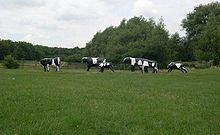
The Development Corporation had an ambitious public art programme and over 50 works were commissioned, mostly still extant. This programme also had two strands: a populist one which involved the local community in the works, the most famous of which is Liz Leyh's Concrete Cows,[89] a group of concrete Friesian cows which have become the unofficial logo of the city; and a tradition of abstract geometrical art, such as Lilliane Lijn's Circle of Light hanging in the Midsummer Arcade of the Central Milton Keynes shopping centre.
- Demographics
Unusually for a new town, Milton Keynes has arrived at a bias in favour of private sector investment, with about 80% of owner-occupied homes.[90] The political climate determined this: previous new towns were mainly specified by Labour Governments to be primarily for social rent. Milton Keynes began the same way but was mainly built under Conservative governments who insisted on substantial private participation.[91]
Further development plans[]
In January 2004, Deputy Prime Minister John Prescott announced the government's 'Expansion plans for Milton Keynes.'[92]
He proposed that the population of Milton Keynes should double in the next 20 years. He appointed English Partnerships to do so, taking planning controls away from Milton Keynes Council and making EP the statutory planning authority. In turn, EP established a subsidiary, the 'Milton Keynes Partnership', to manage the programme locally. Their proposal for the next phase of expansion moves away from grid squares to large scale, mixed use, higher density developments. This phase of development lasted until EP was wound up in 2008 and in that time had specified substantial expansions to the east (Broughton and Brooklands) and to the west (Whitehouse and Fairfields), as well as intensification of the city centre. As of April 2020, Milton Keynes Partnership continues but as an agency of Milton Keynes Council.
Milestones since 1967[]
1960s

- 1961 Census: Population of districts to become[93] the Borough of Milton Keynes = 52,931
- 1967 Designation of the New Town[13]
- 1969 The Open University moves to its new headquarters in Walton Hall.[94]
1970s
- 1970
- First section of new city grid road system (H2 from V4 Watling Street).
- The Stables presents its first concert.[95]
- 1971
- First major MKDC housing scheme (Galley Hill, Stony Stratford).
- 1971 Census: Population of future Borough of Milton Keynes = 66,949; population of designated area = 46,500
- 1974
- Stantonbury Campus opens;[96]
- first major grid road (V8 Marlborough Street connects Bletchley to Stantonbury (for New Bradwell and Wolverton);
- work begins on the Shopping Building (now The Centre:MK);
- the first balancing lake (Willen Lake) is finished.
- Borough of Milton Keynes created (as a district of Buckinghamshire until 1997)
- 1975 The first office building in Central Milton Keynes (Lloyds Court) opens.
- 1979
- First concert at Milton Keynes Bowl (Desmond Dekker/Geno Washington);
- Margaret Thatcher opens the Shopping Building.[97]
1980s
- 1980
- A5D opens, bypassing Watling Street;
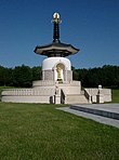
- Peace Pagoda dedicated at Willen.
- 1981
- Homeworld, Central Library, Willen Hospice
- 1981 Census: Population of the Borough of Milton Keynes = 123,289; population of designated area 95,800
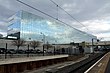
- 1982 Milton Keynes Central railway station officially open.[98]
- 1983 Caldecotte balancing lake ready.
- 1984
- A421 road connects to M1 motorway at Junction 13;
- Milton Keynes General Hospital opens (renamed Milton Keynes University Hospital in 2015).
- 1985 Britain's first multiplex cinema, The Point, opens.
- 1986
- Energy World;
- new county court;
- Forte Crest Hotel (now Holiday Inn);
- Gyosei International School UK opens (closes 2002).
- 1987 Woughton Marina opens.
- 1989
- Furzton balancing lake,
- Bradwell aqueduct (first aqueduct on Grand Union in over 100 years).
1990s
- 1991
- 1991 Census: Population of the Borough of Milton Keynes = 179,252; population of designated area = 144,700.
- Church of Christ the Cornerstone was completed;
- De Montfort University opens Milton Keynes campus. (Closes 2003).
- 1992
- Milton Keynes Development Corporation wound up, replaced by Commission for New Towns;
- Kingston District Centre;
- HMP Woodhill.
- 1994 Westcroft district centre opens.
- 1996 National Hockey Stadium opens.
- 1997 Borough of Milton Keynes becomes a unitary authority.[99]
- 1999 Milton Keynes Theatre, Art Gallery and new Visitor Centre open.[100]
2000s


- 2000 Xscape opens.
- 2001
- 2001 Census: Population of Borough of Milton Keynes = 207,063; population of designated area = 177,500.
- 2003 Wimbledon F.C. moves to the former England National Hockey Stadium
- 2004 ('MMIV') Wimbledon F.C. renamed and relaunched as Milton Keynes Dons F.C..
- 2007 Stadium MK opens and Milton Keynes Dons move in.
- 2007 The Hub & Vizion developments are completed at the western end of CMK
- 2008 University Centre Milton Keynes opens.[101]
2010s

- 2010
- Former National Hockey Stadium is demolished, construction begins on Network Rail National Centre, Quadrant:MK.[102]
- Milton Keynes Shopping Centre is grade II listed.[103]
- IF: Milton Keynes International Festival is launched.[104]
- 2011
- 2011 Census: Population of Borough of Milton Keynes = 248,800; population of Milton Keynes urban area = 229,941. (Includes Newport Pagnell and Woburn Sands. Data for the original designated area is no longer collected).
- 2012 Network Rail National Centre (Quadrant:MK) officially opens
- 2015 Three of the 2015 Rugby World Cup matches were played at Stadium MK.
- 2017 series of events and exhibitions to celebrate 50 years since the original designation
- 2018
- Milton Keynes becomes the first 'city' in the UK scheduled to have ubiquitous fibre to the home.[105][106]
- The world's first urban delivery service by robot.[107] (The 'robots' or 'ground drones', made by Starship Technologies, are not fully autonomous.)
- 2019
- The gallery is substantially extended and remodelled and includes an art-house cinema.[108]
- International prize winning design for MK:U (a planned undergraduate University of Technology) is announced, for a site near the central railway station.[109]
- Milton Keynes is designated as the European City of Sport for 2020.[110]
2020s
- 2020
- A421 (Kingston to M1 J13) upgraded to dual carriageway.[111]
- Work begins on East West Rail (Oxford–Cambridge).[112] Work began on Bletchley Flyover rebuild.[113]
- Campbell Park is grade II listed in the 'Park and Garden' category.[114]
Notes[]
- ^ Although Milton Keynes was specified to be a city in scale and the term 'city' is used locally (inter alia to avoid confusion with its constituent towns), formally this title cannot be used. This is because conferment of city status in the United Kingdom is a Royal prerogative.
- ^ The Plan for Milton Keynes begins (in the Foreword by Lord ("Jock") Campbell of Eskan): "This plan for building the new city of Milton Keynes ... "
- ^ now in collection of the British Museum, replicas are on display in the Milton Keynes Museum
- ^ meaning both "the last" and "the best". The Greater London Council (GLC) was very proud of the Lakes Estate, declaring it to be the finest in modern architecture for a working class estate, based on the design concept pioneered in Radburn, New Jersey[17]
References[]
- ^ a b c "The Milton Keynes hoard". British Museum/Google Cultural Institute. Retrieved 31 January 2018.
- ^ a b UK Census (2011). "Local Area Report – Milton Keynes Built-up area (E34005056)". Nomis. Office for National Statistics. Retrieved 29 March 2019.
- ^ a b c The South East Study 1961–1981 (Report). London: HMSO. 1964. Retrieved 27 November 2006.
A big change in the economic balance within the south east is needed to modify the dominance of London and to get a more even distribution of growth
- ^ "Bletchley Pioneers, Planning, & Progress". Clutch.open.ac.uk. Retrieved 23 November 2012.
- ^ "Early days of overspill". Clutch.open.ac.uk. Retrieved 23 November 2012.
- ^ a b c "Need for more planned towns in the South-East". The Times. 2 December 1964.
- ^ "Urgent action to meet London housing needs". The Times. 4 February 1965.
- ^ a b Llewellyn-Davies et al. 1970, p. xi.
- ^ Llewellyn-Davies et al. 1970, p. 8.
- ^ "Census 2001 Key Statistics, Urban areas in England and Wales" (PDF). ONS. Retrieved 3 July 2013.
- ^ Area of New Town Increased by 6,000 acres (2,400 ha). The Times. 14 January 1966. Retrieved 21 September 2006
- ^ a b Llewellyn-Davies et al. 1970, p. 4.
- ^ a b c d ""North Buckinghamshire (Milton Keynes) New Town (Designation) Order", London Gazette, 24 January 1967, page 827". London Gazette. Retrieved 14 January 2014..
- ^ Llewellyn-Davies et al. 1970, p. 3.
- ^ a b Dave Persaud. "Father of the New City". Milton Keynes: Living Archive.
Labour Minister Dick Crossman …looked at [a] map and saw [the] name and said "Milton the poet, Keynes the economic one. 'Planning with economic sense and idealism, a very good name for it.'" (Lord Campbell)
- ^ Croft, R. A.; Mynard, Dennis C.; Gelling, Margaret (1993). The Changing Landscape of Milton Keynes. Buckinghamshire Archaeological Society Monograph Series. Aylesbury: Buckinghamshire Archaeological Society. ISBN 9780949003126.
The creation of Milton Keynes provided an opportunity to study an extensive rural landscape before it was changed irreversibly. This book brings together the results of 20 years of excavation, fieldwork and documentary studies carried out by the Milton Keynes Development Corporation.
- ^ a b Bendixson & Platt 1992.
- ^ "History of Milton Keynes". Archived from the original on 5 August 2012. Retrieved 29 May 2007.CS1 maint: bot: original URL status unknown (link)
- ^ "Big-Eye – The Caldecotte Monster". MKweb.co.uk. Archived from the original on 27 September 2007. Retrieved 29 May 2007.
- ^ "Archaeology in the Milton Keynes District: Stone Age". Milton Keynes Heritage Association. Retrieved 3 January 2007.
- ^ "Archaeology in the Milton Keynes District: Bronze Age". Milton Keynes Heritage Association. Retrieved 3 January 2007.
- ^ R.J. Williams; R.J. Zeepvat (1994). Bancroft : the late Bronze Age and Iron Age settlements and Roman temple-mausoleum, and the Roman villa. Buckinghamshire Archaeological Society monograph series. Aylesbury: Buckinghamshire Archaeological Society. ISBN 9780949003133.
- ^ Needham, S (2002). "Milton Keynes, Buckinghamshire: Bronze Age gold hoard of two torcs and three bracelets in a pot" (PDF). Treasure Annual Report 2000. Department of Culture, Media and Sport. pp. 13–15. Archived from the original (PDF) on 1 March 2012. Retrieved 26 July 2010.
- ^ "Gold stater ('Gallo-Belgic A' type) -199/-100". British Museum. Retrieved 5 April 2020.
- ^ a b "Archaeology in the Milton Keynes District: archaeological sites and artefacts found at Bancroft and Blue Bridge, part of the old farmland of Stacey Hill Farm, now Milton Keynes Museum". Milton Keynes Heritage Association. Retrieved 3 January 2007.
- ^ Historic England. "Monument No. 345100". Research records (formerly PastScape). Retrieved 2 June 2019.
- ^ a b c d e f g h Milton Keynes Heritage (map), Milton Keynes Development Corporation, 1983.
- ^ "Key to English place names: Bletchley". Institute for Name-Studies, the University of Nottingham. Retrieved 6 April 2020.
- ^ "Key to English place names: Shenley". Institute for Name-Studies, the University of Nottingham. Retrieved 6 April 2020.
- ^ a b c Mynard & Hunt 1994.
- ^ Historic England (4 November 1993). "Bradwell Bury: a moated site and associated manor house remains at Moat House (1011298)". National Heritage List for England. Retrieved 6 April 2020.
- ^ a b c William Page (ed.). "Newport Hundred: Introduction". A History of the County of Buckingham. Victoria History of the Counties of England. 4. pp. 268–269. Retrieved 7 April 2020.
- ^ Adkins, R; Petchey, M. (1984). "Secklow hundred mound and other meeting place mounds in England". Archaeological Journal. 141 (141): 243–251. doi:10.1080/00665983.1984.11077777.
- ^ Ordnance Survey. "Ordnance Survey 1:25,000 mapping, Milton Keynes". streetmap.co.uk. Retrieved 6 April 2020. (a little over 110 meters elevation)
- ^ Woodfield 1986, p. 96.
- ^ Woodfield 1986, p. 64.
- ^ a b Woodfield 1986, p. 84.
- ^ Woodfield 1986, p. 189.
- ^ William Page, ed. (1927). "Parishes : Newport Pagnell". A History of the County of Buckingham. Victoria History of the Counties of England. 4. pp. 409–422. Retrieved 7 April 2020.
- ^ William Page, ed. (1927). "Parishes : Stony Stratford". A History of the County of Buckingham. Victoria History of the Counties of England. 4. pp. 476–482. Retrieved 7 April 2020.
- ^ William Page, ed. (1927). "Parishes : Bletchley with Fenny Stratford and Water Eaton". A History of the County of Buckingham. Victoria History of the Counties of England. 4. pp. 274–283. Retrieved 7 April 2020.
- ^ "Bradwell Abbey". Milton Keynes City Discovery Centre. Archived from the original on 9 November 2006. Retrieved 3 January 2007.
- ^ "Snelshall Priory (OS map 1:25000)". Ordnance Survey (via Streetmap.co.uk). Retrieved 3 November 2016.
- ^ Historic England (7 August 1996). "Motte and bailey castle, deserted village and monastic grange at Old Wolverton (1013660)". National Heritage List for England. Retrieved 7 April 2020.
- ^ a b c English Heritage (13 June 2012). Wolverton and New Bradwell: Historic Town Assessment Report (PDF) (Report). p. 31.
- ^ Buckinghamshire Historical Service plaque on site, of which this section is a summary.
- ^ a b William Page, ed. (1927). "Parishes : Wolverton". A History of the County of Buckingham. Victoria History of the Counties of England. 4. p. 505–509. Retrieved 17 February 2019.
- ^ Historic England (7 February 1992). "Moated site, fishponds and deserted medieval village of Tattenhoe, 300m west of Home Park Farm. (1007942)". National Heritage List for England. Retrieved 7 April 2020.
- ^ R. J. Ivens (1990). "The deserted village of Westbury by Shenley" (PDF). South Midlands Archaeology (20): 21.
- ^ James Joseph Sheahan (1862). History and Topography of Buckinghamshire: Comprising a General Survey of the County, Preceded by an Epitome of the Early History of Great Britain. Longman, Green, Longman, and Roberts. p. 604. ISBN 9780804833905.
- ^ "History of Stony Stratford". Milton Keynes Heritage Association. Retrieved 2 October 2007.
- ^ William Page, ed. (1927). "Parishes : Newport Pagnell". A History of the County of Buckingham. Victoria History of the Counties of England. 4. p. 409–422. Retrieved 17 February 2019.
- ^ "Wolverton Works". Milton Keynes Museum. Retrieved 16 August 2013.
- ^ a b Milton Keynes Museum. "OUR TRAM: THE STORY OF THE TRAM]". Milton Keynes Heritage Association. Retrieved 8 April 2020.
- ^ Quick, Michael (2009) [2001]. Railway passenger stations in Great Britain: a chronology (4th ed.). Oxford: Railway & Canal Historical Society. p. 90. ISBN 978-0-901461-57-5. OCLC 612226077.
- ^ William Page, ed. (1927). "Parishes : Bletchley with Fenny Stratford and Water Eaton". A History of the County of Buckingham. Victoria History of the Counties of England. 4. p. 274–283. Retrieved 17 February 2019.
- ^ 'Place of historic interest' plaque in Stony Stratford High Street.
- ^ Copeland 2006, Copeland, Jack, Introduction p. 2.
- ^ Hinsley, Harry (1996) [1993], The Influence of ULTRA in the Second World War, retrieved 13 February 2015 Transcript of a lecture given on Tuesday 19 October 1993 at Cambridge University
- ^ Buckinghamshire XV (includes: Bletchley; Bow Brickhill; Walton.) (Map). [1:10,560]. Ordnance Survey. 1885 – via National Library of Scotland. (six inches : 1 mile)
- ^ "Vision of Britain: Bletchley and Fenny Stratford". Vision of Britain. Retrieved 3 January 2007.
- ^ Buckinghamshire XV.SW (includes: Bletchley.) (Map). [1:10,560]. Ordnance Survey. 1926 – via National Library of Scotland. (six inches : 1 mile)
- ^ Bigger Brighter Better – Ed. Marion Hill (http://www.livingarchive.org.uk) ISBN 0-904847-29-2
- ^ "Bletchley: Early Days of Overspill". Clutch Club. Retrieved 3 January 2007.
- ^ "Vision of Britain: Bletchley Urban District". Vision of Britain. Retrieved 3 January 2007.
- ^ Bendixson & Platt 1992, pp. 129–154.
- ^ "Bletchley: Early Days of Overspill: Beginning". Clutch Club. Retrieved 3 January 2007.
- ^ "Bletchley: Early Days of Overspill: Housing". Clutch Club. Retrieved 3 January 2007.
- ^ Pooley, Fred (1966). North Bucks New City (Report). Department of Architecture & Planning, Buckinghamshire County Council.
- ^ "Northampton, Bedford and North Bucks", cited in The Plan for Milton Keynes (Llewellyn-Davies et al. 1970).
- ^ "The area of the New Town increased by 6,000 acres". The Times. 14 January 1966. (6,000 acres is about 24 sqkm.)
- ^ "New town will be home for 250,000 Londoners : Plan for Buckinghamshire approved". The Times. 13 January 1967.
- ^ a b c d e Llewellyn-Davies et al. 1968.
- ^ "Modern Milton Keynes". Archived from the original on 28 July 2012. Retrieved 5 January 2007.
- ^ The CLUTCH Club Milton Keynes site holds a collection of archival photos and recorded interviews compiled by residents of the older towns and villages incorporated within Milton Keynes. Larger Milton Keynes-related oral history collections have been created at The Living Archive, and a broader family of sites and links to archaeological studies of the Milton Keynes area is maintained by the Milton Keynes Heritage Association Archived 8 October 2006 at the Wayback Machine, which "exists to encourage and develop cooperation and coordination between all members having an interest in heritage within the Milton Keynes district."
- ^ a b Llewellyn-Davies et al. 1970.
- ^ Walker, Derek (1982). The Architecture and Planning of Milton Keynes. London: Architectural Press. p. 8. ISBN 0-85139-735-2. cited in Clapson, Mark (2004). A Social History of Milton Keynes: Middle England/Edge City. London: Frank Cass. p. 40.
- ^ Webber, Melvin M (1963). Order and Diversity: Community Without Propinquity. in Wirigo, L (ed.) (1963). Cities and Space. Johns Hopkins University Press.CS1 maint: extra text: authors list (link)
- ^ Melvin, Jeremy (12 August 2014). "Richard MacCormac (1938-2014)". Architectural Review.
- ^ Hatherley, Owen (2010). A guide to the new ruins of Great Britain (PDF). New York: Verso. p. 60. ISBN 978-1-84467-700-9.
- ^ "Building of the month: Heelands Housing, Milton Keynes". c20society.org.uk. Twentieth Century Society. January 2008.
- ^ Pitcher, Greg (12 March 2018). "A Milton Keynes housing estate designed by Ralph Erskine in the 1970s should be designated a conservation area, a heritage body has urged". The Architects' Journal.
- ^ Billings, Henrietta (February 2013). "Obituary: John Winter (1930–2012)". Twentieth Century Society.
- ^ Bishop, Jeffrey. Milton Keynes – the Best of Both Worlds? Public and professional views of a new city. University of Bristol School for Advanced Urban Studies. ISBN 9780862922245.
- ^ Bendixson & Platt 1992, p. 95.
- ^ Bendixson & Platt 1992, p. 104.
- ^ Derek Walker 1994.
- ^ "The Parks Trust model". Archived from the original on 7 March 2012. Retrieved 7 April 2012.
- ^ The Sculpture 100. Archived from the original on 23 April 2006., made for Sky Television in December 2005, the Concrete Cows were included in a list of the 100 most influential works of 20th century open-air sculpture in England.
- ^ "Neighbourhood Statistics – Area: Milton Keynes (Local Authority)". National Statistics. Retrieved 8 June 2007.
- ^ Bendixson & Platt 1992, p. 226–237.
- ^ Hetherington, Peter (6 January 2004). "Milton Keynes to double in size over next 20 years (Guardian)". The Guardian. London. Retrieved 25 March 2007.
- ^ Boundary translation and census data from Vision of Britain
- ^ Bendixson & Platt 1992, p. 75.
- ^ Kate Barrett; Monica Ferguson, eds. (2005). The Stables - Inside Story. Wavendon: The Stables Trading Ltd. ISBN 9780955155307.
- ^ Pevsner, Williamson & Brandwood 1994, p. 551.
- ^ Bendixson & Platt 1992, p. 146.
- ^ "Milton Keynes Central opened". The Railway Magazine. Vol. 128 no. 974. June 1982. p. 258. ISSN 0033-8923.
- ^ "The Buckinghamshire (Borough of Milton Keynes) (Structural Change) Order 1995". Government of the United Kingdom. Retrieved 15 July 2020.
(2) A new county shall be constituted comprising the area of Milton Keynes and shall be named the county of Milton Keynes.
- ^ "Milton Keynes Theatre". ambassadortickets.com. Archived from the original on 23 January 2009.
- ^ Mark Gould (23 September 2008). "The University Centre Milton Keynes opens". The Guardian.
- ^ "Network Rail opens The Quadrant:MK". Railway Gazette International. 11 June 2012.
- ^ Historic England (16 July 2010). "Shopping Building (1393882)".
- ^ Milton Keynes International Festival 2010
- ^ "Cityfibre and Vodafone Name First UK City for 1Gbps Home Broadband UPDATE". ISPreview. 18 January 2018. Retrieved 23 December 2019.
- ^ "CityFibre FTTP footprint passes 100,000 premises mark - UPDATED". Think Broadband. 28 October 2019. Retrieved 23 December 2019.
- ^ "Starship enterprise means Co-op shopping is delivered by ROBOTS in Milton Keynes". Milton Keynes Citizen. 26 November 2018. Retrieved 5 March 2021.
- ^ Williams, Fran (11 March 2019). "MK Gallery by 6a architects to open doors this weekend". Architects' Journal. Retrieved 11 March 2019.
- ^ "Milton Keynes university contest winner revealed". Architects' Journal. 30 July 2019. Retrieved 30 July 2019.
- ^ "Milton Keynes wins European City of Sport title". BBC News. 18 July 2019.
- ^ "Central Bedfordshire Council completes A421 dualling upgrade into Milton Keynes" (Press release). Central Bedfordshire Council. 14 December 2020.
- ^ Cuzner, Mark, ed. (April 2020). "EWR2 Project Newsletter – April 2020". East West Rail Alliance.
- ^ Cuzner, Mark, ed. (January 2021). "EWR2 Project Newsletter – Winter 2020/2021". East West Rail Alliance.
- ^ Historic England (18 August 2020). "Campbell Park (1467405)".
Sources and bibliography[]
- Bendixson, Terence; Platt, John (1992). Milton Keynes: Image and reality. Cambridge: Granta Editions. ISBN 978-0906782729.
- Clapson, Mark (2014). The Plan for Milton Keynes with a foreword by Mark Clapson. Abingdon: Routledge. ISBN 9780415645003.
- Clapson, Mark (2004). A Social History of Milton Keynes, Middle England/Edge City. London: Frank Cass. ISBN 0-7146-8417-1.
- Croft, R. A.; Mynard, D. C.; Gelling, Margaret (1993). The Changing Landscape of Milton Keynes. Aylesbury: Buckinghamshire Archaeological Society. ISBN 0-949003-12-3.
- Erskine, Ralph; Smith, Michael, eds. (2011). The Bletchley Park Codebreakers. Biteback Publishing Ltd. ISBN 978-1-84954-078-0. Updated and extended version of Action This Day: From Breaking of the Enigma Code to the Birth of the Modern Computer. 2001. Bantam Press.
- Erskine, Ralph (2011). "Breaking German Naval Enigma on Both Sides of the Atlantic". In Erskine, Ralph; Smith, Michael (eds.). The Bletchley Park Codebreakers. Biteback Publishing Ltd. pp. 165–83. ISBN 978-1-84954-078-0.
- Copeland, B. Jack, ed. (2006). Colossus: The Secrets of Bletchley Park's Codebreaking Computers. Oxford: Oxford University Press. ISBN 978-0-19-284055-4.
- Finnegan, Ruth (1998). Tales of the City: A Study of Narrative and Urban Life. New York: Cambridge University Press. ISBN 9780521626231.
- Ivens, R. J.; Petchey, M. R.; Caple, Chris (1995). Tattenhoe and Westbury – Two Deserted Medieval Settlements in Milton Keynes. Aylesbury: Buckinghamshire Archaeological Society, Monograph Series. ISBN 9780949003003.
- Llewellyn-Davies; Weeks; Forestier-Walker; Bor (1968). Milton Keynes: Interim Report to Milton Keynes Development Corporation. Milton Keynes Development Corporation. OCLC 1086629624.
- Llewellyn-Davies; Weeks; Forestier-Walker; Bor (1970). The Plan for Milton Keynes, Volume 1. Wavendon: Milton Keynes Development Corporation. ISBN 0-903379-00-7.
- Markham, Frank (1975). A History of Milton Keynes and District (two volumes). Luton: White Crescent Press. ISBN 0-900804-29-7.
- Marney, P.T.; Hartley, Kay. Roman & Belgic Pottery – From Excavations in Milton Keynes 1972–82. Aylesbury: Buckinghamshire Archaeological Society, Monograph Series. OCLC 602120606.
- de Monchaux, John (24 February 2003). "Big plans". Archived from the original on 11 September 2006. (Professor de Monchaux was one of the original lead design consultants for Llewellyn Davies). An MIT OpenCourseware lecture.
- Morrison, Kathryn. "'A Maudlin and Monstrous Pile': The Mansion at Bletchley Park, Buckinghamshire" (PDF). English Heritage. Retrieved 24 April 2012.
- Mynard, D. C.; Blinkhorn, Paul (1994). Excavations on medieval sites in Milton Keynes. Aylesbury: Buckinghamshire Archaeological Society, Monograph Series.
- Mynard, D. C.; Hunt, Julian (1994). Milton Keynes, a pictorial history. Chichester: Phillimore. ISBN 0-85033-940-5.
- Mynard, D. C.; Zeepvat, R. J.; Williams, R. J (1992). Excavations at Great Linford 1974–80. Aylesbury: Buckinghamshire Archaeological Society, Monograph Series.
- Pevsner, Nikolaus; Williamson, Dr Elizabeth; Brandwood, Geoffrey K. (1994). The Buildings of England: Buckinghamshire (Pevsner Architectural Guides). Penguin Books. ISBN 9780140710625.
- Derek Walker, ed. (1994). New Towns. Architectural Design. London: Academy Editions. ISBN 1-85490-245-8.
- Williams, R. J.; Zeepvat, R. J.; Green, H Stephen Green (1993). Pennyland and Hartigans – Two Iron Age and Saxon sites in Milton Keynes. Aylesbury: Buckinghamshire Archaeological Society, Monograph Series. ISBN 9780949003119.
- Williams, R. J.; Hart, P. J.; Williams, A. T. L. (1996). Wavendon Gate – A Late Iron Age and Roman settlement in Milton Keynes. Aylesbury: Buckinghamshire Archaeological Society, Monograph Series. ISBN 9780949003164.
- Williams, R. J.; Zeepvat, R. J. (1994). 'Bancroft : the late Bronze Age and Iron Age settlements and Roman temple-mausoleum, and the Roman villa. Aylesbury: Buckinghamshire Archaeological Society, Monograph Series. ISBN 9780949003133.
- Woodfield, Paul (1986). A guide to the historic buildings of Milton Keynes. Milton Keynes: Milton Keynes Development Corporation. ISBN 978-0903379052.
- Zeepvat, R. J.; Roberts, J. S.; King, N. A. (1994). Caldecotte, Milton Keynes – Excavations and Fieldworks 1966–91. Aylesbury: Buckinghamshire Archaeological Society, Monograph Series. ISBN 9780949003140.
External links[]
- Milton Keynes City Discovery Centre: History of Bradwell Abbey
- Bletchley Park Trust: History of Bletchley Park
- Milton Keynes - A Village City (1973) | Britain on Film BFI (60 seconds).
| History of England |
|---|
 |
|
|
- History of Milton Keynes