Hodkovičky
Hájek | |
|---|---|
Cadastral district of Prague | |
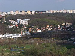
 View to Hodkovičky | |
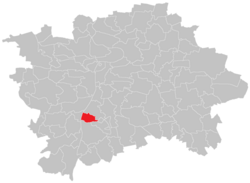
 Location of Hodkovičky within the City of Prague. | |
| Coordinates: 50°1′18″N 14°24′45″E / 50.02167°N 14.41250°ECoordinates: 50°1′18″N 14°24′45″E / 50.02167°N 14.41250°E | |
| Country | Czech Republic |
| City | Prague |
| District | Prague 4 |
| Incorporated into Prague | 1922 |
| Area | |
| • Total | 2.08 km2 (0.80 sq mi) |
| Population (2011)[1] | |
| • Total | 3,708 |
| • Density | 1,800/km2 (4,600/sq mi) |
| Time zone | UTC+1 (CET) |
| • Summer (DST) | UTC+2 (CEST) |
Hodkovičky is a cadastral district of Prague, Czech Republic. In 2011 it had 3708 inhabitants.
References[]
- ^ "Historický lexikon obcí České republiky – 1869–2011". Retrieved 2011-12-21.
Categories:
- Districts of Prague
- Prague geography stubs
