Kyje
Kyje | |
|---|---|
Cadastral district of Prague | |
 Medieval church in Kyje | |
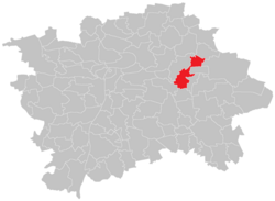 Location of Kyje within the City of Prague. | |
| Coordinates: 50°5′51″N 14°32′54″E / 50.09750°N 14.54833°ECoordinates: 50°5′51″N 14°32′54″E / 50.09750°N 14.54833°E | |
| Country | Czech Republic |
| City | Prague |
| District | Prague 14 |
| Incorporated into Prague | 1968 |
| Area | |
| • Total | 5.69 km2 (2.20 sq mi) |
| Population (31 December 2015)[1] | |
| • Total | 9,036 |
| • Density | 1,600/km2 (4,100/sq mi) |
| Time zone | UTC+1 (CET) |
| • Summer (DST) | UTC+2 (CEST) |

Kyje is a cadastral district of Prague, Czech Republic. In 2015 it had 9,036 inhabitants.
The German name of Kyje is Keeg.
Sights[]

Mediveal church

Kyje pond

Doubravka lookout tower


References[]
- ^ "Obyvatelstvo a rozloha katastrálních území Prahy 2001–2015". Český statistický úřad. Retrieved 2015-12-31.
- ^ "Památkový Katalog". pamatkovykatalog.cz. Retrieved 2019-12-03.
- ^ https://www.praha14.cz/MC/stezka/Z04.pdf
- ^ "Rozhledna Doubravka XIV. « Život na Praze 14". www.praha14.cz. Retrieved 2019-12-03.
| Authority control: National libraries |
|---|
This Prague location article is a stub. You can help Wikipedia by . |
Categories:
- Districts of Prague
- Prague geography stubs