Hopewell Township, Seneca County, Ohio
Hopewell Township, Seneca County, Ohio | |
|---|---|
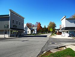 Street scene in Bascom | |
 Location of Hopewell Township (red) in Seneca County, adjacent to the city of Tiffin (yellow). | |
| Coordinates: 41°7′3″N 83°14′24″W / 41.11750°N 83.24000°WCoordinates: 41°7′3″N 83°14′24″W / 41.11750°N 83.24000°W | |
| Country | United States |
| State | Ohio |
| County | Seneca |
| Area | |
| • Total | 34.5 sq mi (89.4 km2) |
| • Land | 34.4 sq mi (89.0 km2) |
| • Water | 0.1 sq mi (0.4 km2) |
| Elevation | 761 ft (232 m) |
| Population (2010) | |
| • Total | 2,774 |
| • Density | 80.4/sq mi (31.0/km2) |
| Time zone | UTC-5 (Eastern (EST)) |
| • Summer (DST) | UTC-4 (EDT) |
| FIPS code | 39-36400[2] |
| GNIS feature ID | 1086947[1] |

Hopewell Township is one of the fifteen townships of Seneca County, Ohio, United States. The 2010 census found 2,774 people in the township.[3]
Geography[]
Located in the west central part of the county, it borders the following townships:
- Liberty Township - north
- Pleasant Township - northeast corner
- Clinton Township - east
- Eden Township - southeast corner
- Seneca Township - south
- Big Spring Township - southwest corner
- Loudon Township - west
- Jackson Township - northwest corner
Part of the city of Tiffin, the county seat of Seneca County, is located in eastern Hopewell Township, and the unincorporated community of Bascom lies in the western part of the township.
Name and history[]
Hopewell Township was organized in 1824.[4]
It is one of five Hopewell Townships statewide.[5]
Government[]
The township is governed by a three-member board of trustees, who are elected in November of odd-numbered years to a four-year term beginning on the following January 1. Two are elected in the year after the presidential election and one is elected in the year before it. There is also an elected township fiscal officer,[6] who serves a four-year term beginning on April 1 of the year after the election, which is held in November of the year before the presidential election. Vacancies in the fiscal officership or on the board of trustees are filled by the remaining trustees.
References[]
- ^ Jump up to: a b "US Board on Geographic Names". United States Geological Survey. 2007-10-25. Retrieved 2008-01-31.
- ^ "U.S. Census website". United States Census Bureau. Retrieved 2008-01-31.
- ^ "U.S. Census website". United States Census Bureau. Retrieved 26 July 2018.
- ^ Lang, William (1880). History of Seneca County, from the Close of the Revolutionary War to July, 1880. Transcript Printing Company. pp. 540.
- ^ "Detailed map of Ohio" (PDF). United States Census Bureau. 2000. Retrieved 2007-02-16.
- ^ §503.24, §505.01, and §507.01 of the Ohio Revised Code. Accessed 4/30/2009.
External links[]
| show Municipalities and communities of Seneca County, Ohio, United States |
|---|

| show Authority control |
|---|
- Townships in Seneca County, Ohio
- Townships in Ohio