Horokanai, Hokkaido
Horokanai
幌加内町 | |
|---|---|
Town | |
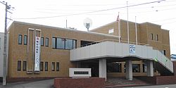 Horokanai town hall | |
 Flag  Emblem | |
 Location of Horokanai in Hokkaido (Kamikawa Subprefecture) | |
 Horokanai Location in Japan | |
| Coordinates: 44°1′N 142°9′E / 44.017°N 142.150°ECoordinates: 44°1′N 142°9′E / 44.017°N 142.150°E | |
| Country | Japan |
| Region | Hokkaido |
| Prefecture | Hokkaido (Kamikawa Subprefecture) |
| District | Uryū |
| Area | |
| • Total | 767.03 km2 (296.15 sq mi) |
| Population (September 30, 2016) | |
| • Total | 1,571 |
| • Density | 2.0/km2 (5.3/sq mi) |
| Time zone | UTC+09:00 (JST) |
| Website | www |

Horokanai (幌加内町, Horokanai-chō) is a town in Kamikawa Subprefecture, Hokkaido, Japan. As of September 2016, the town has an estimated population of 1,571. The total area is 767.03 km2 (296.15 sq mi).
History[]
On April 1, 2010, Horokanai was transferred from Sorachi Subprefecture to Kamikawa Subprefecture.
On December 31, 2020, a minimum temperature of −32.6 °C (−26.7 °F) was registered.[1]
References[]
- ^ Mori, Sayaka [@sayakasofiamori] (December 31, 2020). "Many new December records have been set on the New Year's eve in #Japan. The Hokuriku region could get an additional 260cm (8.5feet) of snow into the next three days. It's likely be a historic #snow event. t.co/83q7XI2a1i" (Tweet). Retrieved January 11, 2021 – via Twitter.
External links[]
 Media related to Horokanai, Hokkaidō at Wikimedia Commons
- Official Website (in Japanese)
| show |
|---|
| show Authority control |
|---|
This Hokkaidō location article is a stub. You can help Wikipedia by . |
Categories:
- Towns in Hokkaido
- Hokkaidō geography stubs