Ishikari Subprefecture
Ishikari Subprefecture
石狩振興局 | |
|---|---|
| Ishikari-shinkō-kyoku | |
 | |
| Prefecture | Hokkaido |
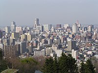
| Capital | Sapporo |
| Area | |
| • Total | 3,539.86 km2 (1,366.75 sq mi) |
| Population (December 31, 2011) | |
| • Total | 2,334,241 |
| • Density | 660/km2 (1,700/sq mi) |
| Website | ishikari.pref.hokkaido.lg.jp |

Ishikari Subprefecture (石狩振興局, Ishikari-shinkō-kyoku) is a subprefecture of Hokkaido Prefecture, Japan, located in the western part of the island. The subprefecture covers 3,539.86 square kilometres (1,366.75 sq mi) and in 2011 had a population of 2,334,241.[1] The subprefecture takes its name from the Ishikari River, the third longest in Japan, which flows through western Hokkaido and empties into the Sea of Japan in the city of Ishikari. There are 6 cities, three towns, and one village under its jurisdiction. Sapporo is both the capital of Hokkaido Prefecture and Ishikari Subprefecture. Shikotsu-Toya National Park is located in the southern part of the subprefecture, and Shokanbetsu-Teuri-Yagishiri Quasi-National Park in the north.[2]
Etymology[]
The word Ishikari comes from the Ainu language, and several theories exist as to the meaning of the name.[2][3]
- The most common translation of "Ishikari", proposed by the missionary and researcher of the Ainu language John Batchelor (1854 – 1944) in 1935, is "a greatly wandering river", a reference to the meandering path of the Ishikari River. According to Batchelor Ishikari is a corruption of "i-sikar-pet" or "ishikaripet". The 'i' sound of i-sikar-pet is a prefix meaning "greatly" or "exceedingly"; shikari meaning "zigzag" or "serpentine", and pet is the Ainu word for river.[4]
- (1864 – 1918), proposed in the , published between 1907 and 1910, that "Ishikaripet" had its origin in the Ainu language word "Ishikarapet", meaning "a beautifully formed river"; ishu meaning "beautiful", kara meaning "constructed" and pet meaning river.[5]
"Ishikari" is written in the Japanese language using ateji, or kanji characters used to phonetically represent native or borrowed words. The first, 石, means to "stone", and the second, 狩, means "to hunt". The meaning of the written form of Ishikari has no relationship to the meaning of word in the Ainu language.
Geography[]
Municipalities[]
| Name | Area (km2) | Population | District | Type | Map | |
|---|---|---|---|---|---|---|
| Rōmaji | Kanji | |||||
| 千歳市 | 594.5 | 96,475 | no district | City | 
| |
| 江別市 | 187.57 | 119,086 | 
| |||
| 恵庭市 | 294.87 | 68,883 | 
| |||
| 石狩市 | 721.86 | 58,755 | 
| |||
| 北広島市 | 118.54 | 58,918 | 
| |||
| 札幌市 | 1,121.26 | 1,973,432 | 
| |||
| 新篠津村 | 78.24 | 3,235 | Ishikari District | Village | 
| |
| 当別町 | 422.71 | 16,694 | Town | 
| ||
Mergers[]
History[]
- 1897: Sapporo Subprefecture established.
- 1922: Renamed Ishikari Subprefecture.
- 1996: Hiroshima Town becomes Kitahiroshima City, dissolving Sapporo District.
Transportation[]
Ishikari Prefecture has two airports, both serving the greater Sapporo area.
- Okadama Airport (Domestic)
- New Chitose Airport (International) (Located in the city of Chitose)
References[]
- ^ 振興局の概要: 地勢 [Subprefecture Overview: Topography] (in Japanese). Sapporo, Hokkaido: Hokkaido Government Ishikari Subprefectural Bureau. 2011. Retrieved Sep 23, 2012.
- ^ Jump up to: a b "S". Encyclopedia of Japan. Tokyo: Shogakukan. 2012. OCLC 56431036. Archived from the original on 2007-08-25. Retrieved 2012-09-23.
- ^ "石狩川" [Ishikara River]. Nihon Kokugo Daijiten (in Japanese). Tokyo: Shogakukan. 2012. OCLC 56431036. Archived from the original on 2007-08-25. Retrieved 2012-08-02.
- ^ Batchelor, John (1935). アイヌ語より見たる日本地名研究 [Japanese Place Names of Ainu Language Origin] (in Japanese). Sapporo: Bachirā Gakuen. OCLC 672445037.
- ^ Yoshida, Tōgo (1969–1971). 大日本地名辞書 [Dictionary of Japanese Place Names] (in Japanese). 8, 北海道・樺太・琉球・台湾 (Annotated ed.). Tokyo: Fuzanbō. ISBN 9784572000279. OCLC 123313133.
External links[]
- Official website (in Japanese)
43°03′52″N 141°20′45″E / 43.064543°N 141.345792°ECoordinates: 43°03′52″N 141°20′45″E / 43.064543°N 141.345792°E
 WikiMiniAtlas
| show |
|---|
- Subprefectures in Hokkaido