Hrejkovice
Hrejkovice | |
|---|---|
Municipality | |
 | |
 Flag  Coat of arms | |
 Hrejkovice | |
| Coordinates: 49°28′25″N 14°17′29″E / 49.47361°N 14.29139°ECoordinates: 49°28′25″N 14°17′29″E / 49.47361°N 14.29139°E | |
| Country | |
| Region | South Bohemian |
| District | Písek |
| Area | |
| • Total | 13.39 km2 (5.17 sq mi) |
| Elevation | 471 m (1,545 ft) |
| Population (2011) | |
| • Total | 487 |
| • Density | 36/km2 (94/sq mi) |
| Postal code | 398 59 |
| Website | http://www.hrejkovice.cz |

Hrejkovice is a village and municipality (obec) in Písek District in the South Bohemian Region of the Czech Republic.
The municipality covers an area of 13.39 square kilometres (5.17 sq mi), and has a population of 457 (2005).
Hrejkovice lies approximately 23 kilometres (14 mi) north-east of Písek, 57 km (35 mi) north of České Budějovice, and 69 km (43 mi) south of Prague.
Gallery[]

Municipal house

Houses
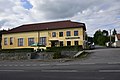
Pub


References[]
| Wikimedia Commons has media related to Hrejkovice. |
| Authority control: National libraries |
|---|
This South Bohemian Region location article is a stub. You can help Wikipedia by . |
Categories:
- Villages in Písek District
- South Bohemian Region geography stubs