Iešjávri
| Iešjávri | |
|---|---|
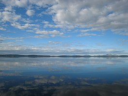 View of the lake | |
 Iešjávri Location of the lake | |
| Location | Troms og Finnmark |
| Coordinates | 69°39′55″N 24°12′32″E / 69.6654°N 24.2090°ECoordinates: 69°39′55″N 24°12′32″E / 69.6654°N 24.2090°E |
| Primary outflows | River Iešjohka |
| Basin countries | Norway |
| Max. length | 13 kilometres (8.1 mi) |
| Max. width | 10 kilometres (6.2 mi) |
| Surface area | 68.16 km2 (26.32 sq mi) |
| Average depth | 4 metres (13 ft) |
| Max. depth | 41 metres (135 ft) |
| Shore length1 | 164.74 kilometres (102.36 mi) |
| Surface elevation | 390 metres (1,280 ft) |
| References | NVE |
| 1 Shore length is not a well-defined measure. | |


Iešjávri (or Iesjavri[1]) is a large lake on the border of the three municipalities of Alta, Kautokeino, and Karasjok in Troms og Finnmark county, Norway. The lake lies on the Finnmarksvidda plateau about 50 kilometres (31 mi) northwest of the village of Karasjok, about 30 kilometres (19 mi) northeast of the village of Masi, and about 45 kilometres (28 mi) southeast of the town of Alta.
The 68.16-square-kilometre (26.32 sq mi) lake is the largest in the county and has a length of over 13 kilometres (8.1 mi) from north to south. The lake has a maximum depth of 41 metres (135 ft) and an average depth of 4 metres (13 ft), making it a characteristic Baltic Shield lake. The lake flows out into the river , a tributary of the large river Karasjohka.[2]
See also[]
- List of lakes in Norway
References and notes[]
- ^ Various Sami and Norwegian language terms distinguish different types of lakes. The name Jávrre: (Lule Sami) or jávri (Northern Sami) is used as a suffix for larger lakes.
- ^ Store norske leksikon. "Iešjávri" (in Norwegian). Retrieved 2013-01-15.
External links[]
This article related to a lake in Norway is a stub. You can help Wikipedia by . |
This article about a location in Troms og Finnmark is a stub. You can help Wikipedia by . |
- Alta, Norway
- Kautokeino
- Karasjok
- Lakes of Troms og Finnmark
- Norway lake stubs
- Troms og Finnmark geography stubs