Ike Kinswa State Park
| Ike Kinswa State Park | |
|---|---|
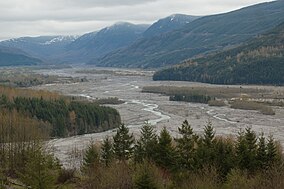 Ike Kinswa State Park, April 2013 | |
 Location in the state of Washington | |
| Location | Lewis, Washington, United States |
| Coordinates | 46°33′54″N 122°32′09″W / 46.56500°N 122.53583°WCoordinates: 46°33′54″N 122°32′09″W / 46.56500°N 122.53583°W[1] |
| Area | 421 acres (170 ha) |
| Elevation | 427 ft (130 m)[1] |
| Established | 1963 |
| Operator | Washington State Parks and Recreation Commission |
| Website | Ike Kinswa State Park |

Ike Kinswa State Park is a public recreation area on the northern side of Lake Mayfield, located three miles (4.8 km) northwest of Mossyrock in Lewis County, Washington. The state park covers 421 acres (170 ha) that include 46,000 feet (14,000 m) of shoreline mostly along the Tilton River including the point where the Tilton and Cowlitz rivers once merged. The park offers boating, fishing, swimming, waterskiing and windsurfing plus facilities for camping, hiking, and mountain biking, It is managed by the Washington State Parks and Recreation Commission.[2]
History[]
The park came into existence with the construction of the Mayfield Dam in 1963. In 1971, the park's original name, Mayfield Lake State Park, was changed to Ike Kinswa State Park, in honor of a member of the Cowlitz Indian Tribe.[2]
References[]
- ^ Jump up to: a b "Ike Kinswa State Park". Geographic Names Information System. United States Geological Survey.
- ^ Jump up to: a b "Ike Kinswa State Park". Washington State Parks and Recreation Commission. Retrieved February 18, 2016.
External links[]
- Ike Kinswa State Park Washington State Parks and Recreation Commission
- Ike Kinswa State Park Map Washington State Parks and Recreation Commission
| show Protected areas of Washington |
|---|
| Authority control |
|
|---|
- State parks of Washington (state)
- Parks in Lewis County, Washington
- Protected areas established in 1963