Lake Roosevelt National Recreation Area
| Lake Roosevelt | |
|---|---|
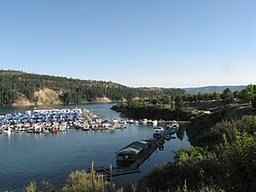 View from Two Rivers Marina | |
 | |
| Location | Ferry, Stevens, Lincoln, and Grant counties, Washington, USA |
| Nearest city | Spokane, Washington |
| Coordinates | 48°06′27″N 118°12′46″W / 48.10743°N 118.21289°WCoordinates: 48°06′27″N 118°12′46″W / 48.10743°N 118.21289°W |
| Area | 100,390 acres (406.3 km2)[1] |
| Established | April 1946 |
| Visitors | 1,781,972 (in 2012)[2] |
| Governing body | National Park Service, U.S. Bureau of Reclamation, U.S. Bureau of Indian Affairs, Confederated Tribes of the Colville Reservation, Spokane Tribe |
| Website | Lake Roosevelt National Recreation Area |


Lake Roosevelt National Recreation Area is a U.S. national recreation area that encompasses the 130-mile (210 km) long Franklin D. Roosevelt Lake between Grand Coulee Dam and Northport, Washington, in eastern Washington state. The Grand Coulee Dam was built on the Columbia River in 1941 as part of the Columbia River Basin project. Lake Roosevelt National Recreation Area is a unit of the National Park Service and provides opportunities for fishing, swimming, canoeing, boating, hunting, camping, and visiting historic Fort Spokane and St. Paul's Mission. Crescent Bay Lake in Grant County just southwest of Lake Roosevelt also falls under the jurisdiction of the National Recreation Area.

It was established in 1946 as the Coulee Dam Recreational Area and renamed for President Franklin D. Roosevelt in 1997.
References[]
- ^ "Listing of acreage as of December 31, 2011" (PDF). Land Resource Division, National Park Service. Retrieved 2012-12-14.
- ^ "NPS Annual Recreation Visits Report". National Park Service. Retrieved 2012-12-14.
External links[]
| Wikimedia Commons has media related to Lake Roosevelt National Recreation Area. |
| show Protected areas of Washington |
|---|
| show Authority control |
|---|
This National Park Service related article is a stub. You can help Wikipedia by . |
- National Park Service National Recreation Areas
- National Park Service areas in Washington (state)
- Protected areas of Ferry County, Washington
- Protected areas of Grant County, Washington
- Protected areas of Lincoln County, Washington
- Protected areas of Stevens County, Washington
- Parks in Washington (state)
- National parks in Washington (state)
- Canoeing and kayaking venues in the United States
- 1946 establishments in Washington (state)
- Protected areas established in 1946
- Washington (state) protected area stubs
- National Park Service stubs