Indragiri River
| Indragiri River Kuantan River, Batang Indragiri, Sungai Indragiri, Soengai Inderagiri, Batang Inderagiri, Batang Kuantan, Batang Koeantan, Sungai Kuatan, Koentan, Sungai Batangkuantan | |
|---|---|
 Map of the Rokan and Indragiri (right) rivers by Isaak de Graaf, circa 1690-1743. | |
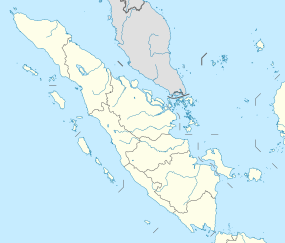 Location of river mouth | |
| Location | |
| Country | Indonesia |
| Physical characteristics | |
| Source | Ombilin River, Sinamar River |
| • location | West Sumatra |
| Mouth | Strait of Malacca |
• location | Riau |

The Indragiri River is a river in Sumatra, in the Indonesian province of Riau, Indonesia, about 800 km northwest of the capital Jakarta.[1][2] It is formed from the union of the Ombilin River and the Sinamar River, and empties into the Strait of Malacca. The middle part that flows in the Kuantan Singingi Regency is called Batang Kuantan (Kuantan River).[3]
Geography[]
The river flows in the eastern area of Sumatra with predominantly tropical rainforest climate (designated as Af in the Köppen-Geiger climate classification).[4] The annual average temperature in the area is 23 °C. The warmest month is February, when the average temperature is around 24 °C, and the coldest is August, at 22 °C.[5] The average annual rainfall is 2757 mm. The wettest month is November, with an average of 345 mm rainfall, and the driest is January, with 107 mm rainfall.[6]
See also[]
References[]
- ^ Batang Indragiri at Geonames.org (cc-by); Last updated 2013-06-04; Database dump downloaded 2015-11-27
- ^ Kosuke Mizuno, Motoko S. Fujita & Shuichi Kawai (2016). Catastrophe and Regeneration in Indonesia's Peatlands: Ecology, Economy and Society. NUS Press. p. 166. ISBN 978-98-147-2209-4.
- ^ Maatschappij-Belangen, 1875.
- ^ Peel, M C; Finlayson, B L; McMahon, T A (2007). "Updated world map of the Köppen-Geiger climate classification". Hydrology and Earth System Sciences. 11 (5): 1633–1644. Bibcode:2007HESS...11.1633P. doi:10.5194/hess-11-1633-2007. Retrieved 30 January 2016.
- ^ "NASA Earth Observations Data Set Index". NASA. 30 January 2016.
- ^ "NASA Earth Observations: Rainfall (1 month - TRMM)". NASA/Tropical Rainfall Monitoring Mission. 30 January 2016.
Coordinates: 0°22′S 103°26′E / 0.367°S 103.433°E

| Authority control: National libraries |
|---|
- Rivers of Sumatra
- Rivers of Riau
- Rivers of Indonesia