Interstate 195 (Florida)
 | ||||
|---|---|---|---|---|
| Julia Tuttle Causeway | ||||
 | ||||
| Route information | ||||
| Auxiliary route of I-95 | ||||
| Maintained by FDOT | ||||
| Length | 4.424 mi[1] (7.120 km) | |||
| Existed | December 23, 1961[citation needed]–present | |||
| Major junctions | ||||
| West end | ||||
| East end | ||||
| Location | ||||
| Counties | Miami-Dade | |||
| Highway system | ||||
| ||||
Julia Tuttle Causeway | |
|---|---|
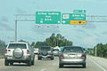
 The Julia Tuttle Causeway eastbound connecting Midtown Miami with Miami Beach | |
| Carries | 6 lanes of I-195 |
| Crosses | Biscayne Bay |
| Locale | Miami |
| Maintained by | MDX |
| Characteristics | |
| Design | Beam, fill causeway |
| Material | Slabs and girders |
| Total length | 2.5 miles (4.0 km) |
| Longest span | 0.4 miles (0.64 km) |
| Clearance above | 68 feet (21 m) |
| History | |
| Opened | December 23, 1961 |
Interstate 195 (I-195) is a 4.4-mile-long (7.1 km) spur freeway connecting I-95 (its parent route) in the west with Miami Beach in the east. It crosses Biscayne Bay by traveling over the Julia Tuttle Causeway, named after Miami founder Julia Tuttle.
It is part of the longer State Road 112 (SR 112), which continues to the west as the Airport Expressway and to the east as Arthur Godfrey Road (41st Street).
As part of a pilot program, the Florida Department of Transportation painted the shoulders as bike lanes east of US 1. Pedestrians are still prohibited.
Route description[]
I-195 begins at the eastern end of the I-95 and SR 112 interchange, heading east with interchanges with Miami Avenue and U.S. Route 1 (US 1) before heading onto the Julia Tuttle Causeway, where the interstate crosses Biscayne Bay. At the eastern end of the causeway in Miami Beach, it has an interchange with SR 907 before terminating at the intersection of SR 907A and Arthur Goodfrey Road, about a mile west of SR A1A.[2][3]
History[]
On December 23, 1961, three signed roads along the route of SR 112 were opened: the 36th Street Tollway (now the Airport Expressway), I-195, and I-195 Spur, along with a stretch of I-95 in Miami. I-195 Spur was the surface portion of the west–east state road along Arthur Godfrey Road in Miami Beach, connecting I-195 and SR A1A east of the causeway. The I-195 Spur signs disappeared from the road shortly after the designation was decommissioned by the newly formed United States Department of Transportation in the late 1960s.[citation needed]
In popular culture[]
Famously, in early 1975, the rhythm of their car on this road was the inspiration for the Bee Gees' song "Jive Talkin'".[4]
Exit list[]
The entire route is in Miami-Dade County.
| Location | mi[1] | km | Exit | Destinations | Notes |
|---|---|---|---|---|---|
| Miami | 0.000 | 0.000 | – | SR 112 continues west | |
| 0.000 | 0.000 | 1 | Westbound exit and eastbound entrance; I-95 exit 4 | ||
| 0.678 | 1.091 | 2A | North Miami Avenue | Eastbound exit and westbound entrance | |
| 1.051 | 1.691 | 2B | |||
| Biscayne Bay (Intracoastal Waterway) | 1.651[5]– 3.690 | 2.657– 5.938 | Julia Tuttle Causeway | ||
| Miami Beach | 4.27[5] | 6.87 | 5 | Eastbound exit and westbound entrance | |
| 4.424 | 7.120 | – | At-grade intersection; SR 112 continues east | ||
1.000 mi = 1.609 km; 1.000 km = 0.621 mi
| |||||
See also[]
I-195 at exit 5

I-195 eastbound towards Miami Beach


- Jive Talkin' (Bee Gees song - Origins)
- Julia Tuttle Causeway sex offender colony
References[]
- ^ Jump up to: a b "Florida Department of Transportation Interchange Report" (PDF). Florida Department of Transportation. August 4, 2010. pp. 8–10. Archived from the original (PDF) on February 8, 2012. Retrieved November 2, 2010.
- ^ Map of Interstate 195 (Map). MapQuest, Inc. 2009. Archived from the original on September 11, 2013. Retrieved July 22, 2012.
- ^ Google (July 22, 2012). "Interstate 195 (Florida)" (Map). Google Maps. Google. Retrieved July 22, 2012.
- ^ "The Bee Gees – 35 Years of Music". Billboard. 113 (12): 22. March 24, 2001. ISSN 0006-2510.
- ^ Jump up to: a b FDOT straight line diagrams Archived March 6, 2014, at the Wayback Machine, accessed March 2014
External links[]
Route map:
| ( • help)
|
 Media related to Interstate 195 (Florida) at Wikimedia Commons
- FDOT GIS data
- Florida @ SouthEastRoads - Interstate 195 and Florida 112
| hide | ||
|---|---|---|
| ||
| ||
| show Greater Miami Area |
|---|
| hide Crossings of the Biscayne Bay | ||||
|---|---|---|---|---|
| ||||
- Auxiliary Interstate Highways
- Interstate Highways in Florida
- Intracoastal Waterway
- Interstate 95
- Expressways in Miami-Dade County, Florida
- Expressways in Miami
- 1961 establishments in Florida