Interstate 35 in Kansas
 | ||||
|---|---|---|---|---|
 I-35 highlighted in red | ||||
| Route information | ||||
| Maintained by KTA and KDOT | ||||
| Length | 235.53 mi (379.05 km) | |||
| Major junctions | ||||
| South end | ||||
| North end | ||||
| Location | ||||
| Counties | Sumner, Sedgwick, Butler, Chase, Lyon, Coffey, Osage, Franklin, Miami, Johnson, Wyandotte | |||
| Highway system | ||||
| ||||
Interstate 35 (I-35) is an Interstate Highway in the US that runs from the Mexican border near Laredo, Texas, to Duluth, Minnesota. In Kansas, the highway goes from the Oklahoma border to Kansas City at the Missouri border, with a length of 235 miles (378 km). Along the way, I-35 passes through Wichita, the state's largest city, linking it to Emporia, Ottawa, and Kansas City and its Johnson County suburbs.
Route description[]
Oklahoma border to Emporia[]
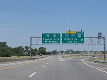
I-35 enters Kansas from Oklahoma where the southern terminus of the Kansas Turnpike is located. After passing exit 4 for U.S. Route 166 (US-166) in South Haven, the Interstate passes through a toll plaza, making I-35 into a toll road. The highway then passes US-160 in Wellington, then the Belle Plaine Service Area, the first of three on I-35, and the first of six on the turnpike. After the service area, the turnpike continues due north to Wichita and intersects I-135. After the I-135 interchange, the turnpike turns northeast and goes around Downtown Wichita. I-35 passes through Wichita's suburbs and in the process intersects US-54 and US-400. The Towanda Service Area lies 10 miles (16 km) north of the Wichita area. Thereafter, the route intersects US-77 and various state highways in El Dorado. After El Dorado, the highway enters the Flint Hills region of Kansas. After passing the Cassoday interchange, the turnpike begins its 25-mile-long (40 km) stretch with no exits. The only stop along the way is the Matfield Green Service Area. Located five miles (8.0 km) north of Cassoday, it is also the last service area on I-35. After the remaining 20 miles (32 km) with no exits or services, I-35 leaves the turnpike in Emporia. Here, the Interstate meets I-335, which the Turnpike carries toward Topeka.
Emporia to Kansas City[]
I-35 passes through a toll plaza to continue on its own alignment running eastward through east-central Kansas. At Ottawa, it turns to a more northeasterly direction. After passing through the Kansas suburbs of the Kansas City Metro Area, it then crosses the state line into Missouri and into Downtown Kansas City.
History[]
The original plan for I-35 was to follow US-50 from Newton, as well as US-81 and US-177 to the Oklahoma state line. But when Kansas Turnpike was created, a part of I-35 was created south of Emporia. The Newton segment was declined, and there was another implication for US-50 that traveled north (which is known today). The segments from Olathe to Shawnee was created by 1962. The relocations of US-75 and K-31 were finished by 1975. I-35 in Kansas (as known today) had its final modification in 1976.[1]
The Kansas Department of Transportation worked with the Burns & McDonnell engineering company to design a new interchange at Homestead Lane in Johnson County as a diverging diamond.[2] The first interchange of its kind in the state, it opened September 28, 2013.[3]
Exit list[]
| County | Location | mi[4] | km | Exit | Destinations | Notes | ||
|---|---|---|---|---|---|---|---|---|
| Sumner | 0.00 | 0.00 | Continuation into Oklahoma; southern end of Kansas Turnpike concurrency; southern terminus of Kansas Tpke. | |||||
| 4.06 | 6.53 | 4 | Last free exit northbound | |||||
| 5 | 8.0 | Southern Terminal toll plaza South end of toll road | ||||||
| 19.20 | 30.90 | 19 | ||||||
| 25.83 | 41.57 | Belle Plaine service area | ||||||
| Sumner–Sedgwick county line | Belle Plaine–Salem township line | 33.42 | 53.78 | 33 | ||||
| Sedgwick | Salem Township | 39.14 | 62.99 | 39 | ||||
| Wichita | 42.10 | 67.75 | 42 | |||||
| 44.54 | 71.68 | 45 | ||||||
| 49.66 | 79.92 | 50 | Access via Kellogg Ave. frontage roads | |||||
| 51.4 | 82.7 | 127th Street East | Southbound entrance only | |||||
| 52 | 84 | 53A | Cashless toll gantry; exit open, entrances under construction, no northbound exit | |||||
| 52.67 | 84.76 | 53 | ||||||
| Butler | Bruno Township | 57.07 | 91.85 | 57 | Andover | |||
| Towanda Township | 64.90 | 104.45 | Towanda service area | |||||
| El Dorado | 70.63 | 113.67 | 71 | |||||
| 75.69 | 121.81 | 76 | ||||||
| Cassoday | 92.73 | 149.23 | 92 | |||||
| Chase | Matfield Township | 97.00 | 156.11 | Matfield Green service area | ||||
| Lyon | Emporia | 126.92 | 204.26 | — | Northern end of Kansas Turnpike concurrency; Kansas Tpke. exit 127 | |||
| 127 | 204 | Emporia Interchange toll plaza North end of toll road | ||||||
| 127.36 | 204.97 | 127A | Last free exit southbound | |||||
| 128.18 | 206.29 | 128 | Industrial Road | |||||
| 130.26 | 209.63 | 130 | ||||||
| 131.57 | 211.74 | 131 | Burlingame Road | |||||
| 132.86 | 213.82 | 133 | Southern end of US-50 concurrency | |||||
| Jackson Township | 135.21 | 217.60 | 135 | County Road R1 | ||||
| 138.08 | 222.22 | 138 | County Road U | |||||
| 141.09 | 227.06 | 141 | ||||||
| Coffey | Lebo | 148.31 | 238.68 | 148 | ||||
| Key West Township | 155.34 | 250.00 | 155 | |||||
| Osage | Melvern | 160.49 | 258.28 | 160 | Western end of K-31 concurrency | |||
| 162.53 | 261.57 | 162 | Eastern end of K-31 concurrency | |||||
| Franklin | Williamsburg | 170.07 | 273.70 | 170 | Williamsburg, Pomona | Formerly designated as K-273 | ||
| Homewood Township | 176.22 | 283.60 | 176 | Homewood | ||||
| Ottawa | 181.89 | 292.72 | 182 | Eisenhower Road | ||||
| 182.94 | 294.41 | 183 | Southern end of US-59 concurrency | |||||
| Harrison Township | 185.27 | 298.16 | 185 | 15th Street | ||||
| Ottawa | 187.28 | 301.40 | 187 | |||||
| 188.52 | 303.39 | 188 | Northern end of US-59 concurrency | |||||
| Franklin Township | 192.79 | 310.27 | 193 | Tennessee Road | ||||
| Wellsville | 197.77 | 318.28 | 198 | |||||
| Miami |
No major junctions | |||||||
| Johnson | Edgerton | 202.77 | 326.33 | 202 | Sunflower Road – Edgerton | |||
| Gardner Township | 204.96 | 329.85 | 205 | Homestead Lane | Diverging diamond interchange | |||
| Gardner | 207.47 | 333.89 | 207 | Gardner Road | ||||
| 210.60 | 338.93 | 210 | Southern end of US-56 concurrency | |||||
| Olathe | 213.83 | 344.13 | 214 | Lone Elm Road / 159th Street | ||||
| 215.35 | 346.57 | 215 | Southern end of US-169 concurrency | |||||
| 216.61 | 348.60 | 217 | Old Highway 56 | Southbound exit and northbound entrance | ||||
| 217.81 | 350.53 | 218 | Santa Fe Street | |||||
| 220.14 | 354.28 | 220 | 119th Street | |||||
| Lenexa | 222.34 | 357.82 | 222A | Northern end of US-50 concurrency; I-435 exit 83 | ||||
| 222B | I-435 exit 83 | |||||||
| 223.80 | 360.17 | 224 | 95th Street | Diverging diamond interchange[5] | ||||
| 225.05 | 362.18 | 225A | 87th Street | |||||
| 225.54 | 362.97 | 225B | Southern end of US-69 concurrency; southbound exit and northbound entrance only | |||||
| Merriam | 226.93 | 365.21 | 227 | 75th Street | Signed as exit 225C northbound | |||
| 227.97 | 366.88 | 228A | 67th Street | |||||
| 228.49 | 367.72 | 228B | Northern end of US-56 / US-69 / US-169 concurrency | |||||
| 228.99 | 368.52 | 229 | Johnson Drive | |||||
| Overland Park | 229.90 | 369.99 | 230 | Antioch Road | ||||
| 230.74 | 371.34 | 231A | I-635 exit 1A; signed as exit 231 northbound; southern terminus of I-635 | |||||
| 231B | Southern end of US-69 concurrency; southbound exit; no access from northbound US-69 (Metcalf Avenue) to I-35 southbound; Metcalf Avenue continues as I-635 northbound | |||||||
| Mission | 231.70 | 372.89 | 232A | Lamar Avenue | ||||
| Wyandotte | Kansas City | 232.27 | 373.80 | 232B | Northern end of US-69 concurrency | |||
| 233.46– 233.86 | 375.72– 376.36 | 233 | Southwest Boulevard / Mission Road | Southbound exit has additional ramp to 37th Ave | ||||
| 234.56 | 377.49 | 234 | ||||||
| Kansas–Missouri line | 235.25 | 378.60 | 235 | Cambridge Circle | ||||
| 235.30 | 378.68 | Continuation into Missouri | ||||||
1.000 mi = 1.609 km; 1.000 km = 0.621 mi
| ||||||||
Auxiliary routes[]
There are five auxiliary routes branching directly or indirectly from I-35 in Kansas:
 I-135: a spur route from Wichita to Salina; originally signed as I-35W until September 1976
 I-235: a loop around the westside of Wichita; branches off of I-135

 I-335 / Kansas Turnpike: a segment of the Kansas Turnpike connecting I-35 in Emporia to the state capital, Topeka
 I-435: the Kansas City beltway
 I-635: a bypass of downtown Kansas City providing access to I-29 in Missouri and Kansas City International Airport
References[]
Route map:

| ( • help)
|
- ^ "Kansas Highways Routelog". Retrieved 4 October 2014.
- ^ "SW Johnson County Interchange: Diverging Diamond Interchange". Kansas Department of Transportation. November 19, 2010. Retrieved January 20, 2012.
- ^ Thompson, Danedri (October 3, 2013). "Intermodal, logistics park, interchange open". The Gardner Newss. Gardner, Kansas. Retrieved October 12, 2013.
- ^ "National Highway Planning Network" (ESRI shapefile). Federal Highway Administration. 2012-09-20. Retrieved November 22, 2012.
- ^ Carney, Candi. "The construction is over! Drivers have access to the I-35 and 95th Street interchange". kshb.com. 41 Action News-KSHB. Retrieved 18 August 2016.
External links[]
- Interstate Highways in Kansas
- Interstate 35
- Transportation in Sumner County, Kansas
- Transportation in Sedgwick County, Kansas
- Transportation in Butler County, Kansas
- Transportation in Chase County, Kansas
- Transportation in Lyon County, Kansas
- Transportation in Coffey County, Kansas
- Transportation in Osage County, Kansas
- Transportation in Franklin County, Kansas
- Transportation in Miami County, Kansas
- Transportation in Johnson County, Kansas
- Transportation in Wyandotte County, Kansas