Interstate 635 (Kansas–Missouri)
 | |||||||||
|---|---|---|---|---|---|---|---|---|---|
| Harry Darby Memorial Highway | |||||||||
I-635 highlighted in red | |||||||||
| Route information | |||||||||
| Auxiliary route of I-35 | |||||||||
| Length | 12.67 mi[1] (20.39 km) | ||||||||
| Existed | 1975–present | ||||||||
| Major junctions | |||||||||
| South end | |||||||||
| |||||||||
| North end | |||||||||
| Location | |||||||||
| States | Kansas, Missouri | ||||||||
| Counties | KS: Johnson, Wyandotte MO: Platte | ||||||||
| Highway system | |||||||||
| |||||||||

Interstate 635 (I-635) is a connector highway between Interstate 35 in Overland Park, Kansas and Interstate 29 in Kansas City, Missouri, approximately 12 miles (19.5 kilometers) long. It is mostly in the U.S. state of Kansas, servicing the city of Kansas City, Kansas, but extends into Kansas City, Missouri as well. The freeway's southern terminus is at a stack interchange with I-35. South of this, the mainline becomes an expressway carrying U.S. 69.
The freeway provides a route around downtown Kansas City by crossing through residential areas of Kansas City, Kansas and Riverside, Missouri. It also provides another direct route to Kansas City International Airport.
Route description[]
Kansas[]

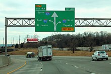
Interstate 635 begins at I-35 in Johnson County, near Shawnee, Kansas. There is a Parclo Interchange with Merriam Drive almost immediately after its terminus. It then enters Wyandotte County and Kansas City, Kansas. There is a diamond interchange with Shawnee Drive and a Parclo Interchange with Metropolitan Avenue upon entering the Argentine neighborhood. There is an interchange with K-32/Kansas Avenue and then crosses the Kansas River into central Kansas City, KS. Immediately after crossing the river, there is an interchange with I-70. There are several interchanges further north, including State Avenue, Parallel Parkway, and Leavenworth Road. The last public interchange before entering Missouri is K-5. A private maintenance facility crossing at grade exists between this exit and the Missouri River.
Missouri[]
Like Interstate 435, I-635's mileposts do not reset after crossing into Missouri.
I-635 crosses the Missouri River from Kansas into Platte County and the city of Riverside, MO. There is an interchange with Horizons Parkway, then US-69. US-69 briefly runs concurrently with I-635 north before exiting at the interchange with MO-9. I-635 runs a few more miles north, then terminates at I-29/US-71.
History[]
Missouri began the plans for I-635 in 1958 when AASHTO approved proposals that also included what would become I-435 and I-470; the plan for I-635 took the route eastward along what is now K-5 to U.S. 69 and northward across the Fairfax Bridge toward I-29.[2] When money from the Highway Trust Fund became available for a new Missouri River crossing, I-635 got a more westward alignment after 1968.[2] Part of the original alignment was built as a spur going into Fairfax as K-5.[3]
In 1990 the highway was given the name Harry Darby Memorial Highway, in honor of U.S. Senator Harry Darby.[4][5][6]
The interchange with I-70 and the bridge over the Santa Fe Railyard in Argentine were reconstructed in 2004.[7]
Maintenance work on the bridge over the Missouri River finished in September 2005.[citation needed]
Exit list[]
| State | County | Location | mi | km | Exit | Destinations | Notes |
|---|---|---|---|---|---|---|---|
| Kansas | Johnson | Overland Park | 0.00 | 0.00 | Southern terminus; continuation beyond I-35 | ||
| 1A | Southbound exit and northbound entrance; I-35 exits 231A–B | ||||||
| Wyandotte | Kansas City | 0.5 | 0.80 | 1B | Merriam Lane, Merriam Drive | ||
| 1.0 | 1.6 | 1C | Shawnee Drive | ||||
| 2.3 | 3.7 | 2A | Metropolitan Avenue | ||||
| 2.9 | 4.7 | 2B | Swartz Road | Southbound exit and northbound entrance | |||
| 3.7 | 6.0 | 3 | |||||
| 4.5 | 7.2 | 4 | Signed as exits 4A (east) & 4B (west); I-70 exits 418A–B eastbound, 419 westbound. | ||||
| 5.4 | 8.7 | 5 | State Avenue | ||||
| 6.3 | 10.1 | 6 | Parallel Parkway | ||||
| 7.3 | 11.7 | 7 | Southern end of K-5 concurrency | ||||
| 8.3 | 13.4 | 8 | Northern end of K-5 concurrency; left exit and entrance southbound | ||||
| Missouri River | 9.0– 9.2 | 14.5– 14.8 | Kansas–Missouri state line | ||||
| Missouri | Platte | Riverside | 9.5 | 15.3 | 9 | Horizons Parkway, Argosy Casino Parkway | |
| 10.6 | 17.1 | 10 | Southern end of US 69 concurrency; southbound exit and northbound entrance | ||||
| 11.0 | 17.7 | 11 | Northern end of US 69 concurrency; signed as exits 11A (US 69/Rte. 9) and 11B (Rte. 9 north) | ||||
| 12.7 | 20.4 | 12 | Northern terminus; I-29 exit 3B; signed as exits 12A (north) & 12B (south); tri-stack interchange. | ||||
1.000 mi = 1.609 km; 1.000 km = 0.621 mi
| |||||||
References[]
- ^ "Route Log - Auxiliary Routes of the Eisenhower National System Of Interstate and Defense Highways - Table 2". Federal Highway Administration. Retrieved 5 October 2014.
- ^ Jump up to: a b "Interstate 635 Kansas / Missouri". AARoads. Retrieved 2015-07-19.
- ^ "1968 Official Road Map of Kansas Inset Side from KSDOT" (PDF). Kansas Department of Transportation. Retrieved 5 October 2014.
- ^ "Statute Number: 68-1037". Kansas Statutes Annotated. Kansas Department of Revenue's Policy Information Library. Retrieved 2015-07-19.
- ^ "Memorial/Commemorative Highway Signs, Payments Toward Those Signs" (PDF). Retrieved 2015-07-19.
- ^ "Highways Named and Signed by Commission Action" (PDF). Retrieved 2015-07-19.
- ^ "I-635/I-70 Interchange". Kansas Department of Transportation. Retrieved 2016-05-11.
External links[]
Route map:

| ( • help)
|
| hide | ||
|---|---|---|
| ||
| hide Crossings of the Missouri River | ||||
|---|---|---|---|---|
| ||||
- Auxiliary Interstate Highways
- Interstate Highways in Kansas
- Interstate Highways in Missouri
- Interstate 35
- Transportation in Johnson County, Kansas
- Transportation in Wyandotte County, Kansas
- Transportation in Platte County, Missouri
- Transportation in the Kansas City metropolitan area
- 1975 establishments in Kansas
- 1975 establishments in Missouri