Ipatinga
Ipatinga | |
|---|---|
Municipality | |
| The Municipality of Ipatinga | |
 Pedro Linhares Gomes Avenue with the Usiminas at the background | |
 Flag  Seal | |
| Nickname(s): "Pouso de Água Limpa" | |
 | |
| Country | Brazil |
| Region | Southeast |
| State | |
| Founded | 29 April 1964 |
| Government | |
| • Mayor | Gustavo Morais Nunes (PSL) |
| Area | |
| • Total | 165.509 km2 (63.903 sq mi) |
| Population (2020[1]) | |
| • Total | 265,409 |
| • Density | 1,440/km2 (3,700/sq mi) |
| Time zone | UTC-3 |
| Postal Code | 35160-000 |
| HDI (2000) | 0,806 – high |
| Website | http://www.ipatinga.mg.gov.br/ |


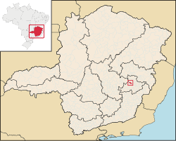
Ipatinga (postal code 35160–000) is a municipality in eastern Minas Gerais state, Brazil. The city was founded on 29 April 1964 and covers a total area of 166.5 km2 (64.3 sq mi). Its population is 265,409 (IBGE 2020). It is part of the Vale do Aço Metropolitan Area (population 430,700).

Ipatinga is at the site where the Piracicaba River flows into the Doce River, 217 km. from the state capital of Belo Horizonte. It is served by highway and railroad connections (Minas-Vitória). There is also a medium-sized airport, Usiminas Airport[2] in the area of the neighbor city Santana do Paraíso, that serves the Steel Valley and can receive small and medium-sized planes, including jets like the Boeing 737 and the Fokker 100.
Industry[]
It is the most important city of the Vale do Aço (Steel Valley) metropolitan area and it is the headquarters for one of the largest steel making complexes in Brazil, Usina Siderúrgica de Minas Gerais – Usiminas.[3]
Environment[]
Despite the steel complex's presence, Ipatinga has 127 m2 of green area per inhabitant, one of the highest averages in the country. Parque Ipanema, Ipatinga's main park, has about one million square meters of green space with 12 thousand trees planted, one of the largest in the country.[4]
Sport[]
Ipatinga Futebol Clube, the city's principal football club won the state championship in 2005 and reached the Copa do Brasil semi-finals in 2006. In 2007, it placed 2nd on the National Championship's Serie B, climbing to the first division. Ipatinga Futebol Clube holds its home at Estádio Municipal João Lamengo Neto popularly known as Ipatingão. The stadium was founded on 23 November 1981, and it is considered the fourth biggest soccer stadium of the state of Minas Gerais.[5] In 2013 this team changed Ipatinga to Betim.
Statistics[]
- Elevation: 220 m
- Climate: Tropical wet and dry (or savanna) climate (Köppen-Geiger climate classification: Aw)
- Average annual temperature: 23 °C
- Latitude South 19°28'46"
- Longitude West: 42°31'18"
- Distances from major cities:
- Belo Horizonte: 217 km
- Rio de Janeiro: 661 km
- São Paulo: 808 km
- Campinas: 830 km
- Vitória: 401 km
- Brasília: 935 km
- Salvador: 1140 km
References[]
- ^ IBGE 2020
- ^ "Archived copy". Archived from the original on 9 February 2006. Retrieved 23 January 2006.CS1 maint: archived copy as title (link)
- ^ TI, USIMINAS /. "Portal Usiminas". www.usiminas.com.br. Retrieved 9 April 2018.
- ^ "Archived copy". Archived from the original on 8 February 2006. Retrieved 23 January 2006.CS1 maint: archived copy as title (link)
- ^ "Epaminondas Mendes Brito (Ipatingao)". O Gol. Retrieved 9 February 2012.
External links[]
Coordinates: 19°30′S 42°32′W / 19.500°S 42.533°W

| show |
|---|

| show Authority control |
|---|
- Municipalities in Minas Gerais