Jefferson Township, Allen County, Indiana
Jefferson Township | |
|---|---|
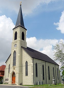 St. Louis' Catholic Church, a historic site east of New Haven | |
 Location in Allen County, Indiana | |
| Coordinates: 41°03′02″N 84°56′28″W / 41.05056°N 84.94111°WCoordinates: 41°03′02″N 84°56′28″W / 41.05056°N 84.94111°W | |
| Country | |
| State | |
| County | Allen |
| Government | |
| • Type | Indiana township |
| Area | |
| • Total | 36.52 sq mi (94.59 km2) |
| • Land | 36.51 sq mi (94.56 km2) |
| • Water | 0.01 sq mi (0.03 km2) 0.03% |
| Elevation | 778 ft (237 m) |
| Population (2010) | |
| • Total | 2,109 |
| • Density | 58/sq mi (22.3/km2) |
| ZIP codes | 46773, 46774, 46797, 46816 |
| GNIS feature ID | 0453478 |

Jefferson Township is one of twenty townships in Allen County, Indiana, United States. As of the 2010 census, its population was 2,109.[1] Jefferson Township was organized in 1840.[2]
History[]
The Craigville Depot, New York Chicago and St. Louis Railroad Steam Locomotive No. 765, and St. Louis, Besancon, Historic District are listed on the National Register of Historic Places.[3]
Geography[]
According to the United States Census Bureau, Jefferson Township covers an area of 36.52 square miles (94.59 km2); of this, 36.51 square miles (94.56 km2) is land and 0.012 square miles (0.03 km2), or 0.03 percent, is water.[1]
Cities, towns, villages[]
- New Haven (east edge)
Unincorporated towns[]
- Maples at 41°00′46″N 84°58′09″W / 41.012826°N 84.969133°W
- Tillman at 41°01′27″N 84°53′36″W / 41.024215°N 84.893298°W
- Zulu at 41°02′13″N 84°53′32″W / 41.036993°N 84.892187°W
(This list is based on USGS data and may include former settlements.)
Adjacent townships[]
- Milan Township (north)
- Maumee Township (northeast)
- Jackson Township (east)
- Monroe Township (southeast)
- Madison Township (south)
- Marion Township (southwest)
- Adams Township (west)
- St. Joseph Township (northwest)
Cemeteries[]
The township contains Emmanuel Cemetery.
Major highways[]
Airports and landing strips[]
- Casad Industrial Park Airport
- Klines Airport
School districts[]
- East Allen County Schools
Political districts[]
- Indiana's 3rd congressional district
- Indiana's 3rd congressional district
- State House District 79
- State House District 85
- State Senate District 14
References[]
Citations[]
- ^ a b "Geographic Identifiers: 2010 Demographic Profile Data (DP-1): Jefferson township, Allen County, Indiana". U.S. Census Bureau, American Factfinder. Archived from the original on February 10, 2020. Retrieved March 26, 2013.
- ^ Griswold, Bert Joseph; Taylor, Mrs. Samuel R. (1917). The Pictorial History of Fort Wayne, Indiana: A Review of Two Centuries of Occupation of the Region about the Head of the Maumee River. Robert O. Law Company. p. 642.
- ^ "National Register Information System". National Register of Historic Places. National Park Service. July 9, 2010.
Sources[]
- United States Census Bureau 2008 TIGER/Line Shapefiles
- United States Board on Geographic Names (GNIS)
- IndianaMap
| Wikimedia Commons has media related to Jefferson Township, Allen County, Indiana. |
Places adjacent to Jefferson Township, Allen County, Indiana | |
|---|---|
Municipalities and communities of Allen County, Indiana, United States | ||
|---|---|---|
| Cities | ||
| Towns | ||
| Townships | ||
| CDPs | ||
| Other unincorporated communities |
| |
| Footnotes | ‡This populated place also has portions in an adjacent county or counties | |
| ||
Categories:
- Townships in Allen County, Indiana
- Fort Wayne, IN Metropolitan Statistical Area
- Townships in Indiana